In a smart city development, a city is expected to be able to provide information that is not only available, but also easily accessible and has an element of intelligence. Furthermore, smart city can provide a more decent life, good quality education or …
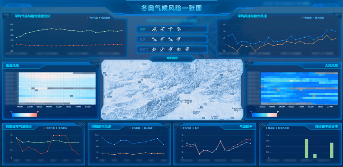
08 Feb,2022The 24th Olympic Winter Games was held in Beijing and Zhangjiakou (in north China’s Hebei Province) on February 4, 2022. Compared with the Summer Olympics, the Winter Olympics, especially the snow sports held outdoors, are more susceptible to weather con…
07 Feb,2022Wetlands are always ecologically fragile and monitoring and early warning are indispensable in their conservation. SuperMap and its partner Attiot jointly constructed a wetland ecosystem monitoring and early warning platform for Poyang Lake, the largest f…
26 Jan,2022Asst.Prof. Tarawut BoonluaFaculty of Architecture, Urban Design and Creative Arts, Mahasarakham UniversityPhra That Phanom locates in That Phanom District in Nakorn Phanom Province, Thailand, which is about 600 meters west of the Mekong River. People in t…
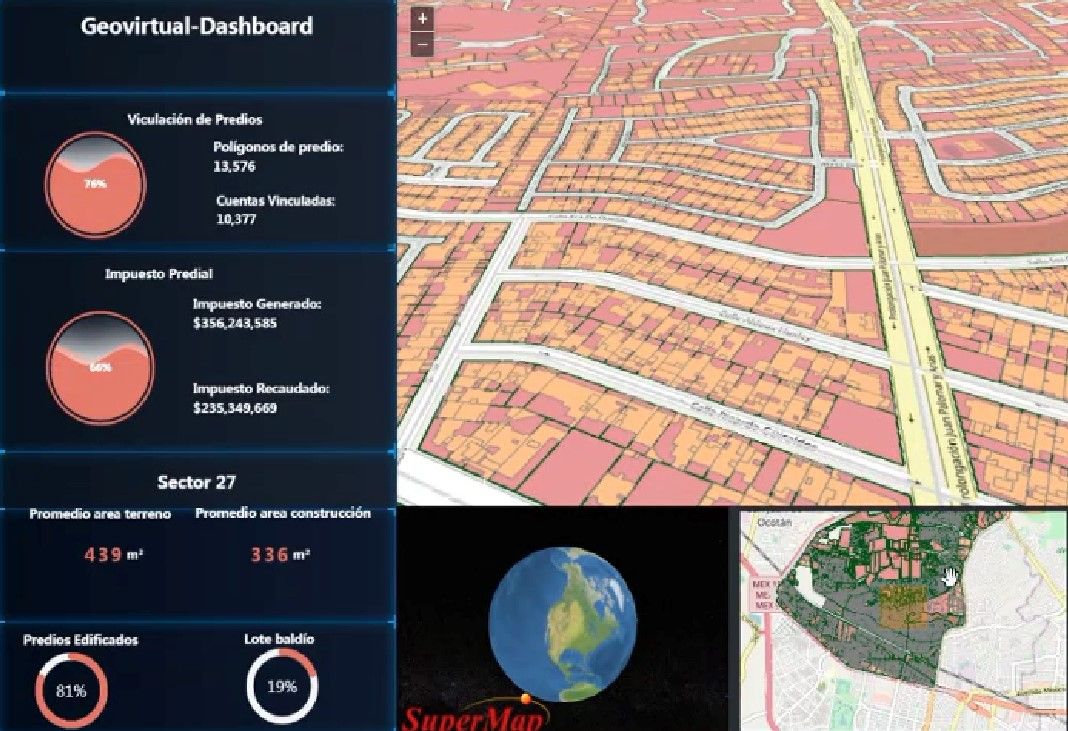
15 Nov,2021Francisco GarridoCEO, Geovirtual SA de CVhttps://www.geovirtual.info BackgroundFor years in Mexico, efforts have been made to have cadastres updated, the Federal, State Government and Municipalities have invested millions of dollars in this task. However,…
04 Nov,2021Chengdu Second Ring Road is an elevated highway in the southwest of China. Built and opened to traffic in May 2013, it is the only hyper channel in the city, with no traffic lights, transporting more than 200,000 people every day, which greatly alleviates…
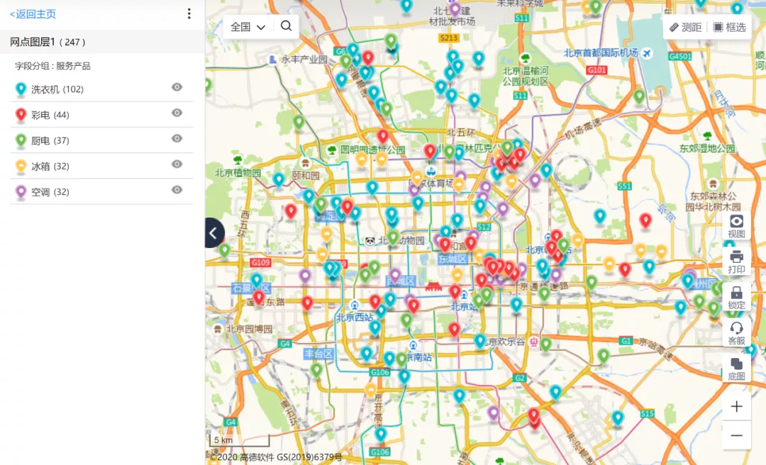
21 Oct,2021Dituhui (Map-Intelligence), a subsidiary of SuperMap, is dedicated to providing intelligent map services to enterprises. In this article, we will explore how the Dituhui platform assists household and appliance companies in smart dispatch, and thus improv…
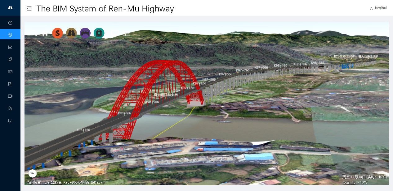
19 Oct,2021The integration of construction drawing design and BIM model in the management system of highway construction can perform the functions of BIM model view, design data management and view, management of site operation, site inspection, design alteration, s…
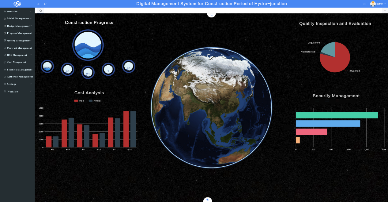
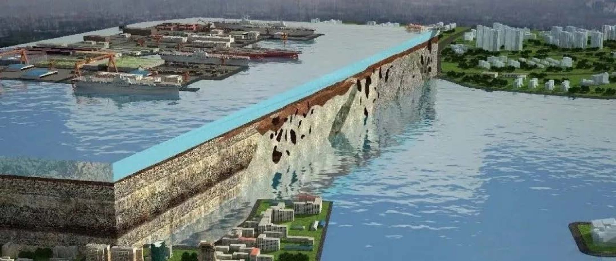
31 Aug,2021YREC participated in the construction of the Narin Gol River Hydro-junction with its BIM+GIS platform integrating design and building on the basis of SuperMap GIS technology.
20 Aug,2021Building Information Modeling (BIM for short) can be combined with GIS technology. We can use GIS software to read BIM data.
18 Aug,2021