SuperMap logo
  • Products

    What is GIS

    About SuperMap GIS

    Technology System

    • Big Data GIS
    • New RS Software
    • New 3D GIS
    • Geospatial AI
    • Distributed GIS
    • Cross Platform GIS

    SuperMap GIS 2024 New!!

    • Cloud GIS Server
    • Edge GIS Server
    • Terminal GIS for Desktop
    • Terminal GIS for Components
    • Terminal GIS for Web
    • Terminal GIS for Mobile

    Previous Versions

    • SuperMap GIS 2023
    • SuperMap GIS 11i(2022)
    • SuperMap GIS 10i(2021)
    • SuperMap GIS 10i(2020)
    • SuperMap GIS 10i
    • SuperMap GIS 9D(2019)
  • Solutions

    Smart City

    Natural Resource

    Land Management

    Facility Management

    Public Safety

    Natural Disasters

    Transportation

    Water Conservancy

    BIM+GIS

  • Stories
    • Articles
    • News
    • Events
    • Magazines
  • Support
    • Download & Online Help
    • Online Demonstration
    • Ask & Answer
    • Discover SuperMap GIS
    • Trial License
  • About
    • lntroduction
    • Careers
    • Contacts
    • Suggestions
 
  • English
  • 中文
  • Español
  • Français
  • ภาษาไทย
  • русский
  • Türkçe
  • Português
  • 日本語
  • 한국어
  • Indonesian
  • عربي
Solutions

Solutions

  • Home
  • Solutions

Solutions

  • BIM
  • Disasters
  • Land
  • Water
  • Transportation
  • Safety
  • Facility
  • City
  • Resource
  • Smarter Airports Empowered with GIS

    In recent years, GIS technology has become requisite to airport construction and running: Smart construction utilizing BIM+GIS in the construction process and intelligent operation utilizing GIS+IoT in the subsequent airport running, which contributes to …

    25 Apr,2022
    Smarter Airports Empowered with GIS
  • Bridge Monitoring&Warning System

    There are 38 waterways in Guangzhou, with a navigable mileage of 585.55 kilometers. The navigable ships in the surrounding waters of Guangzhou are mainly cargo ships, and sand carriers account for more than three-quarters. Among the bridges maintained by …

    21 Apr,2022
    Bridge Monitoring&Warning System
  • Building Data Middle Platform, "Managing"​ City on One Map

    In order to regulate activities of development and land-use of territorial space in Lijiang city more effectively, local authorities collaborated with SuperMap to develop the Territorial Space Basic Information Platform and the “One-map” Territorial Spa…

    14 Apr,2022
    Building Data Middle Platform, "Managing"​ City on One Map
  • SuperMap GIS Utilized in Forest Management in Korea

    Korea Forest Service(An independent agency specializing in forestry that is overseen by the South Korean Ministry for Food, Agriculture, Forestry and Fisheries)Forest disaster integrated management systemForest disaster integrated management system can mi…
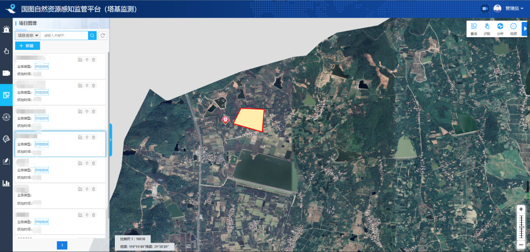
    06 Apr,2022
    SuperMap GIS Utilized in Forest Management in Korea
  • Video Supervision Platform Developed by SuperMap Empowers Smart Supervision of Natural Resources

    In recent years, information technology has gradually stepped into the intelligent era. Natural resources have also been set a higher demand in supervision. Since its development by Guotu Information in 2017, a part of SuperMap, "Land-protecting Smar…

    28 Mar,2022
    Video Supervision Platform Developed by SuperMap Empowers Smart Supervision of Natural Resources
  • “One Map” Solution for Campus—3D Underground Pipeline System

    SuperMap GIS, Beijing Bolue company, and Tsinghua Tongheng Planning and Design Institute have built a strategic partnership. Concerted efforts have been made in GIS solutions for underground pipelines informatization on the campus, and GIS education with …

    22 Mar,2022
    “One Map” Solution for Campus—3D Underground Pipeline System
  • Application of GIS in fine management mode in Baiyun Airport

    Guangzhou Baiyun International Airport was the world’s 13th-busiest airport by passenger traffic, with 65.8 million passengers handled (statistics in 2017) and over 210 destinations around the world. On April 26, 2018, the opening of the T2 Terminal of B…
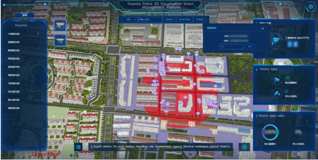
    07 Mar,2022
    Application of GIS in fine management mode in Baiyun Airport
  • Smart Police Service in Huantai County

    Smart security and protectionVideo monitoringPatrol allocation 

    04 Mar,2022
    Smart Police Service in Huantai County
  • The Digital Twin Platform for Smart Park

    The digital twin platform for smart park, based on the digital twin concept, builds a comprehensive service middle platform oriented towards applications, data, and AI analysis. It forms a digital environment in smart park that supports the planning, cons…

    28 Feb,2022
    The Digital Twin Platform for Smart Park
  • The Application of Space Technology in Smart Highway—A Case Study of Wuxi Provincial Highway 342

    Introduction: How to automatically detect accumulated snow on the highway and get it removed in time on heavy snow days? How to remind the motorist to slow down when pedestrians are crossing the highway? How to automatically detect someone drying grain in…

    22 Feb,2022
    The Application of Space Technology in Smart Highway—A Case Study of Wuxi Provincial Highway 342
<<< < 6 7 8 9 10 > >>>

SuperMap GIS

  • Cloud GIS Server
  • Edge GIS Server
  • Terminal GIS for Desktop
  • Terminal GIS for Components
  • Terminal GIS for Web
  • Terminal GIS for Mobile

Stories

  • Articles
  • News
  • Magazines
  • Events

Support

  • Download & Online Help
  • Online Demonstration
  • FAQ
  • Demo Code
  • Technical Docs
  • Training Files
  • Videos
  • Trial License

Events

  • [list:pagetitle] [list:targetlink]
  • {/zzz:list}

About

  • lntroduction
  • Careers
  • Contacts
  • Suggestions

Follow Us

  • LinkedIn
  • Facebook
  • Twitter
  • Instagram
  • YouTube
© 1997-2023 SuperMap Software Co., Ltd.
  • Sitemap
  • | Privacy