bool(false) Land Management Overview and Solutions - SuperMap GIS Software

Overview

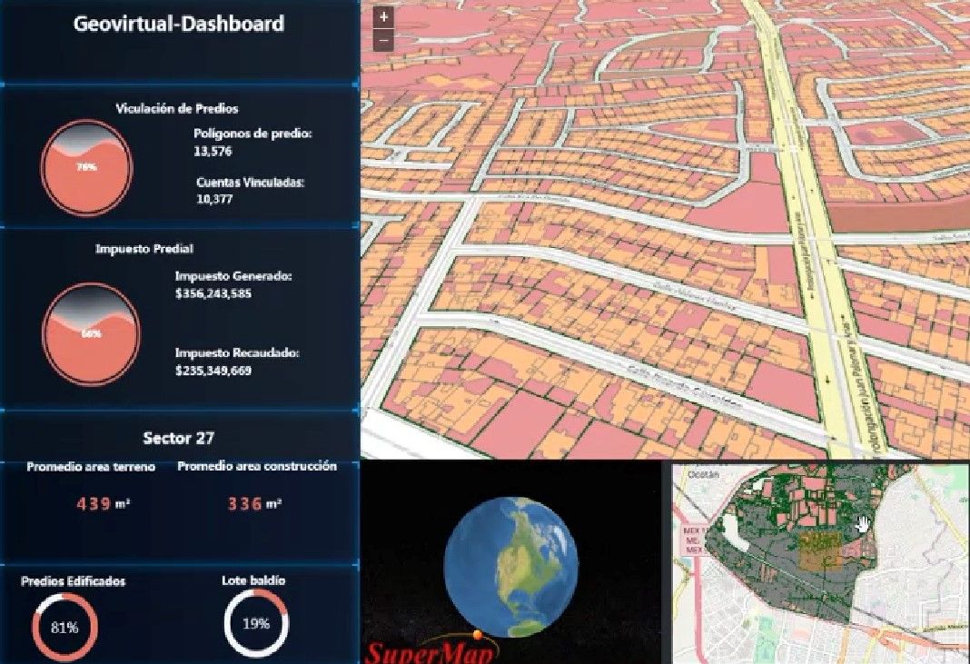
SuperMap focuses on the innovation and application of new technologies in the land industry with over 20-year project experience. In face of the new business needs of the land industry, a set of land solutions are formed. It involves in land survey, information management and application, land monitoring and land inspection.

SuperMap Land Information System

Multi-tier service structure, and the functionality of the system is broken down to three layers logically: presentation layer, application layer and data layer.

Different function components are provided according to the needs of business.

Solves the issues of history land data management and back-tracing.

Solutions

Building Data Middle Platform, "Managing"​ City on One Map

Read More

Building Data Middle Platform, "Managing"​ City on One Map

Digital Transformation of Cadastre in Mexico

Read More

Digital Transformation of Cadastre in Mexico

Dimension Upgrading of Cadastral Data - SuperMap Helps the Digital Construction of 3D Cadastral in Turkey

Read More

Dimension Upgrading of Cadastral Data - SuperMap Helps the Digital Construction of 3D Cadastral in Turkey