Overview

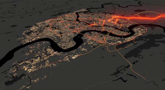
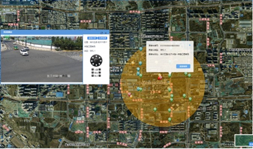
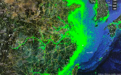
The big data GIS system includes the storage and management of geospatial big data, geospatial analysis, streaming data processing and visualization technology, dedicates to providing a comprehensive support for big data GIS infrastructure software and services, and making more users easily manage geospatial big data "gold mine".

Highlights

Geospatial big data storage engines
  • Provides HBase and HDFS engines for large scale raster data.
  • Provides Elasticsearch engines for streaming data.
  • Supports customized extensible geospatial big data storage engine.

Analysis capability of geospatial big data
  • Kernel level extended Spark geospatial data model.
  • Supports 6 categories covering 200 kinds of geospatial big data analysis operator.

Visualization of geospatial big data
  • Integrated open source map development library (OpenLayers, Leaflet, MapboxGL JS) and visualization library (ECharts, MapV, DECK.GL).
  • Provides 2D / 3D and dynamic / static visualization effects.
  • Provides spatial big data visualization technologies such as scatter map, heat map, honeycomb map, grid map, trajectory map, O-D map, flow map, etc.

Distributed computing resource management
  • Provides built-in spark clusters and external spark cluster.
  • Supports Hadoop cluster YARN mode.