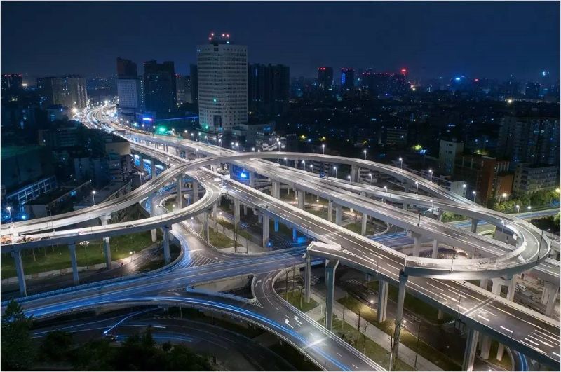
Chengdu Second Ring Road is an elevated highway in the southwest of China. Built and opened to traffic in May 2013, it is the only hyper channel in the city, with no traffic lights, transporting more than 200,000 people every day, which greatly alleviates the traffic pressure in the city. The total length of this road is 28.327 kilometers with four lanes in two directions. There are only six overpasses on this road when it was built in the last century. Since May 2012, it was transformed to an entire line elevated highway within a year.
The maintenance of this road was a great challenge for the local service department. Since local people are highly dependent on this road in daily life, the tardy work of maintenance and news release, as well as the inaccuracy of information, could bring numerous social problems.
Quantities of institutions and companies are involved in the construction project. A large amount of data information, the difficulty in the match between completion data and completed roads and bridges, and trouble of information search jointly posed a challenge to the maintenance of this road. Some bridges are even as high as more than 40 meters, and it is very difficult and dangerous for the staff to detect the components such as box girders and bridge piers. At the same time, due to the lack of powerful tools and the management system, it often took quite a long time from the discovery of problems to the settlement, and it may even affect people's travel. For the sake of the normal operation of this road and the safe travel of people, the local authority decided to implement the transformation and upgrading of maintenance through information technology means.
The BIM application of Chengdu RYD (a local company) based on CATIA+ ENOVIA of Dassault Systèmes of France integrated with SuperMap 3DGIS system was finally selected. The integration of BIM+3DGIS supports management informatization, visualization and modernization, digitalization and virtualization of infrastructure, and mobile monitoring and maintenance. RYD project team chose one overpass at the first attempt, splitting more than 1300 drawings, and built a 3D model with the same interior and exterior, from the bridge pier to the drainage outlet, which was visible and could be managed on the model. There were more than 16,000 bridge components and each one had its unique ID number, which could enable the staff to quickly locate the problem and find the design, construction, maintenance information related to this component. With hand-held mobile devices, data could be quickly collected and uploaded to ENOVIA cloud anytime, anywhere, and mission-related 3D BIM models and technical data could be viewed.
This system has greatly improved the efficiency of road maintenance. The speed of problem-solving has been increased by 8 times, the efficiency of manpower use has increased by 8.3 times, financial resources have been saved by 4.42 times, the quality assurance has increased by 1 time. Furthermore, the entire process is completed on the network without papers, which is energy-efficient and environmentally friendly.