Background
For years in Mexico, efforts have been made to have cadastres updated, the Federal, State Government and Municipalities have invested millions of dollars in this task. However, there was no basic regulation that standardized cadastral data and processes, as well as the linking of the Cadastre (physical security of the property) with the Public Property Registries (legal security of the property). Currently, the Law of Cadastre and Public Registry of Property (RPPyC) was published in Mexico. This law seeks to standardize strategic aspects to guarantee a large database at the national level that allows dynamically visualizing the updating of cadastral and registry data throughout the country through a single geographical platform. Each Cadastre and RPPyC must comply with requested standards and business rules. For example, the cadastral certificate when carrying out an operation before the RPPyC is requested. Based on this, the link of cadastral and registry information will be maintained, while for a cadastre it must georeference the properties according to national standards set by the National Institute of Geography and Informatics (INEGI) and the Secretariat of Agrarian Development, Territorial and Urban (SEDATU) in order to guarantee a correct inventory of private property using the Unique Territory Registration Code (CURT), Social Property (Ejidos, Plots, Plots, Plots, Lands for Common Use) and National Lands. Based on this law, the public policy of maintaining an updated cadastre is expected and that the properties are duly registered in terms of the law to offer physical and legal certainty to all citizens in Mexico, this information being the basis of multipurpose applications such as Urban Development, Public Lighting, Public Security, Drinking Water and Sewerage Networks, Transportation, and Municipal Services among others.
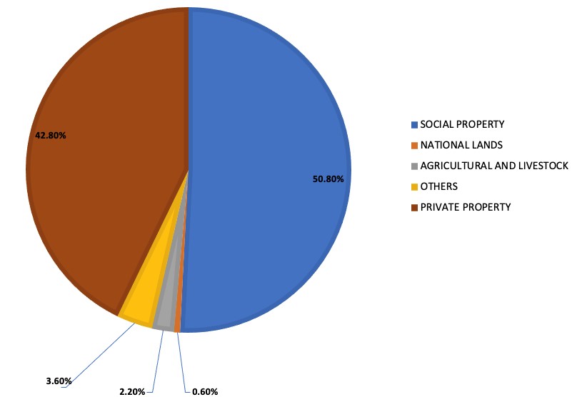
The ejido and communal property called social property distributed to the peasants under the principle of “(1) The Land belongs to those who work it” after the Mexican Revolution 1910-1917, represents 50.8% of the national territory, distributed in 29,709 ejidos and 2,393 communities that together occupy approximately 100 million hectares of a total area of 196,437,500 hectares of the Mexican Republic, to which 5.5 million people are entitled.
(1) Emiliano Zapata, Caudillo of the Mexican Revolution 1910-1917.
Technologies related to Cadastre on the technological side, geographic information systems applied in cadastre in Mexico began to boom in 1987 when the National Bank of Works (Banobras) began a credit support program to state and municipal governments in order to reactivate the country’s cadastres. To this end, it established a line of credit and generated the respective policies and regulations for its granting. In 1992, it continued to promote programs such as the “100 Cities” of the Ministry of Social Development (SEDESOL) where it was sought to inventory and update the real estate base of urban and rustic property (private property) of the main municipalities in Mexico in order to strengthen, among other points, the municipal public haciendas in a fair and equitable way by inventorying the real estate base and correctly calculating the cadastral value of each property (avaluó), while in 1992 the government also promoted the “Program for the Certification of Ejido Rights and Titling” (PROCEDE) through the Secretariat of Agrarian Reform (SRA) and the National Institute of Geography and Informatics (INEGI) to update the cartography of social property in Mexico by measuring ejidos, plots, plots and lands of common use in order to give geographical and legal certainty to the ejidatarios. Currently, the Federal Government, through the Secretariat of Agrarian, Territorial and Urban Development (SEDATU), continues to promote the modernization of cadastres, granting resources to federal, state and municipal institutions, promoting the LCRPP to standardize keys and link cadastral and registry data. Until today the cadastral systems in Mexico have been operated mainly in 2 dimensions in a traditional way and their functionality is limited to maintaining the physical characteristics of the property. However, this is no longer enough. The digital transformation will require more of the cadastral models to be able to potentiate the functionalities not only of cadastre, if not that of smart cities that will bring countless new applications that will change the way of operating and managing a city. Continuing to operate with 2D models away from new technologies such as the Industrial Internet of Things (IIOT), Cloud Services, Big Data, Artificial Intelligence, Blockchain and augmented reality will leave governments limited to applying modern solutions based on digital transformation such as smart agriculture, smart cities and public safety among others. SuperMap is a Geographic Information System platform software and service company that has functionalities to integrate 2D and 3D data from diverse sources. It allows you to use powerful 2D and 3D analysis functions, operate in a synchronized manner with IIOT sensors and online telemetry, apply Machine Learning and Deep Learning algorithms for vector and/or raster pattern recognition, recreate digital terrain models and special effects for simulation of 3D scenarios, including augmented reality. On the other hand, this technology can support large volumes of data (BIG DATA) and operate under distributed architectures (Geoblockchain) necessary in the management of smart cities. How fast is it to use this technology developed in China for projects not only of the cadastre but also be the basis of various solutions of digital transformation in Mexico? We have done an exercise where a cadastral cartographic database of a municipality in the state of Jalisco of just over 400,000 properties was migrated. This geobase is in Postgress and uses a CAD of 2D cartographic editing, the steps to follow to migrate the entire Cadastral Management System, including the cartographic model to SuperMap was:
1. Derived from a photogrammetric study 1:4500 of 640 km² and oblique photography, ground support works, aerotriangulation, restitution of cadastral coverages (Urban Limit, Cadastral Sectors, Blocks, Properties and Constructions, Contour Lines, ...), with SuperMap topological cleaning works were carried out as an example with a complete sector resulting which is quite easy and quick. Once the SuperMap scheme was prepared, the data were loaded to integrate the geobase, and the other sectors were read in shape format. The keys assigned in sectors, blocks, properties and constructions were linked to the cadastral registers using a Postgress database. The final result was the complete migration of a cadastral cartographic geobase linked to the cadastral registers and catalogs.
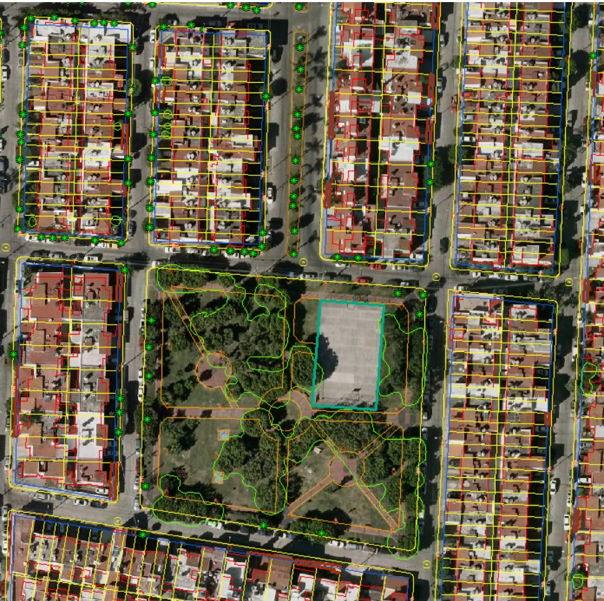
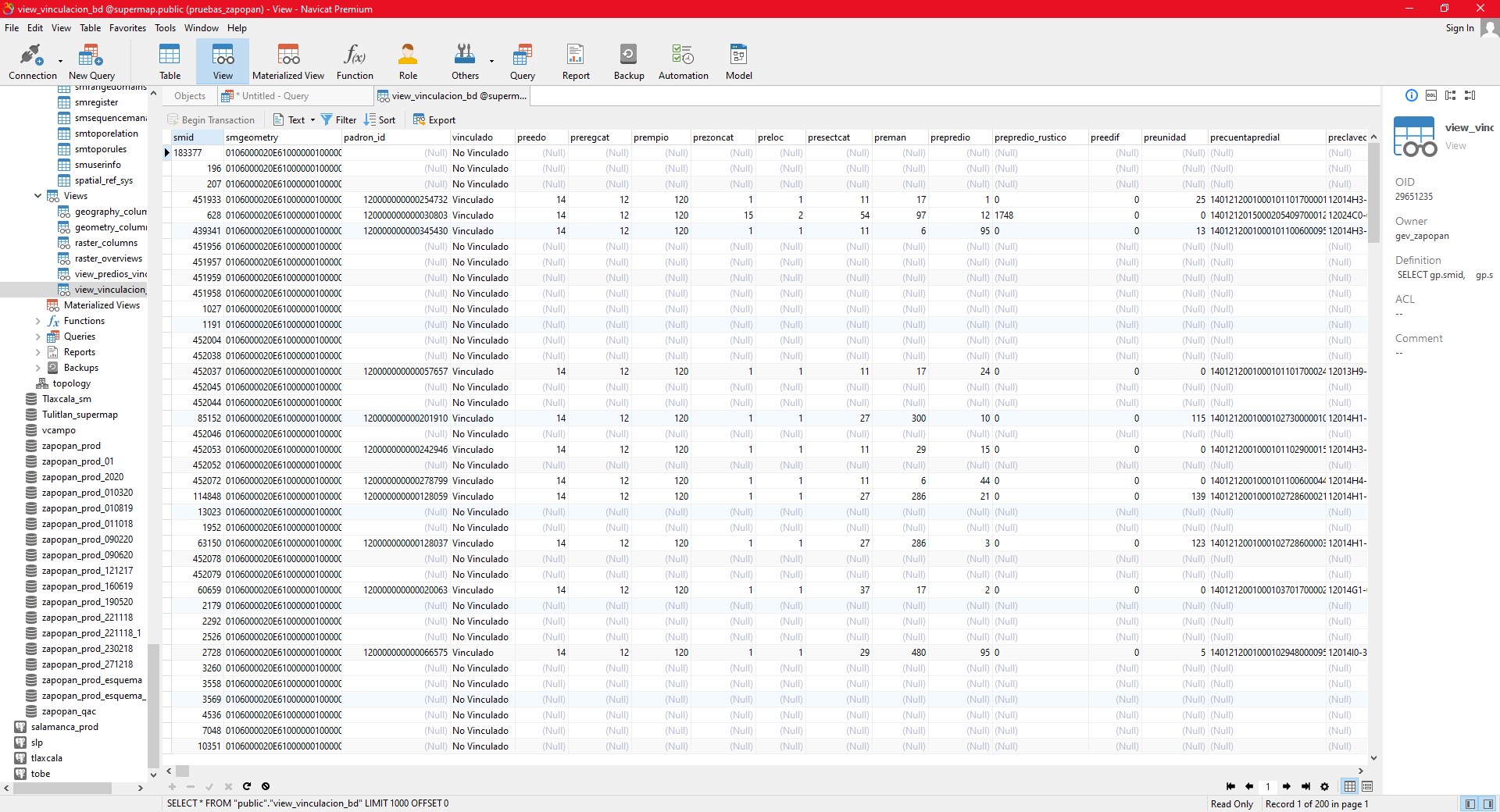
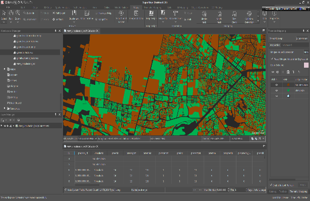
From iDesktop 10xi the reading of various layers was made; the topology was reviewed (e.g. Points for public lighting; lines for streets and polygons for properties) with their respective labels according to the INEGI standard.
2. Migration of the cadastral management system by programming the cadastral module in the iDesktop API with C++.
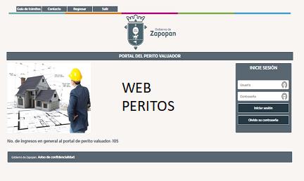
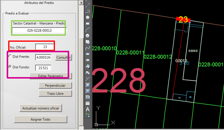
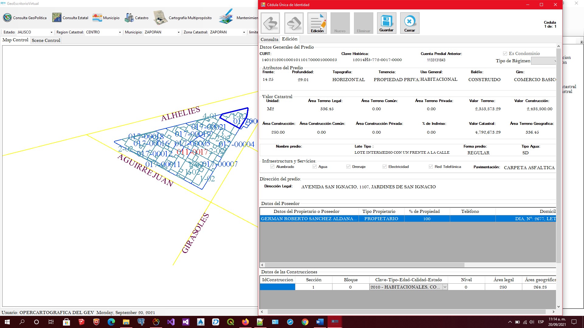
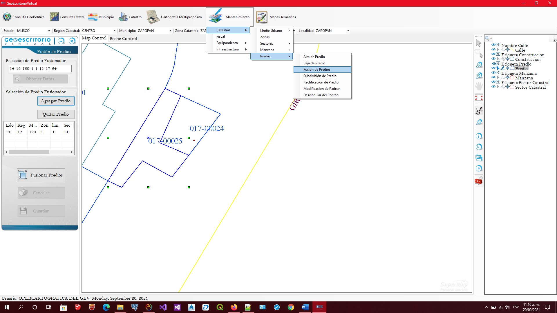
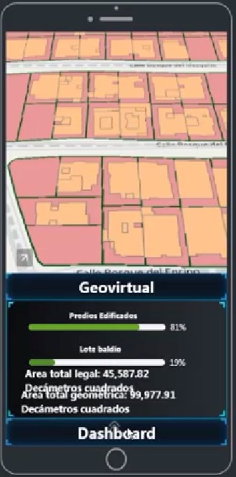
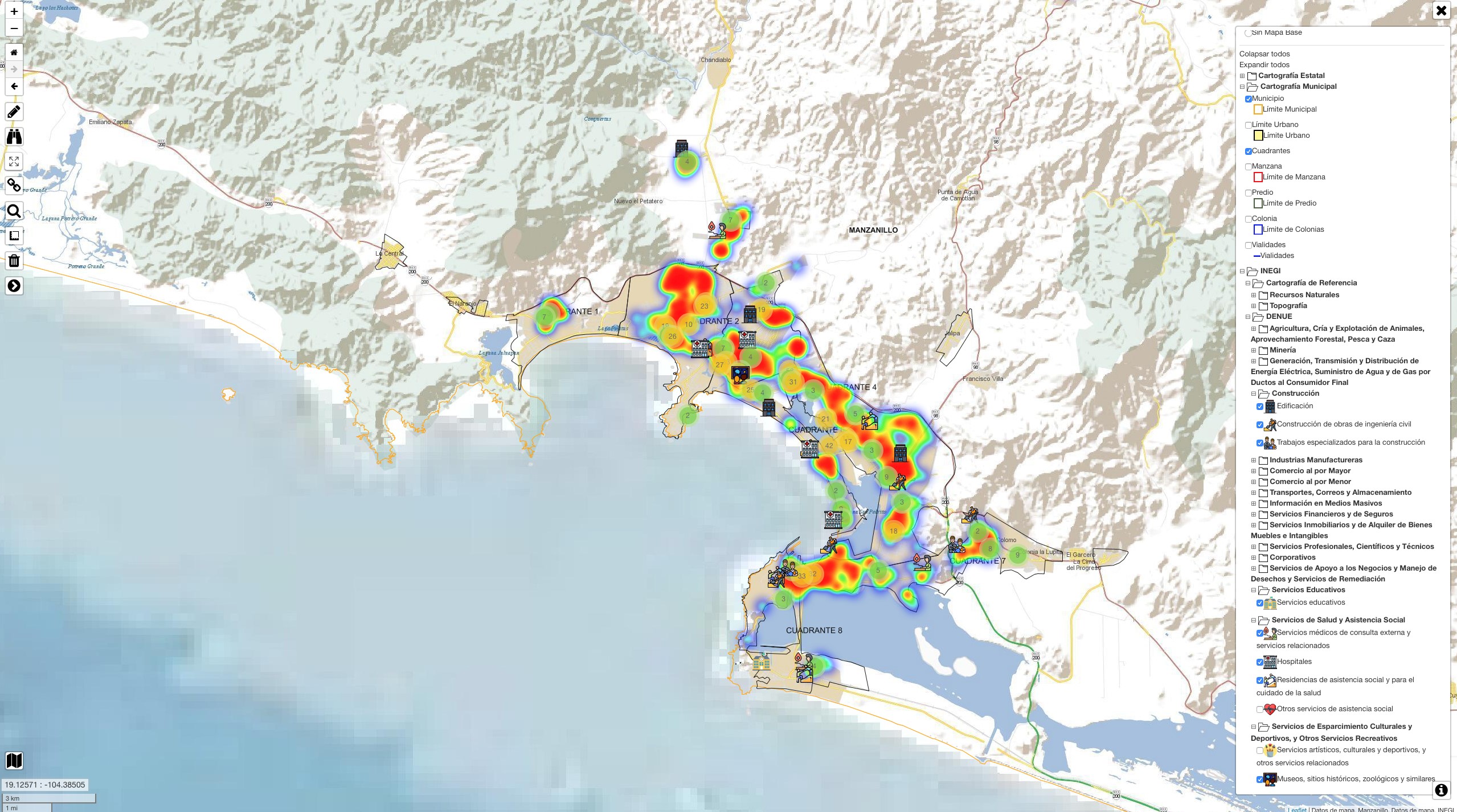
The Cadastral Management System that carries out cadastral procedures according to the Optimal Cadastre Model under Mexican norms and standards, Administration Module, procedures and services, cadastral cartographic creation, maintenance and consultation module (iDesktop 10x), Spatial Data Infrastructure (Iserver + iClient), Dashboard and mobile applications with iPortal.
This system migration with multipurpose examples and 2D and 3D analysis which took a time of 90 days brings the following benefits: Fast import, cartographic editing, terrain modeling and 3D building blocks. It makes it easy to integrate the geobase in Postgress to operate the cadastral cartographic linkage through SuperMap technology. It supports the reprogramming of functionalities for the creation, maintenance and consultation of the cadastral cartographic database of your choice, such as C++, Java or Phyton. It also supports the potentiation of functionalities for visualization of a 3D cadastre, 2 and 3D analytics (iPortal), development of multipurpose functionalities such as Lines of View, 3D flyover over the city, flood simulation, identification of patterns to vectorize property boundaries of a raster photograph (AI), effects of water leaks, fires, rain, virtual animation walking or driving over the city or buildings, explosion simulation, communication with intelligent sensors, video surveillance systems, telemetry for public safety applications, overflow measurement in rivers or dams, etc. Traditionally, the cadastre in Mexico reaches this point, and its objective is the cadastral cartographic update in 2D, to generate a cadastral management system to deal with real estate traffic, to link with the Public Registry of property and be the basis for multipurpose applications without having achieved a 100% integral model of municipal services with other areas such as transport, public lighting, drinking water and sewerage, etc. There is no comprehensive system that works in a synchronized and unified way, and the cadastre becomes a mapping provider and each institution develops its applications. The cadastre is considered as a geographical component in digital transformation in government. This is a great challenge where municipalities must prepare the way to generate solutions that benefit citizens by integrating the cartographic base of a cadastre that is dynamically updated every day and has a large amount of data from the various areas so that development areas or specialized companies develop applications with new technologies that are transforming services to society.
Intelligent digital platforms for citizens can be used to report their mobile lack of municipal service. The statistic and 3D visualization is carried out and it empowers decision making. Report and analysis of fires in wooded areas, floods, explosions or natural disasters where geographic technology is an important component to issue alerts to citizens in internet time, technology that can georeference any event by citizens for better attention in calls to police, firefighters, red cross or civil protection units, location of SENSORS and IIOT telemetry, georeferenced reporting of citizens through mobile phones, interface to video surveillance cameras in residences, commerce, industry that require to be georefer