bool(false) Water Conservancy Overview and Solutions - SuperMap GIS Software

Overview

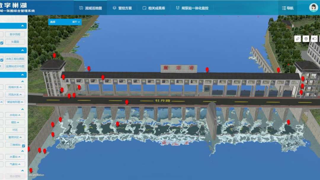
Water conservancy informatization construction is an important method to enhance and innovate water conservancy work, also is an important driving force for water conservancy reform and development. The construction of water conservancy informatization is undergoing a development process from decentralized database construction to data center construction, from partial application to collaborative application.

Water Conservancy Spatial Information Sharing Service Platform

Provides a practical functional model library, and shares the professional analysis model of water conservancy to users.

Provides services for 2D&3D display, query and analysis of water conservancy data.

Perfect operation and maintenance management system.

Solutions

GIS Promotes the Lake’s Digital, Intelligent and Precise Management

Read More

GIS Promotes the Lake’s Digital, Intelligent and Precise Management

Natural Resource Protection Supervision Platform

Read More

Natural Resource Protection Supervision Platform

The "1+1+3" construction model helping with the high-quality development of water conservancy informatization

Read More

The "1+1+3" construction model helping with the high-quality development of water conservancy informatization