The traditional park management currently faces three major pain points: 90% of alerts rely on manual verification, 60% of operational manpower is consumed in repetitive inspections, and the average response time to emergencies exceeds 30 minutes.
16 Jul,2025 Intelligent park park management GIS AI UAVsAI technology is becoming a new driving force in the construction of digital twin cities, creating novel application models for urban information collection and operational analysis, and catalyzing the emergence of urban intelligent agents that combine ge...
11 Jul,2025 AI GeoAI SuperMapIn the era of ubiquitous connectivity, remote sensing satellites serve as a critical means of spatial data acquisition. Converting massive volumes of remote sensing imagery into high-quality standardized base data and rapidly extracting actionable in...
22 Jun,2025 GISTC remote sensingIn an era where cloud computing and artificial intelligence (AI) are deeply integrated, AI is driving transformative changes in geographic information platforms. This transformation presents both breakthrough opportunities—such as elastic computing and in...
18 Jun,2025 GISTC Cloud GISDriven by initiatives like the 3D Real-Scene China Initiative and CIM (City Information Modeling), combined with the deep integration and mutual empowerment of AI and 3D GIS technology, 3D GIS is continuously advancing towards autonomy and intelligen...
16 Jun,2025 GISTC 3D GIS 3D Modeling
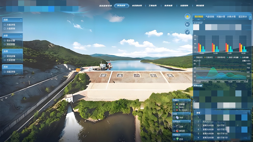
Under the intensifying global climate change, extreme weather events are occurring more frequently. Ensuring comprehensive coverage of early warning systems worldwide has become a critical priority for global disaster prevention and mitigation.
I...
Amid the surging digital wave, AI large models are reshaping the global technology landscape with disruptive force. Natural language models enable human-machine dialogues with near-real authenticity, vision models unlock the ultimate code for image i...
12 Jun,2025 GISTC 2025 AIdigital twin technology is reshaping management paradigms in core areas of water management such as flood control, water resource allocation, and ecological governance.
21 May,2025 water SuperMap GIS digital twin AI diaster prevention