Introduction NewBorn, a recycling platform developed based on SuperMap GIS that brings idle resources back to life, is an award-winning work of the SuperMap GIS Contest.With the advancement of the Internet and the per capita consumption level, people are …
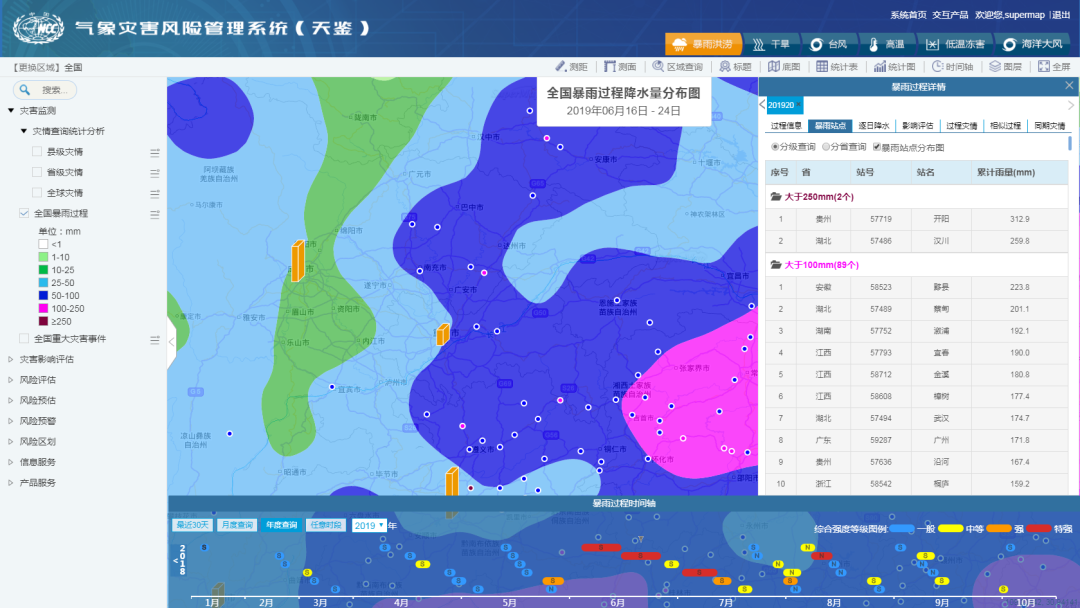
02 Feb,2023Meteorological disasters feature a wide range of influence, high frequency of occurrence, and large losses, accounting for more than 70% of China's natural disaster losses.With “integration” as the guiding idea for construction, cloud-based arc…
01 Feb,2023The Lhasa Municipal Natural Resources Bureau has built a set of integrated natural resources management models with snow-covered plateau characteristics based on the overall construction framework of one network, one map, one platform, and N applications,…
29 Jan,2023SuperMap's meteorological industry solutions cover meteorological data processing, display, analysis and meteorological and climate services. The main platforms include:Disaster risk survey system and disaster risk management system involving the whol…
11 Jan,2023SuperMap forms a complete set of water industry information solutions, relying on the SuperMap GIS platform software and years of experience in the water industry. SuperMap provides comprehensive water solutions ranging from GIS platform software to indus…
10 Jan,2023Highways stretch in a band, and have the characteristics of long-distance, narrow width, complex terrain, diverse environments, and many types of data. Sichuan Highway Planning, Survey, Design and Research Institute adopts SuperMap multi-source data fusio…
05 Jan,2023The Smart Digital Foundation for Water Affairs mainly utilizes technologies including BIM, GIS, cloud native, and micro-service. It supports the collection, storage, management and use of foundation data resources through the development of foundation dat…
03 Jan,2023The 3D Visualization Platform for Social Governance was developed by Shanxi Provincial Investment Group Information Technology Co., Ltd. based on SuperMap GIS technologies. It is used to facilitate the three-dimensional social public security defense syst…
30 Dec,2022In traditional fire-fighting information systems, most of the maps used are images and vector maps. However, firefighters cannot intuitively see the indoor and underground conditions through image maps and vector maps, which brings great challenges to the…
27 Dec,2022The goal of the systemGuangdong Weihao Intelligent Technology Co., Ltd. and SuperMap cooperated to build a campus security system for Huazhong Agricultural University. Based on three-dimensional geographic information, the project integrates equipment, pi…
19 Dec,2022


