

SuperMap iMobile for Android / iOS

SuperMap iMobile for Android / iOS
It is a mobile GIS software development platform based on map browsing, data collection, data analysis, and route navigation and combined with AR maps, mobile 3D, cloud collaboration, etc. It is used for rapid development of online, offline, 2D, 3D mobile GIS applications, and provides advanced, professional and intelligent mobile GIS services for professional data collection product developers, industry mobile GIS product developers, and application mobile GIS product developers.

◇ Supports for loading MVT vector tiles and modifying symbol styles for MVT point, line, polygon, and text layers.
◇ Supports for loading MBTiles raster tiles and overlaying vector and text layers.
◇ New encrypted UDBX data source capability for batch updating datasets within a data source.
◇ Supports multiple OGC services, XYZ services, SuperMap iServer REST map services and data services.
◇ Supports third-party map services such as Sky Map, OSM, etc.
◇ Supports importing more than 20 common vector and raster data.
◇ Supports pre-caching map services for offline use on mobile devices.

Mapbox Vector Tile

◇ New industry-specific navigation settings for custom road weight fields.
◇ New simplified navigation voice prompts suitable for short-distance scenarios in small-scale environments like industrial parks.
◇ Supports self-collection of road data for path analysis and navigation between two or more points.
◇ Supports indoor cross-floor path and indoor and outdoor integrated pathanalysis and navigation.
◇ Supports editing and compiling road network, and the compiled road network directly participates in route planning and navigation.

◇ New ability to place, select, and delete generic models at specified locations or positions in AR scenes.
◇ New capabilities in AR scenes to move model positions horizontally and vertically, and rotate models 360°.
◇ Supports adding maps, images, videos, text, sandbox, models, charts, 3D, etc. to AR scenes.
◇ Supports AR intelligent recognition such as target recognition, license plate recognition, stereo recognition, etc.
◇ Supports AR 3D viewshed analysis and sectioning analysis.
◇ Supports distance raster analysis, which analyzes paths based on grid surface distance and cost factors such as consumption.
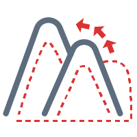
◇ Supports terrain analysis such as slope, aspect, and surface area.
◇ Supports vector analysis such as buffer analysis, overlay analysis, network analysis, etc.
◇ Supports data registration and projection conversion.

Raster distance analysis

◇ Provides functionality for loading, displaying, and browsing multi-source 3D data, including terrain imagery, oblique aerial photography 3D models, BIM (Building Information Modeling), point clouds, pipelines, urban detailed models, vector lines/polygons, and points/texts/labels.
◇ Supports measurement, cropping, viewshed analysis, visibility analysis, skyline analysis, 3D Spatial query, model explosion, etc.
◇ Provides various scene viewing modes, including first-person camera and fixed-point flight, with camera follow capability for panning through 3D scenes.
◇ Provides multiple 3D effects such as atmospheric effects, node animations, particle effects, dynamic water surface effects, PBR materials, enhancing realism in 3D scenes.
◇ 3D AR functionality supports loading and displaying BIM models, 3D pipelines, oblique aerial photography 3D models, terrain/imagery (loaded as models), urban detailed models, labels, etc. It supports overlaying 3D pipelines with real-world matching, facilitating 3D pipeline inspection.

◇ Supports the collection of vector data such as points, lines, and surfaces through gestures and GNSS.
◇ Supports collection and editing of attribute tables.
◇ Supports the collection of multimedia data such as pictures, videos, and sounds.
◇ Supports graphic editing tools such as cutting, merging, erasing, etc.

◇ Supports plotting of point symbols and arrow symbols
◇ Supports creation and editing of plotting animations, enabling situational development

◇ Supports thematic map types such as segment, label, single value, etc.
◇ Supports more than 10 kinds of charts such as area chart, ladder chart, line chart, scatter chart, rose chart, etc.
◇ Supports heat maps, grid heat maps, density maps, aggregation maps, relationship maps.

◇ New overlay display of native maps with Web (HTML5), message communication, and gesture operations.