During the e-commerce festival, a large number of orders flood into the backstage of merchants in a short period of time. If they are not processed in time, it will often cause order congestion or even loss. Some e-commerce companies use manual sorting of…
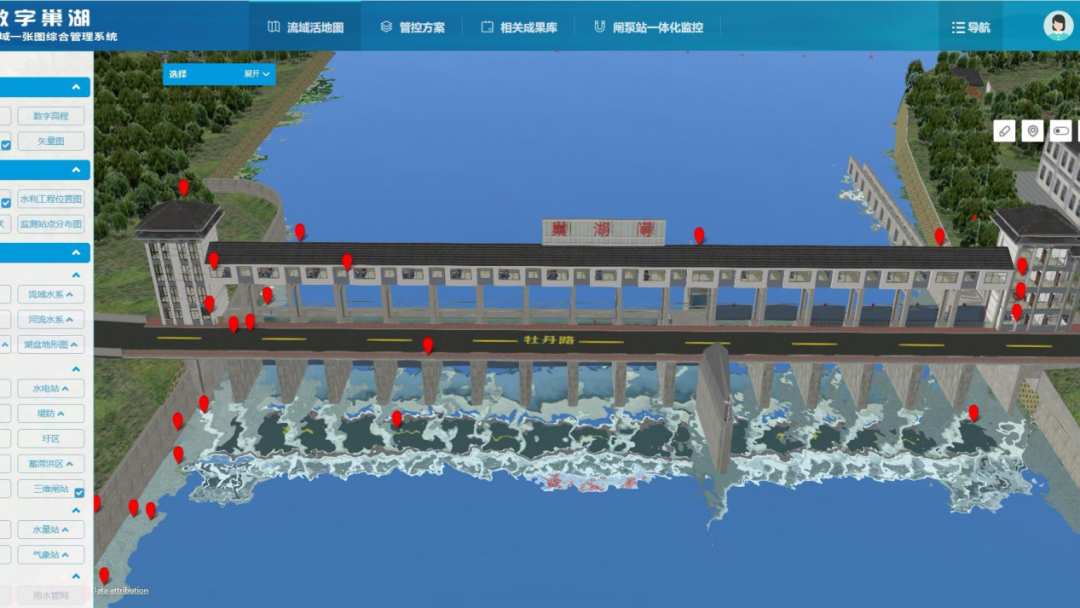
18 Dec,2022As one of the five largest freshwater lakes in China, Chaohu Lake has a well-developed water system and convenient transportation. It has played a very important role in regulating and storing floods in the basin, ensuring urban water use, developing agri…
09 Dec,2022Based on SuperMap GIS technology, Shuifa Smart Agriculture Technology Co., Ltd. built a smart park production management platform, utilizing technologies such as digital twins and IoT perception to enable intelligent control and mechanized production, rep…
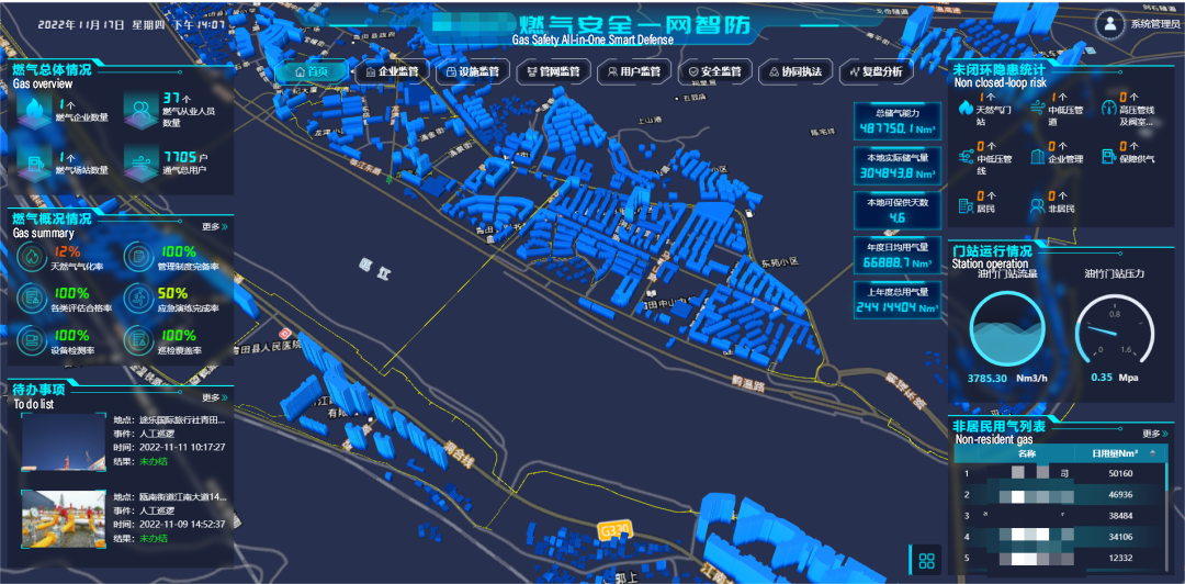
07 Dec,2022In recent years, city gas users and indoor gas facilities are rapidly increasing, which gives rise to more gas safety risks. To facilitate the safety management of gas in cities, SuperMap utilizes digital twin technology to create a “Gas Safety All-in-On…
02 Dec,2022This project covers typhoon storms, mountain reservoirs, flood disasters, geological disasters, as well as production and business, road traffic, marine fishery ships, city gas, etc., and has initially formed the "air-space-ground-sea integrated, dep…
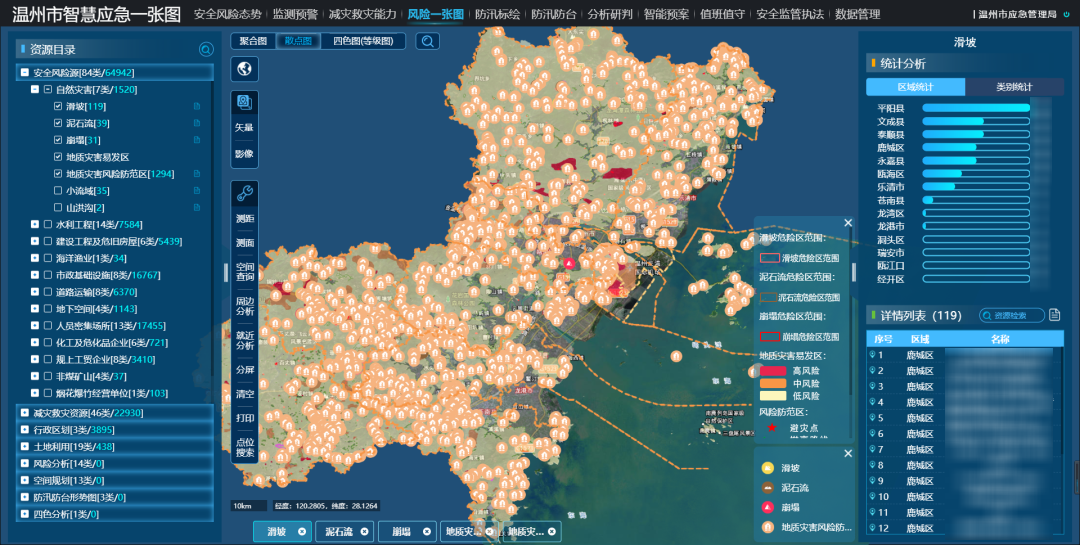
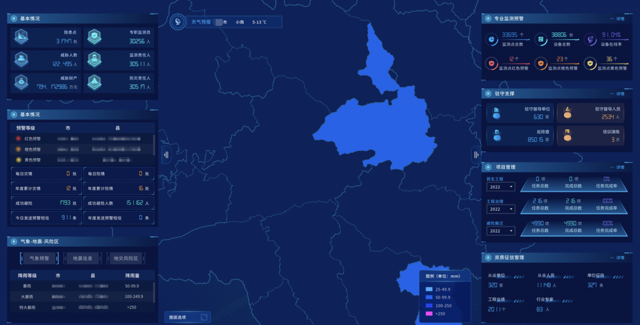
30 Nov,2022In the investigation of geological disasters, it is necessary to keep an eye on the "old problems" and find out the "new hidden dangers" generated by the development. "Where are the hidden dangers of earth disasters?" "W…
22 Nov,2022Global e-Service GIS is an after-sale service system developed for Hitachi Construction Machinery based on SuperMap GIS technology. Since it entered into service in 2005, from SuperMap IS .NET to SuperMap cloud structure, it has experienced several substa…
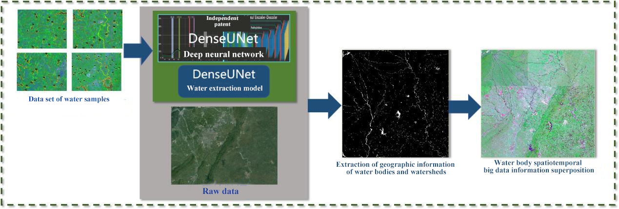
11 Nov,2022Based on the remote sensing data of the Gaofen-2 satellite, Unionbigdata has built a big data analysis system for remote sensing of rivers and lakes in Chengdu for the Chengdu Smart Governance Center. The core mechanism is that water that is clean, malodo…
01 Nov,2022Gansu Province 3D Digital Plan Platform for Rescue and Firefighting, based on the geospatial database and adopting the method of 3D display, proposes a new rescue and firefighting drill method - online drilling. Integrating ordinary digital plans and 3D d…
31 Oct,2022Utilizing technologies of GIS, 5G, Internet of Things, big data, digital twins, SuperMap geological disaster prevention and management platform adopts the “1+1+N” model: one geological disaster big data center, one geological disaster prevention basic i…
28 Oct,2022