The 3D Visualization Platform for Social Governance was developed by Shanxi Provincial Investment Group Information Technology Co., Ltd. based on SuperMap GIS technologies. It is used to facilitate the three-dimensional social public security defense system, in response to the shortage of police resources and changing circumstances of public security.
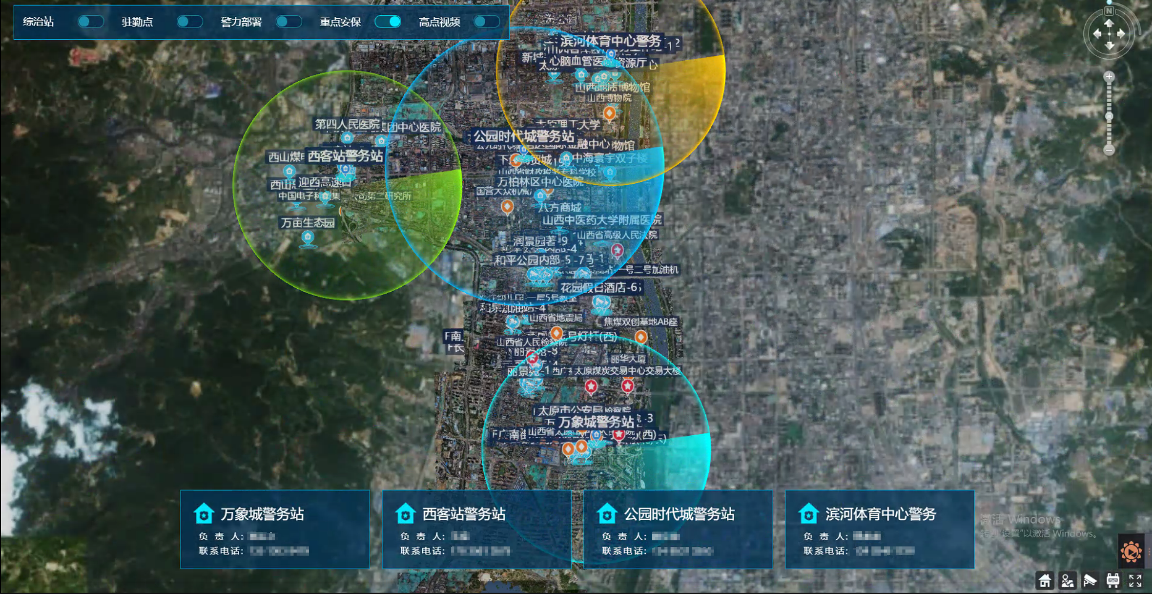
1. System interaction platform: The overview map of the jurisdiction, using the service released by 3D oblique photography data as a base map, can display the classified information of various places, the general situation of the community, and key places and key personnel. For key places, users can open the corresponding layer, click to display the marked position on the map, and expand the details panel for the detailed query.

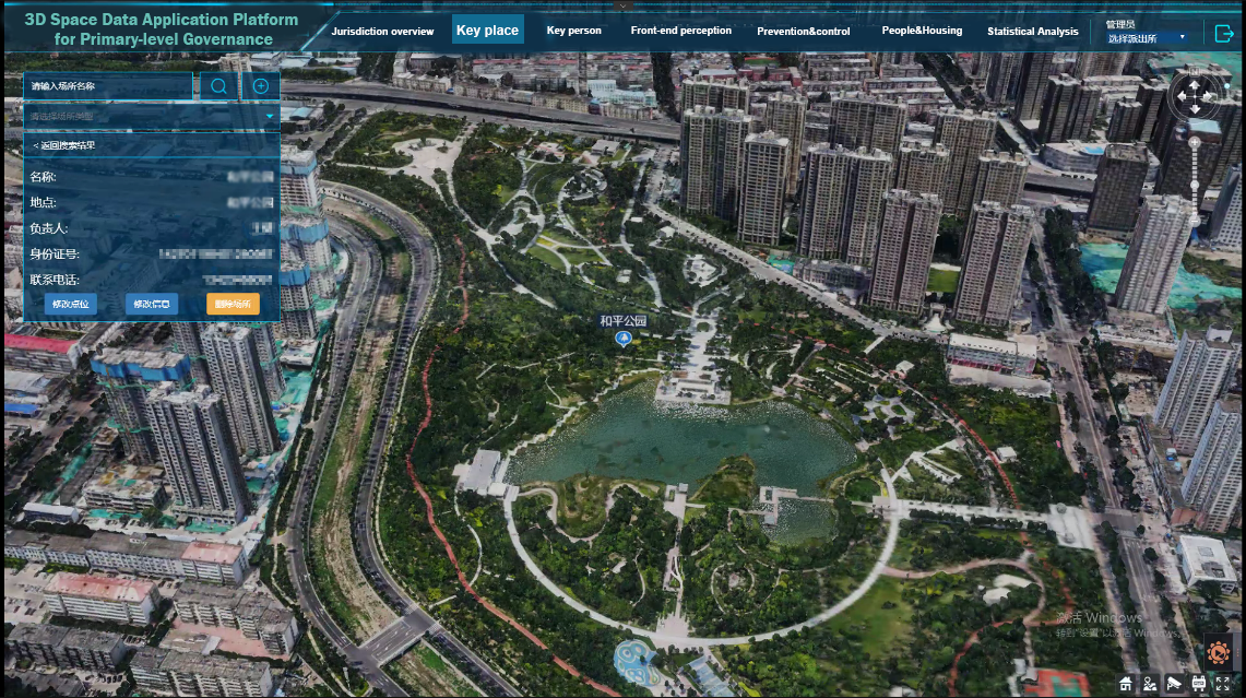
2. Key place: In the key place module, the platform can select the places that the public security focuses on in the drop-down menu, and supports fuzzy/precise retrieval. After users input the place's name, this module supports the precise positioning on the 3D map and the display of the place's details.
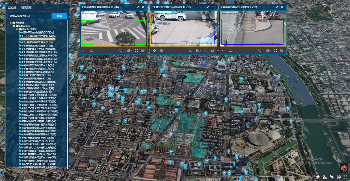
3. Video point preview: Based on the existing video surveillance space layer data, the fixed-point surveillance video is scattered on the map, aggregated and displayed, and accessed to the video in real time by docking with the third-party video management platform.
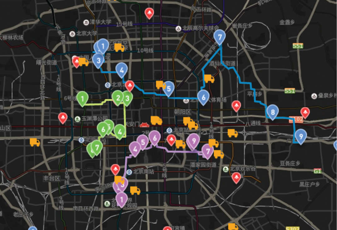
4. Deployment: The means of video monitoring, 3D GIS and GPS monitoring and dispatching are combined. It enables multi-level linkage and coordinated operations. The huge 3D space information, video information and real-time location monitoring information can assist leaders in formulating operation plans, commanding in cooperation with on-site command vehicles, and assist the personnel in understanding the situation of the scenes.