Highways stretch in a band, and have the characteristics of long-distance, narrow width, complex terrain, diverse environments, and many types of data. Sichuan Highway Planning, Survey, Design and Research Institute adopts SuperMap multi-source data fusion technology to form a unified highway project geospatial database through managing multi-scale, multi-type and multi-regional spatial data. Among them, the seamless fusion technology of high-precision terrain in strip-shaped areas and large-scale low-precision terrain solves the technical problems that have plagued the expression of highway engineering terrain for a long time. Also, the technology integrates BIM, oblique photogrammetry and vector data, and solves the problems of complex organization and maintenance of highway project data.
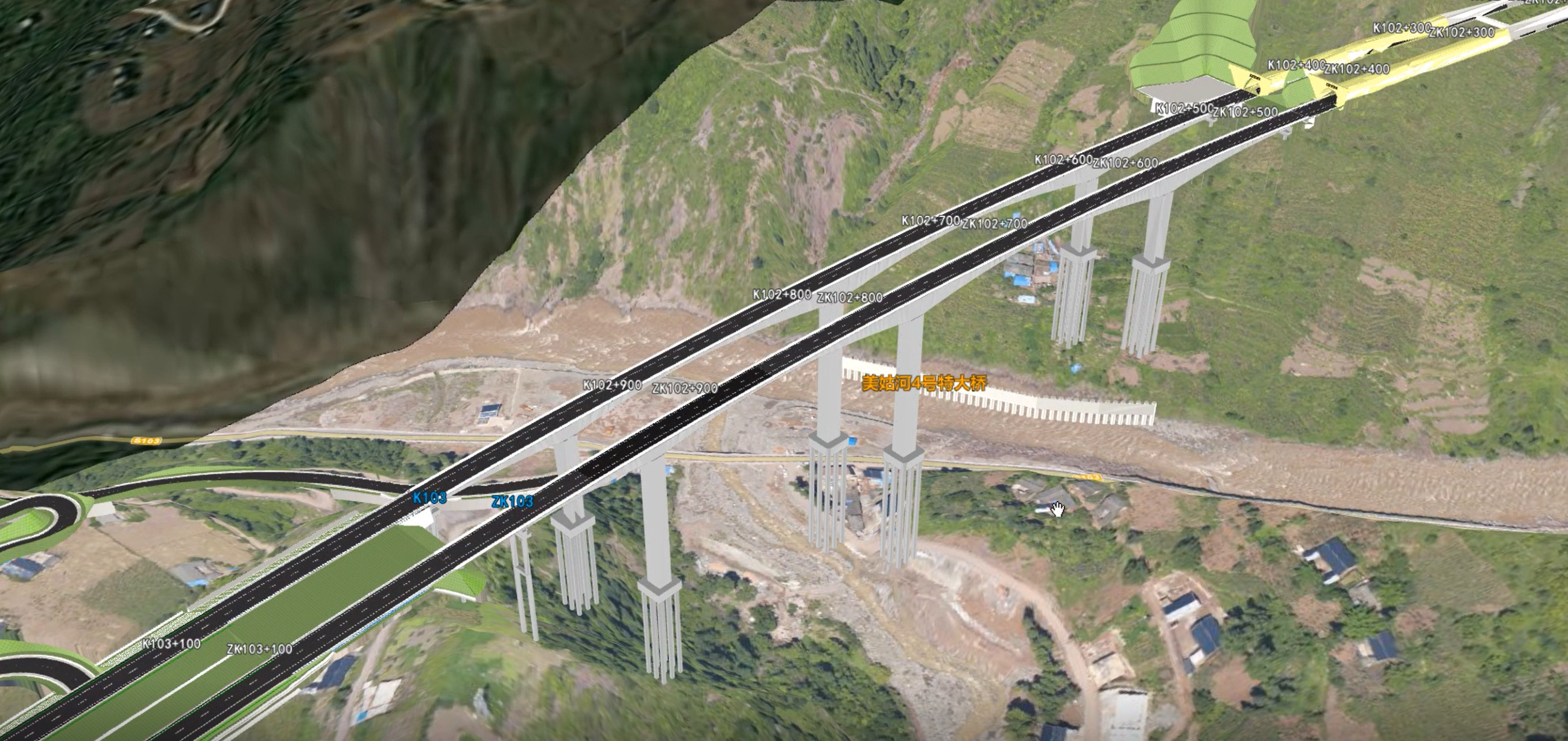
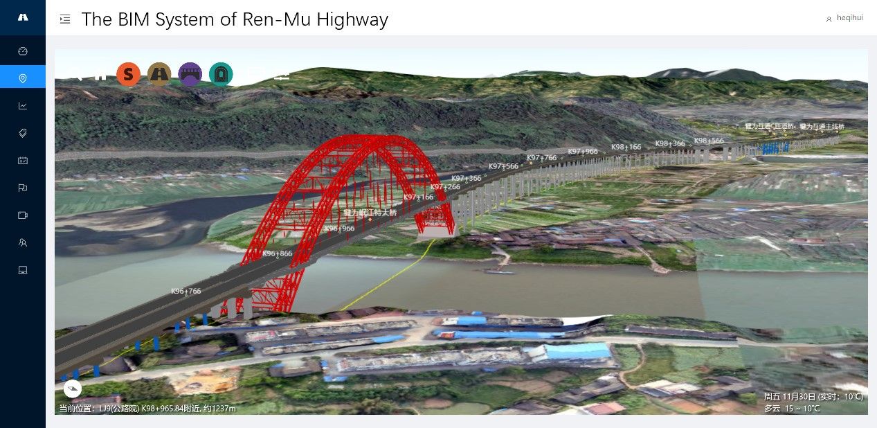
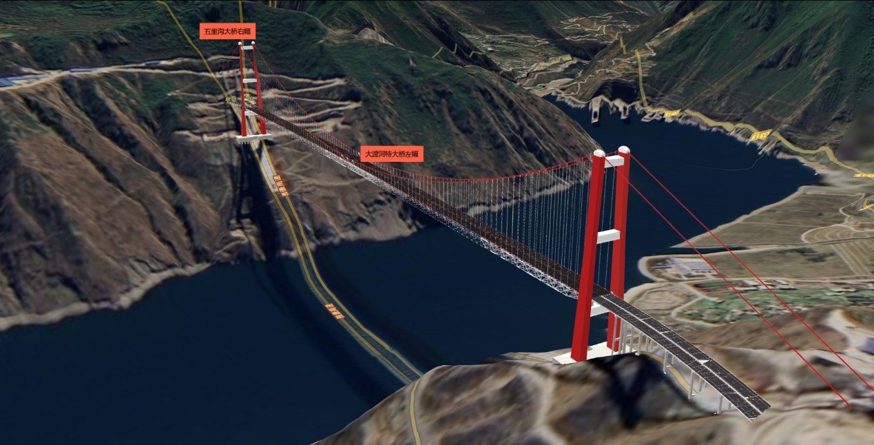
Relying on the BIM refined model and WebGL technology, the system can truly, intuitively and accurately express the overall image of the highway project and the component-level information of each facility on the front end, and provide the functions of the interactive browsing and display of design drawings, pile numbers, design and construction-related data information based on the 3D model to support on-site construction and construction management. It is convenient for users to understand the project construction process and the situation after completion through this module.
Combining detailed land acquisition information with GIS allows users to intuitively see the actual situation of land acquisition. They can go deep into the scope and status of each piece of land to be acquired, and can also have an overview of the land acquisition situation of all plots. Combined with the final calculation of land acquisition data, statistical reports are automatically generated, and an overview map of land acquisition status is launched. Users can see the land acquisition situation of the entire highway project at a glance, and also allow owners to understand the demolition process more timely and accurately.
Onsite construction data information can be dynamically collected and managed according to management standards and requirements with the App, improving the timeliness, accuracy, and integrity of on-site data collection.
The design department can feed back the design information to the construction process in real time through the system, and also understand and update the information feedback in the actual construction, which is helpful for the rapid processing of subsequent engineering construction.
The construction department and the supervisory department fill in the construction data through the App terminal of the system, standardizing the submission of construction data, achieving simple and fast filling, avoiding the problem of irregular data status in the past, and saving part of the cost through paperless reporting.
The system manages the electronic drawing resources in the process of engineering design and construction, and users can retrieve and view them at any time through the PC or mobile app, avoiding the traditional difficulty of finding drawings.
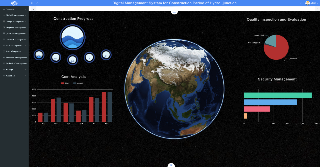
By means of BIM refined model and construction data log, combined with SuperMap's 3D thematic display capability, the project design progress, actual progress, and expected progress are displayed on the front end in the form of 3D thematic maps, so that users can quickly and intuitively view the real-time construction status of the project, so that the owner can understand and effectively control the construction progress in real time.
The Highway Institute innovatively has standardized BIM data, sub-item data, and on-site construction information filling, which is conducive to data management and extended application. Through intuitive visualization of facility components, land acquisition control, construction process, and project progress, users can quickly and clearly understand the project situation. Based on the sub-section item division standard, the sub-section item self-service division is carried out, so that the sub-section item division work is standardized, normalized and efficient.
The system carries out data integration based on sub-items, supports data generation at one time, and multi-party sharing. With BIM+GIS as the data integration basis, the integration of all engineering data is achieved. At present, the system has been applied to the management of many highways.