In traditional fire-fighting information systems, most of the maps used are images and vector maps. However, firefighters cannot intuitively see the indoor and underground conditions through image maps and vector maps, which brings great challenges to the informatization work of fire indoor rescue and underground rescue.
With the development of 3D surveying and mapping technology and the new generation of 3D GIS technology, smart fire protection has enabled the restoration of indoor, outdoor and underground scenes, making fire rescue command more accurate and intelligent. At present, Guizhou Fire and Rescue Department uses SuperMap new-generation 3D GIS technology to develop functions such as indoor and outdoor visual display, geographic analysis, 3D plotting, pre-plan deduction, and 3D emergency mapping of key locations, achieving the overall management of real 3D model data, indoor model data, as well as the plan deployment, plan sharing, and plan collaborative plotting.
3D real scene model, supporting emergency rescue
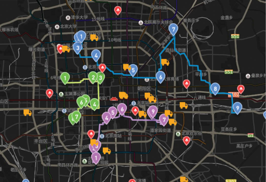
The application of the 3D real-scene model can help firefighters quickly grasp the surrounding environment of the incident site. In particular, the development of 3D rapid modeling technology provides technical support for the urgent need for the rapid drawing of emergency rescue work, which greatly shortens the production time of 3D real scene models, and firefighters can quickly obtain 3D geographical environment data before, during and after firefighting and make rapid response to the deployment of rescue operations.
At present, SuperMap GIS platform software has realized the docking with the fast modeling software of DJI, and the mapping software of DJI can directly export the oblique photographic data formats such as S3M and osbg supported by the platform software of SuperMap GIS. In the “7.23” large landslide incident in Shuicheng, Guizhou, the fire rescue team used DJI drones to take aerial photos of the landslide site, generate image data and oblique photography data in real-time, and use SuperMap GIS platform software and its secondary development platform to optimize and load data to observe the changes in the geographical environment of the landslide site and the deployment of rescue plans.
High-precision real-scene 3D model, presenting outdoor applications
In the Guiyang smart fire protection project, the new generation of 3D GIS technology system supports a large number of high-precision real 3D models, which presents the surrounding geographical environment of the accident for the fire protection industry.
Users can use GIS technologies such as measurement, spatial analysis, and 3D plotting to get familiarized with the surrounding environment, query surrounding fire facilities, roads, and fire departments, and deploy rescue plans.
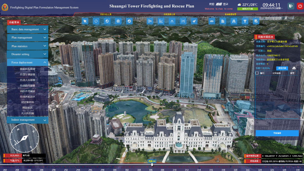
BIM model, viewing the internal environment of the building in time
In fire rescue and emergency plan drills, the application of indoor models facilitates firefighters to view the internal environment of buildings in real time, from the internal structure of buildings to the location of safety exits, to the deployment of firefighting equipment, and even to the control buttons of firefighting equipment. SuperMap GIS platform software breaks through key technologies such as lossless access and light weight of BIM mainstream data, and provides strong technical and platform support for the application of 3D GIS from macro to micro, and from outdoor to indoor.
In the BIM model data, operation data such as the number of people in each building/floor, business operations, and potential safety hazards can be displayed; in addition, firefighters can view indoor escape routes, deployment of firefighting facilities, etc., to facilitate the review of firefighting accidents after the event and learn from it.
The highly real scene simulation with the new generation of 3D GIS technology has brought brand-new changes to indoor, outdoor and underground fire rescue, and solved the difficult problems of indoor, outdoor and underground rescue for many fire rescues in Guizhou, saving people's lives and property loss. It is believed that with the popularization and application of the new generation of 3D GIS technology, this technology will play a more important role in the fire emergency and other industries.