SuperMap logo
  • Products

    What is GIS

    About SuperMap GIS

    Technology System

    • Big Data GIS
    • New RS Software
    • New 3D GIS
    • Geospatial AI
    • Distributed GIS
    • Cross Platform GIS

    SuperMap GIS 2024 New!!

    • Cloud GIS Server
    • Edge GIS Server
    • Terminal GIS for Desktop
    • Terminal GIS for Components
    • Terminal GIS for Web
    • Terminal GIS for Mobile

    Previous Versions

    • SuperMap GIS 2023
    • SuperMap GIS 11i(2022)
    • SuperMap GIS 10i(2021)
    • SuperMap GIS 10i(2020)
    • SuperMap GIS 10i
    • SuperMap GIS 9D(2019)
  • Solutions

    Smart City

    Natural Resource

    Land Management

    Facility Management

    Public Safety

    Natural Disasters

    Transportation

    Water Conservancy

    BIM+GIS

  • Stories
    • Articles
    • News
    • Events
    • Magazines
  • Support
    • Download & Online Help
    • Online Demonstration
    • Ask & Answer
    • Discover SuperMap GIS
    • Trial License
  • About
    • lntroduction
    • Careers
    • Contacts
    • Suggestions
 
  • English
  • 中文
  • Español
  • Français
  • ภาษาไทย
  • русский
  • Türkçe
  • Português
  • 日本語
  • 한국어
  • Indonesian
  • عربي
Transportation

Transportation Solutions

  • Home
  • Solutions
  • Transportation

Transportation

  • BIM
  • Disasters
  • Land
  • Water
  • Transportation
  • Safety
  • Facility
  • City
  • Resource
  • The Intelligent Urban Public Transportation Application

    ?The intelligent urban public transportation project assists the competent department of the industry to improve the urban public transport comprehensive operation monitoring network and the information collection system.

    08 Oct,2019
    The Intelligent Urban Public Transportation Application
  • The Huizhou Expressway Maintenance Management System

    The Huizhou Expressway Maintenance Management System is one of the important application systems of the transportation infrastructure management.

    11 Sep,2019
    The Huizhou Expressway Maintenance Management System
  • The North Jiangsu Canal Comprehensive Information System

    The comprehensive information system of the North Jiangsu Canal covers the 400 kilometers of the north section of the Beijing-Hangzhou Grand Canal, as well as 11 cascades and 28 ship locks.

    09 Sep,2019
    The North Jiangsu Canal Comprehensive Information System
  • The Application of BIM + GIS Technology in National Highway of Yellow River Bridge Project

    The National Highway of Yellow River Bridge Project fully utilizes?the technical advantages of “Internet + BIM+GIS”, which realizes?the visualization of design results, core construction process, construction process controlling, and maintenan…

    21 Aug,2019
    The Application of BIM + GIS Technology in National Highway of Yellow River Bridge Project
  • BIM+GIS in Urban Rail Transit System

    Till 2017, 33 cities have been running urban rail transit with a total length of 3,965 km and 11 cities have been running modern trams with a total mileage of 233 km in China. Currently, the urban rail transit system of 53 cities is under construction wit…

    28 Jul,2019
    BIM+GIS in Urban Rail Transit System
  • BIM+GIS Application in Qianzhangchang Railway

    Qianzhangchang Railway starts from Qianjiang District of Chongqing and ends at Changde of Hunan Province. The total length of the railway is 340 kilometers and it works as the national first-class two-lane electrified railway for both passengers and cargo…

    27 Jul,2019
    BIM+GIS Application in Qianzhangchang Railway
  • The 3D Expressway Facility Digital Management System

    The expressway facility digital management system is a set of road digital management system developed by a corporate partner of SuperMap based on 3D technology. The system supports the rapid collection of expressway environment information, the rapid con…

    26 Jul,2019
    The 3D Expressway Facility Digital Management System
  • The Expressway Comprehensive Management Platform

    Based on SuperMap GIS, the partner company has developed a comprehensive project management system. The system realizes the integration and application of the 3D geographic information of the project area, the BIM model of the project, and various data in…

    25 Jul,2019
    The Expressway Comprehensive Management Platform
  • The Airport Transportation Operation Management System

    The Airport Transportation Operation Management System is?a unified operation and management platform for ground transportation of Qingdao New Airport. It realizes the organization and coordination of various transportation modes including subway, hi…
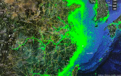
    15 Jul,2019
    The Airport Transportation Operation Management System
  • Satellite Tracking + Big Data GIS Application in Real-time Ship-controlling

    With the coming era of big data, SuperMap realizes the technological innovation of all aspects of the spatial big data process. SuperMap deeply integrates big data storage management, big data spatial analysis and big data real-time stream processing with…

    04 Mar,2019
    Satellite Tracking + Big Data GIS Application in Real-time Ship-controlling
<<< < 1 2 > >>>

SuperMap GIS

  • Cloud GIS Server
  • Edge GIS Server
  • Terminal GIS for Desktop
  • Terminal GIS for Components
  • Terminal GIS for Web
  • Terminal GIS for Mobile

Stories

  • Articles
  • News
  • Magazines
  • Events

Support

  • Download & Online Help
  • Online Demonstration
  • FAQ
  • Demo Code
  • Technical Docs
  • Training Files
  • Videos
  • Trial License

Events

  • [list:pagetitle] [list:targetlink]
  • {/zzz:list}

About

  • lntroduction
  • Careers
  • Contacts
  • Suggestions

Follow Us

  • LinkedIn
  • Facebook
  • Twitter
  • Instagram
  • YouTube
© 1997-2023 SuperMap Software Co., Ltd.
  • Sitemap
  • | Privacy