The comprehensive information system of the North Jiangsu Canal covers the 400 kilometers of the north section of the Beijing-Hangzhou Grand Canal, as well as 11 cascades and 28 ship locks. It includes the largest ship lock transfer system in China and the first non-stop gate transfer system based on mobile APP.
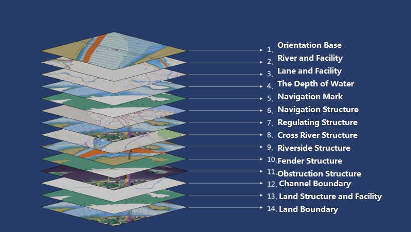
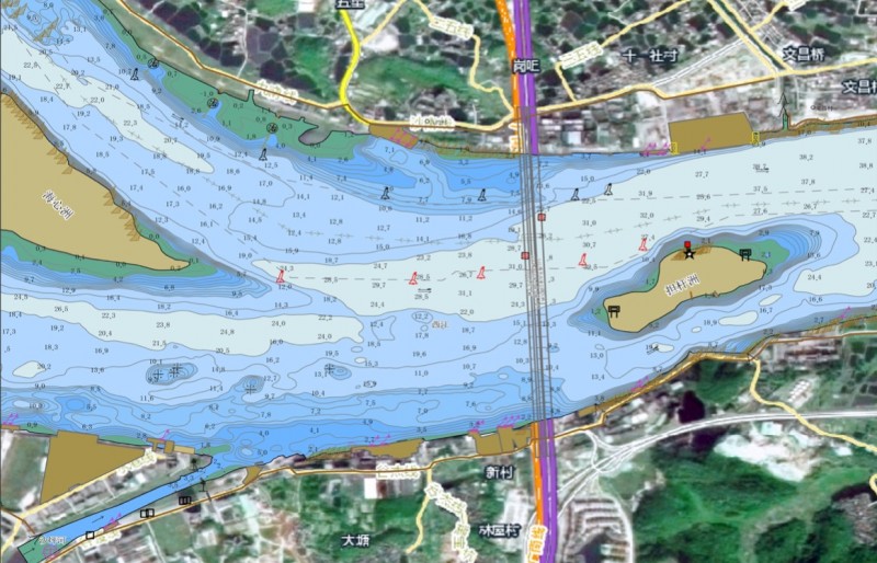
The "Comprehensive Shipping Information Service System" builds an integrated navigation channel data resources by constructing channel stereoscopic perception system and integrating shipping business data. It also builds a multi-service collaborative application system by combining the business needs of channel management, service, and decision-making. Among them, the electronic channel map is the systematic visual platform. Based on the powerful platform software supported by GIS graph analysis, data mining and virtual reality computing technology, the channel data is aggregated in real time on the channel GIS map. Also, through the web and the mobile GIS services, the dynamic, centralized, intelligent and visual shipping management and service capabilities can be realized to provide intuitive, accurate and real-time support on decision-making services for managers and the public.
Satellite Tracking + Big Data GIS Application in Real-time Ship-controlling>