The expressway facility digital management system is a set of road digital management system developed by a corporate partner of SuperMap based on 3D technology. The system supports the rapid collection of expressway environment information, the rapid construction of facility refined spatial database, and the rapid inspection and comprehensive management of expressway facility infrastructure with the technologies of geographic information, 3D scanning, 3D refined modeling, spatio-temporal massive data management technology, 3D dynamic display technology, and interactive scene technology, etc..
Also, the system can access and integrate the highway dynamic business data to provide basic geographic information data for traffics operation state monitoring and analysis systems and smart service platforms, which can improves the digital and smart expressway management.
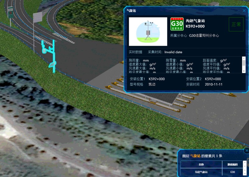
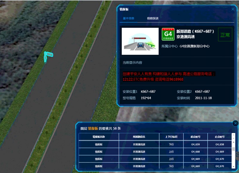
(1) The 3D visual display and location query of the infrastructure
The system provides 3D model display according to the terrain images, expressways, interchanges, toll stations, service zones, bridges, tunnels, entrance and exit ramps, monitoring equipment, signal lines, mileage piles, information boards, lighting facilities, noise reduction facilities, isolation belts and reflective facilities layers. It realizes the visual inspection and browsing of expressway infrastructure, and quickly locates and queries equipment attribute information according to equipment number and station number to support the management of expressway assets.

(2)Operation decision management of traffic
Through the accessing of dynamic traffic information, such as the highway monitoring video data and the traffic flow monitoring data, it can realize the visual condition monitoring of the traffic. Through obtaining the height limit and the limit width of each road section and each structure (bridge and tunnel), it can provide intelligent guidance for the special vehicles.
New 3D GIS Technology in Underground Water Management>
2D and 3D GIS in Natural Resources Management>
New 3D GIS Technology Supports the Construction of "Digital Twins" in Transportation>