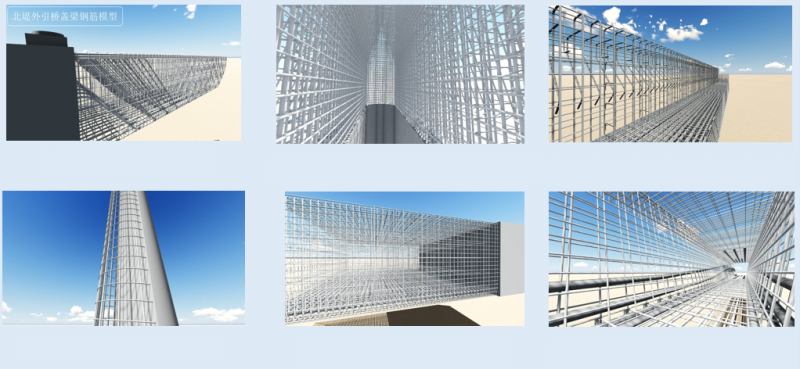
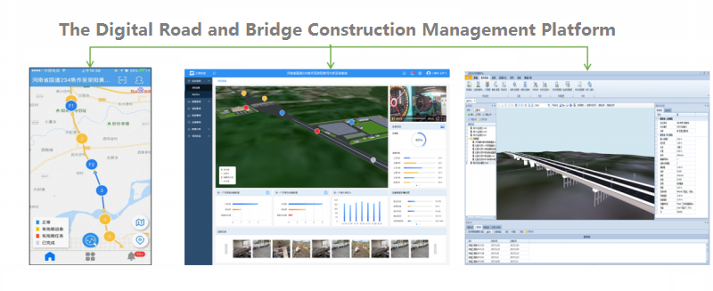
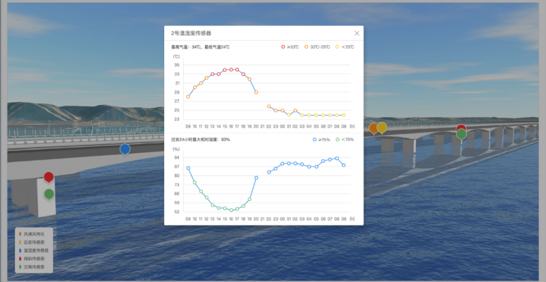
The National Highway of Yellow River Bridge Project fully utilizes the technical advantages of “Internet + BIM+GIS”, which realizes the visualization of design results, core construction process, construction process controlling, and maintenance management during operation. Also, the project establishes the management and control system that taking the knowledge engineering as the core, and realizes the refined management of road and bridge.
The main technical applications and innovations of the project are mainly in following three aspects:
1) Establishing the model design standards: Based on the project life cycle, it establishes the model design standards, standardize modeling rules, operational procedures, and technical measures to ensure the creation of models and ancillary information, while meeting the application requirements of road and bridge construction and operation and maintenance.
2) The refined design: Conducting the pre-stressing refined design on the standard box girder, generating large-scale rebar maps to guide the on-site processing, reducing the occurrence of cutting steel on the construction site, and improving the project quality and saving construction time.
3) The construction site layout: Establishing an accurate 3D terrain model, and using the drone to take corresponding landscape photos for real-life restoration. According to different construction areas and stages, plan on-site construction and processing areas, the quickly calculation of the amount of excavation and filling can be done according to the different road plans.

1) The integrated monitoring: Establishing the visual monitoring data such as project schedule management view, investment management view, quality management view, and safety and civilized management view, that can accurately and intuitively reflect the progress of the project and the trend analysis data to assist the scientific decision-making.
2) The work synergy: Making full use of the convenience of the mobile terminal to establish a new mode of quality, safety and coordination problem management of the construction process based on Internet + knowledge engineering. It can realize the full control of the construction problems from the discovery, reporting, rectification, confirmation, analysis and summary stages to the end stage of developing the preventive measures.
3) The system integration: In order to improve the efficiency of information collection and avoid data errors caused by manual inputting, the project integrates real-time data of intelligent system such as real-time monitoring, equipment monitoring, construction monitoring of pre-stressed systems, online monitoring of slopes, etc.
4) The handover of the completed project: With the information bearing ability of the BIM information model, the design data, construction process data and completion acceptance data are effectively integrated with the BIM model to form a complete set of digital assets for the construction process.

1) The maintenance management: the information integration carrier based on GIS+BIM can regularly organizes road traffic surveys, and uses advanced technologies such as video surveillance and intelligent inspection vehicles to standardize maintenance management.
2) The emergency protection: According to the characteristics of the traffic information of the project, and based on the “BIM+GIS” technology, the project integrates the systems of road network monitoring, bridge online health monitoring and related traffic operation monitoring to realize the network operation of all road sections.

BIM+GIS in Building Information Management>
BIM+GIS Application in Life Cycle Digital Management of Yalong River Hydropower>
BIM+GIS Application in Urban Rail Transit System>