Introduction: How to automatically detect accumulated snow on the highway and get it removed in time on heavy snow days? How to remind the motorist to slow down when pedestrians are crossing the highway? How to automatically detect someone drying grain in the sun on the highway? The smart highway in the future based on GIS technologies will render travel more scientific and technological. Wuxi Highway Development Center, together with SuperMap and Thinvent, has created a comprehensive intelligent smart road project for Wuxi 342 Provincial Highway.
Wuxi 342 provincial Highway spans three cities and is about 119 kilometers long. Through many years of operating and exploration, this section initially formed a real-time monitoring, rapid response, real-time management of highway intelligent perception system, but compared with the requirements of network-based highway regulation and whole-life-cycle management of major infrastructure, there is still a certain gap, which requires advanced perception technology and delicate space technology to build a sustainable and new generation of the smart highway.
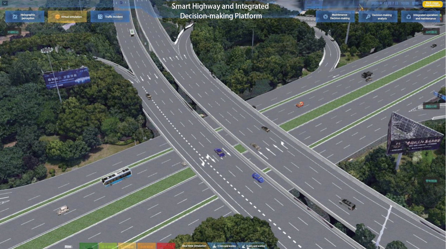
This picture shows the Smart Road and Integrated Decision-making Platform, including the functions of Holographic perception, Virtual simulation, Traffic Incident, Maintenance Decision-making, Decision-making analysis, Integrated operation and maintenance, Back-stage management, Real-time simulation, 15 mins early-warning, 30 mins early-warning, etc.
>Key GIS technologies in building a 3D base of the information management center for the smart highway
The project aims to form an information management center (and build a 3D base), laying a foundation of geographic information for the smart management of the highway.
The key technologies of geographic information include:
1. Multi-source data fusion
It fully integrates a large number of existing multi-source heterogeneous spatial data such as BIM, vector, image, tilt photography, and high-precision map of this highway, and integrates them with traffic management data.
2. Strong effects of visualization
Based on the fusion of all kinds of data, the visual and aesthetic requirements of different data, elements, levels, perspectives, and scenes are taken into full consideration, to enhance the visualization effect and improve user interaction experience without reducing access efficiency.
3. Practice of space technology
Combining the 3D space analysis technology with the road management scene, the practical application system based on space technology is formed, including traffic scene simulation and reproduction, stream data display and statistics, traffic status short-term prediction, traffic management impact evaluation, and so on.
4. Expansion of space technology
The project fully introduces advanced IT technologies such as Internet of Things, big data, artificial intelligence, holographic perception, micro-services, and edge computing, and integrates them with GIS technology to facilitate the construction of smart roads in multiple dimensions.
>How does the information management standard of the smart highway get improved?
1. Visible, measurable, and available highway data can be a reliable basis for decision-making.
2. The pressure of road management is greatly eased. The online traffic scenes supported by virtual simulation allow for predicting short-term traffic conditions and evaluating the impact of traffic management. The traffic network incident flow data obtained by video surveillance and video event monitoring camera are superimposed and analyzed with geographic information data, which effectively alleviates the traffic safety pressure caused by the highway’s parallel to the busiest Shanghai-Nanjing Expressway.
3. The project enables first-class road management services. The project creates application scenarios such as efficient control, low visibility induction, vehicle-road coordination, travel in severe weather environments, intelligent parking, and intensive light pole, and brings a better service experience for motorists.
>What users say
Wuxi 342 Provincial Road Smart Highway Project utilizes delicate space technology and improves the safety, efficiency, environmental performance, and convenience of highway traffic.
Author: Chen Jun, Wuxi Highway Development Center; Zhang Chuanyang, Thinvent; Shen Jian, SuperMap Platform Business Group
Click Tags below for more about 3D GIS and Transportation