In order to regulate activities of development and land-use of territorial space in Lijiang city more effectively, local authorities collaborated with SuperMap to develop the Territorial Space Basic Information Platform and the “One-map” Territorial Space Planning Supervision System. Why is it imperative to develop such a platform and system? How do they work based on GIS technology?
The Territorial Space Basic Information Platform innovatively puts forward the concept of a numerical database, which can be updated through manual input, database extraction, model calculation, IOT equipment access, etc., to form a natural resource index management system that is easy to manage, sustainable and efficient. The platform integrates 980 spatial data services, more than 1,700 document data and more than 8,000 numerical data of more than 500 items from all government departments of cities, counties, and districts, forming a "one map" data resource system involving the current situation, planning regulation, management, economy and society, building a natural resource and planning data center of Lijiang city.
Orienting toward application systems, the platform can provide a variety of easy-to-use spatial analysis services, greatly saving the cost of system development and maintenance. The analysis functions commonly used in natural resource management and planning services are set as services to avoid results deviation caused by inconsistent data and analysis logic. Based on geographic processing modeling, the evaluation model of spatial data is streamlined, reducing the threshold of model application.
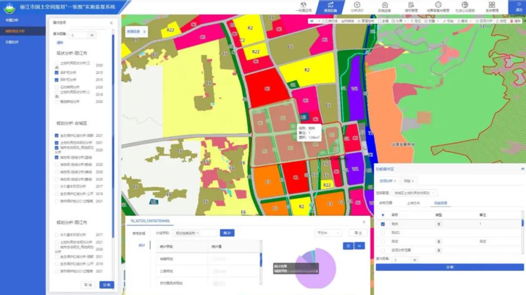
Resource browsing and spatial analysis on “One map”
Lijiang city is located in the transverse mountain area, and the height difference of the whole city is as high as 4,581 meters. Lakes and basins are inlaid in high mountains and valleys, and geological disasters occur frequently. Traditional 2D maps are not intuitive enough to support the compilation of territorial space planning and the usage regulation is a problem to solve.
The “One-map” Territorial Space Planning Supervision System utilizes SuperMap 2D-3D integrated technology. It can simulate a real geographical environment. In the planning, urban development boundary delimitation, the location of the project work, the remote sensing images, oblique photography, architectural models such as 3D data and present situation of land use, ecological protection red line, permanent basic farmland turn from traditional 2D data to 3D.
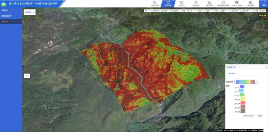
DEM slope and aspect analysis
In order to reduce the technology threshold for users, the system supports automatic modeling of graphic design drawing import, real-time adjustment of building height, number of floors, and other parameters, and calculation of floor area ratio and building density, as well as BIM model import and upload. Combined with data such as oblique photography, the system can accurately simulate the real scene after the completion of the construction project, supplemented by 3D analysis, enabling users to intuitively judge the feasibility of the planning project.
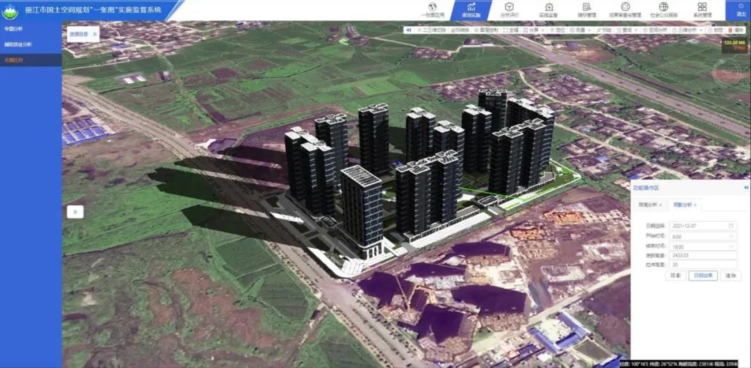
BIM model sunlight analysis
The system can provide a variety of map tools through the "One Map" application, and provides numerous map operation tools in the map interface. In terms of analysis and evaluation, the system supports browsing, querying and statistics of spatial graphics of evaluation results, and provides thematic evaluation scenarios including population, land, economy and public service facilities. As regards implementation supervision, the system can combine the index management system, compare the current planning and status monitoring data, automatically warn when it is near or exceeds the planning index value, and comprehensively display the health status of each index.