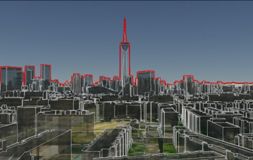
By utilizing SuperMap 3D platform, the City Spatial Information Model Management System was designed and completed in 2019. The system focuses on the four aspects of "seeing, checking, using, and managing". Through the system, the 3D real-scene …
17 Jan,2020 3D GISiServerWith the rapid development and popularization of Internet, IoT (Internet of things), cloud computing and other technologies, the global data has been growing exponentially during the past 20 years.
07 Jan,2020 3D GISBIM+GIS2D+3DstreamingdataWhen making a map, it should not only consider the aesthetics, but also the performance of map. When facing a wide range of maps with large amounts of data, the poor performances of loading, rendering, querying and analyzing maps, especially on the BS and…
19 Dec,2019 Grid tilesVector tilesWith the continuous progress of large-scale 3D spatial data collecting technologies, 3D spatial data is also enriched, such as 3DTile on the Cesium platform, OSGB on the OpenScene Graph platform, and 3MX on the Bentley platform.
05 Dec,2019 BIM+GIS3D GISOn 30 Oct, SuperMap launched the latest product - SuperMap GIS 10i at GIS Software Technology Conference 2019. SuperMap GIS 10i fully integrates AI technology, and innovates and re-builds the technology system “BitCC” of SuperMap platform software, whic…
28 Nov,2019 Cloud GISBIM+GIS3D GISIn recent years, China's higher education has made great progress, and education informationization has also been put on the agenda. Thus, the concept of "smart campus" came into being.
19 Nov,2019 3D GIS2D+3D“Tiandi Map” is the professional and unique provincial geographic information public service platform in Hunan Province. It is also an important display platform and application platform for basic geographic information in Hunan Province.
09 Oct,2019 3D GISThe smart campus is an advanced form of information construction. The 3D virtual campus is the basic platform of the smart campus and an indispensable part of the smart campus construction.
29 Sep,2019 3D GIS