By utilizing SuperMap 3D platform, the City Spatial Information Model Management System was designed and completed in 2019. The system focuses on the four aspects of "seeing, checking, using, and managing". Through the system, the 3D real-scene data of the five city districts of downtown are managed in an integrated manner. It can realize the co-construction and sharing and the dynamic updating of various thematic data information between the system and the city housing space, POI points, subway status and planned routes, etc., thereby meeting the daily display and planning management requirements of 3D real-scene for city planning information technology center. Also, the system provides supports for city scientific planning and decision and plays a positive role in promoting the soft power of city planning and management and enhancing the sustainable development.
Supportive layer: The supportive layer supports environment of cloud servers that are planned to operate on the internal secret network and on the Internet.
Data layer: The data layer includes three major types of databases: the basic geographic information database, the planning thematic database, and the business management database. The basic geographic information database mainly manages real-scene 3D model data, 0.5-meter image data, and multi-resolution mixed DEM data. The thematic data is various types of planning vector thematic data docked from city public platform service interface, including data such as control regulations, subways, and buildings across the city; the business management database mainly manages system operation and maintenance data and various system configuration information.
Service layer: The service layer manages and organizes various 3D cache data through the SuperMap iServer platform, publishes the data as a service, and provide 4 types of interfaces such as 3D display service, 3D query service, 3D spatial analysis service, and data service for client implementation 3D display and planning application management.
Application layer: Based on various 3D service interfaces on the server terminals, a variety of city 3D application functions, such as 3D scene display, planning thematic 3D display, 3D scene POI query positioning, sunlight analysis, skyline analysis, construction intensity analysis, architectural thematic display, and program management can be realized.
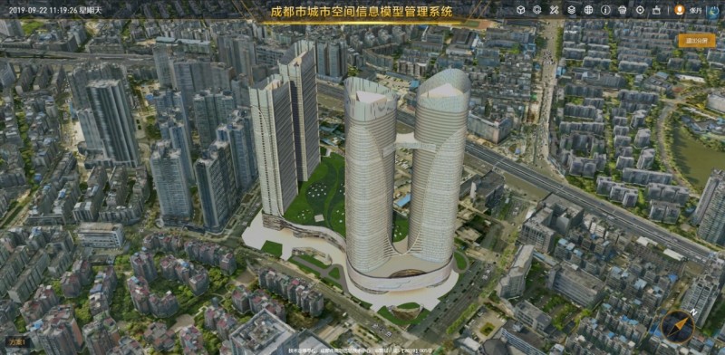
3D scene displaying and browsing: It provides functions such as browsing, querying and positioning for real-scene 3D data and planning thematic data of the city.
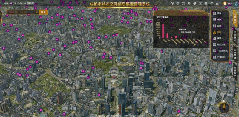
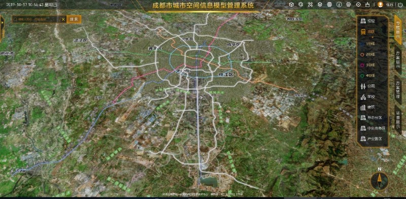
3D scene query and positioning: It provides POI point-based query and retrieval functions in 3D scenes, including functions such as searching the entire geographical name of city, surrounding queries, and quick positioning. It also includes 3D querying of buildings and control information.
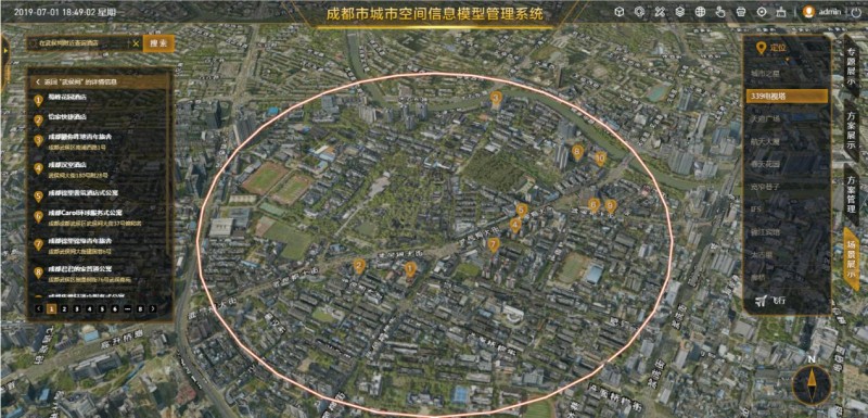
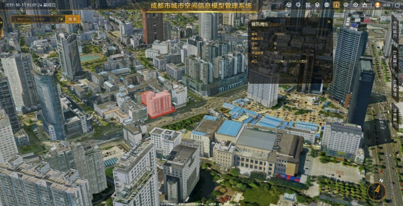
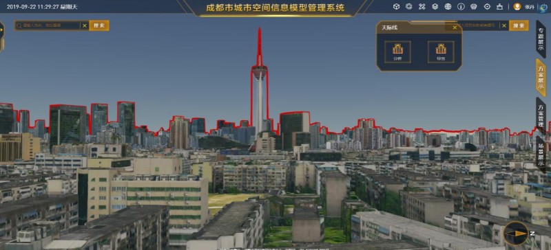
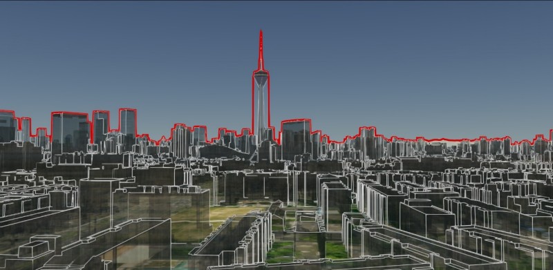
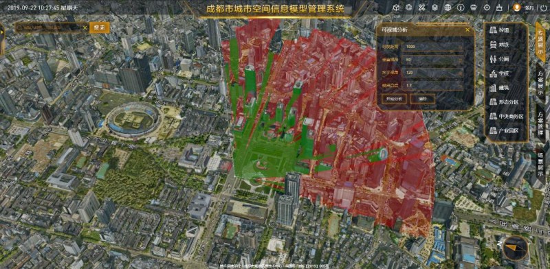
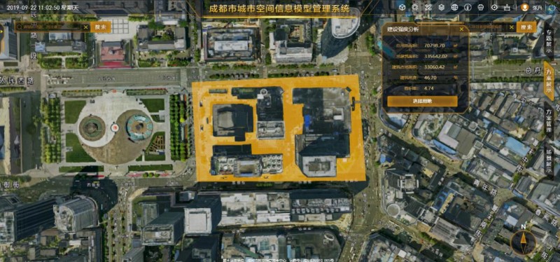
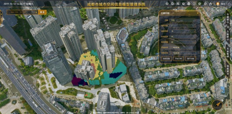
3D analysis: It provides 3D city planning and analysis functions such as skyline analysis, visible area analysis, sunlight analysis, general view analysis, construction intensity analysis, and building thematic analysis.
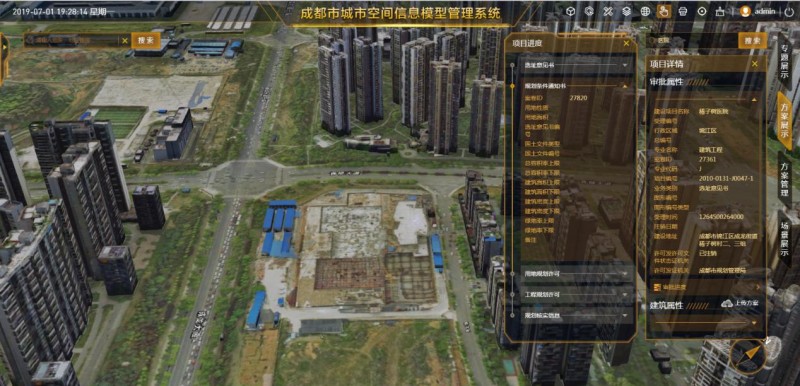
3D planning solution management: It provides plan for B / S client terminal to upload 3D planning solution online directly, display it in superposition with the current 3D scene, and view the 3D planning solution in a multi-screen comparison mode.
New 3D GIS Technology in Underground Water Management>
2D and 3D GIS in Natural Resources Management>
New 3D GIS Technology Supports the Construction of "Digital Twins" in Transportation>


