1 Forestry GIS for forest protection
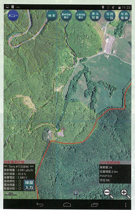
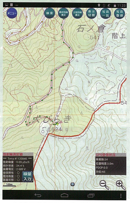
Geographic information is highly important for forest workers. 'High precision positioning portable device for forestry GIS'is developed based on SuperMap iMobile for Android, applying for Android devices with GPS functions. There are necessary modules like high-resolution aerial images, GIS positioning, trajectory, destination information generation, forestry registration query, distance measurement, photograph taking, etc. Meanwhile, the system also contains the land layer, which can compare the land attributes and forestry log information, linking the land shape data and GPS locations.Forestry GIS also can interact with forestry GIS windows version, realizing information sharing. This system has been given Japan electronic land award.

Local government, forestry companies can use portable device to investigate boundaries, acquiring the information of the owner of forestry, setting forestry path, making the cutting plan.
Boundaries investigation: Use high-resolution aerial image data and GPS coordinates to locate.
Forestry information acquirement: Query forestry information according to the current location, query the owners of the forest and label with color, making the circumstances under control. The local governments which have provided land data can distinguish the owner of the form and boundaries, so that they can know the differences of boundaries and registered forestry, registered land.
Setting forestry path, making the cutting plan: To plan forestry path, GIS trajectory is very useful. It will take the photo when meeting obstacles, recording the image and location information for the future use.
2 System Application Category
After the development of forestry GIS, there are more business like radiation measurement, UAV photogrammetry like Radiation, UAV forestry investigation, forestry repair.
2.1 Forestry Pest Monitoring
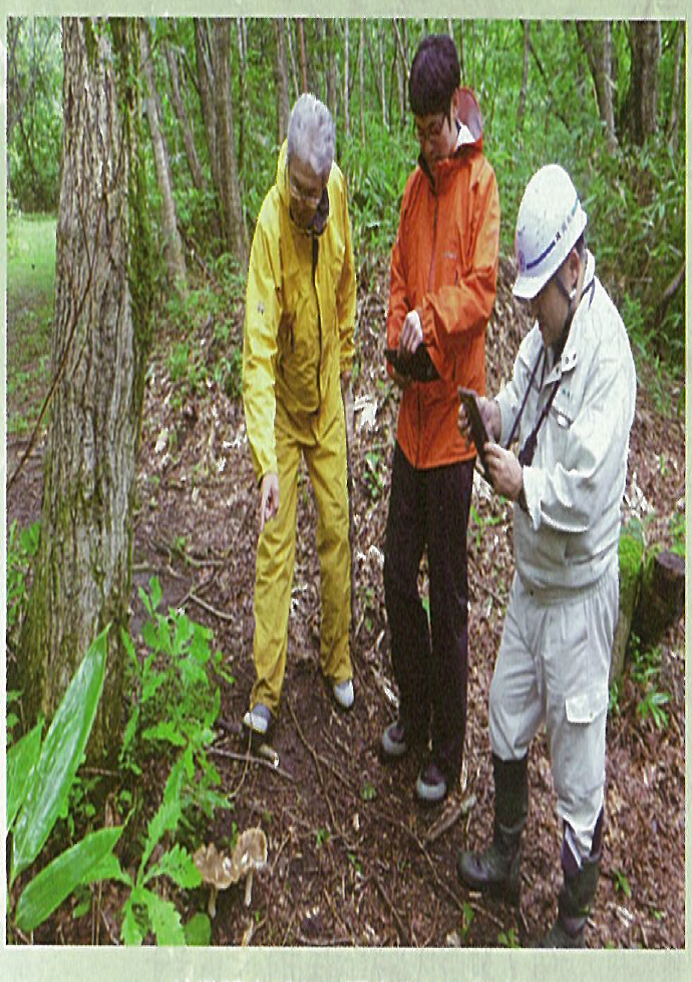
In the forestry area along Japan Sea, there are serious pest problems in pines, which needs checking the pest status from helicopters time after time. If the anomaly has been found, the scientists from institute of forestry science will bring the forestry GIS to collect data on site.
2.2 Radioactivity Investigation
The local mushroom has been influenced by the radiation of Fukushima nuclear accident, using the radioactivity density monitoring devices linking with potable forestry GIS, it is easy to get the radiation distribution. Portable forestry GIS has become a necessary tool for the forestry experts.
2.3 Forestry investigation and GPS
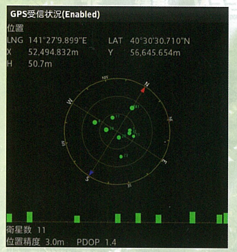
In Aomori, Japan, there are more than over 90% of area with cadastral information, and 100% for forestry area. Therefore, the boundaries of forestry can include the results of cadastral information. However, the accuracy of forestry cadastral investigation is low, there might be the situations of the differences of registered forest boundaries, whose errors may be meters even tens of meters.
Forestry companies know the accuracy of mountain data is low, so they will use different GPS devices when acquiring the location information. The errors range should be within 150-300cm according to Japan Land Investigation law, most GPS can meet this requirement.
During the process of developing forestry GIS, in order to tackle the problem of low accuracy of mountain areas, we have tested the measured coordinates of GPS, and added automatic calculation in the system to display the location accuracy.
Satellite Tracking + Big Data GIS Application in Real-time Ship-controlling>
Big Data - Signaling Data Makes Cities Smarter>