In mobile era, signal data (mobile signaling data) can be created when using mobile phone to talk, send message or access Internet. It is the excellent data sources for its wide coverage, highly continuity and huge user base characters to urban management.
The following case is the preliminary research result of the smart Liuzhou spatial-temporal information cloud platform project. We can understand the visualization of mobile signaling data to analyze the process of mobile signaling data, then to explore the application of mobile signaling data in urban management.
Application of Mobile Signaling in Population Supervision
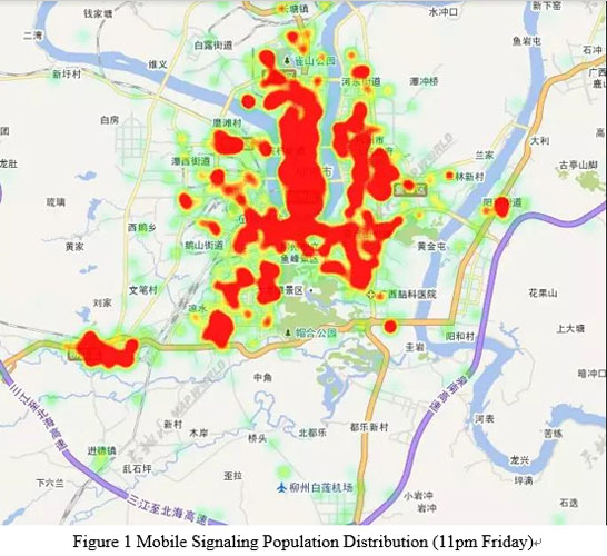
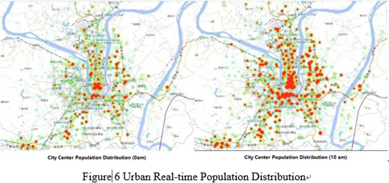
Mobile signaling analysis technology can be used to monitor and count the mobile phone users in city. It will benefit the analysis of population dynamic distribution. For the population data of smart city, on the one hand, it takes the traditional method to build materialized database by using the family planning population data; on the other hand, in order to solve the problem of population location timeliness, it introduces the telecom signaling data to estimate the law of the population movement from mobile phone users, so as to realize the data mining and analysis work such as crowds distribution, life travel law, concentration analysis, etc. This effectively improves the objectivity and scientificity of government decision-making.
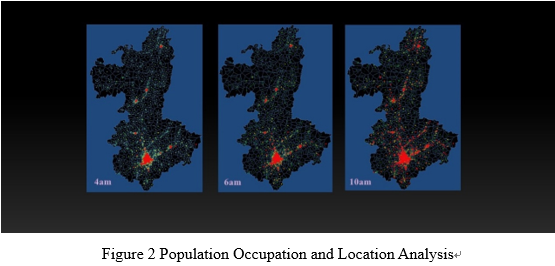
Population Occupation and Location Analysis
Figure 2 shows the spatial variation of mobile signaling data of Liuzhou at different time in a day. It can be seen that the population center of Liuzhou gradually spreads from city center to surrounding areas and office locations. To compare the data variations at different time and urban construction layout, it is possible to provide data analyze to urban road planning and constructions and bus route planning.
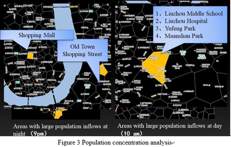
Population Concentration Analysis
Figure 3 shows the population concentration analysis based on mobile data The analysis targets are the largest population inflow areas during the night and the day. Based on mobile data and the analysis of the population concentration situation in different time of the city, the quasi-real-time dynamic changes of urban population can be noticed. It can provide real-time, reliable and effective population big data for urban managers to respond to urban emergency, urban construction and urban planning by offering big data reference.
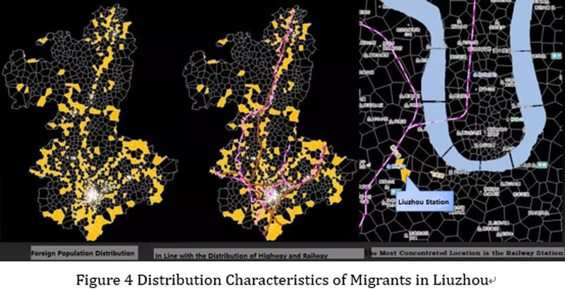
Analysis of Population Distribution Law
According to the real-time location information of mobile phone, enter the data which is updated every 15 minutes into the database, analyze the data of one year and combine the detailed personal information of the owner and the urban traffic layout to analyze the distribution law of population inflow. Figure 4 shows the migrant population trend in Liuzhou is basically distributed alongside the high-speed and railway lines and the most concentrated location is the railway station in urban area.
Application of Mobile Signaling in Urban Planning
With the comprehensive analysis of the 3-year signaling data and changing laws, it can provide decision-making assistance for cities in urban planning, planning implementation monitoring, and evaluation. In planning stage, the future population growth layout can be predicted to provide reference for the city's overall planning and various unit thematic planning according to the population changes in the city over the years and the analysis of urban real-time flowing population. Also, in order to provide reference for the city's overall planning and various unit thematic planning, it is an important basis for the subsequent evaluation of the planning rationality and implementation process.

Application of Mobile Signaling in Urban Emergency
Urban comprehensive emergency is the top priority of urban management. Large-scale activities are always with high population density. When the disasters such as natural disasters or urban public security accidents, the emergency command center needs to understand the situation of the site personnel and to allocate rescue resources quickly according to the disaster situation. The real-time distribution of mobile signaling data can reflect the real-time distribution of urban population distribution, which can judge the potential victims form the population distribution differences before and after the accidents to offer the decision-making basis for emergency command.
In addition, signaling big data can better improve the scientificity and veracity of urban transportation supervision, population monitoring, smart tourism and other areas of management, service and decision-making, and inject new elements into urban development.
Satellite Tracking + Big Data GIS Application in Real-time Ship-controlling>
Big Data - Signaling Data Makes Cities Smarter>