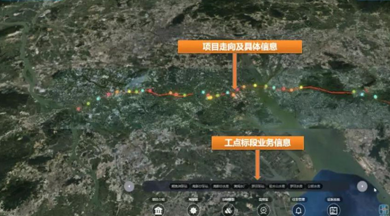
The Pearl River Delta Water Resources Allocation Project includes a main line, two secondary lines, a branch line, a regulating reservoir, and three lift pumping stations. The total length of the water conveyance line is 113.1km, which is the largest water conservancy project ever invested in Guangdong province, China.
The project adopts Bentley's MicroStation as the 3D design platform, the Bentley's ProjectWise software as the collaborative platform and SuperMap GIS platform as GIS platform. All basic geographic data (including Oblique Photogrammetry data, Point Cloud data, etc.) are provided by the Surveying and Mapping organizations and imported into the SuperMap platform for further project works.
In the construction of the BIM + GIS digital platform for the project, the geographic information system (GIS), Internet of Things, engineering life cycle management, building information model (BIM), virtual reality and interactive simulation, and other high-tech are comprehensively applied. The project integrates the existing information system data resources, digitally collects, transmits, stores, and manages various data related to the construction, operation management, and comprehensive management of the project, analyzes and processes the acquired data for integrated utilization.
The project builds an engineering digital foundation platform, which includes the construction of basic geographic data and 3D model data warehouses, 3D GIS and BIM integration of an integrated visualization environment, 2D GIS, data access and display in the enterprise data center, development of 3D visualization function modules for various business application systems.

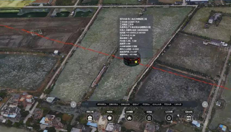
The BIM + GIS digital platform of Pearl River Delta Water Resources Allocation Project builds and integrates three pumping stations across the entire line, which includes more than 90 kilometers of underground pipelines, more than 30 professional wells and high-level pools of professional BIM models, and four-layer GIS model (online map + HD satellite image + oblique photogrammetry model + TIN terrain).
Six major decision-making support the development of whole project
The project has built six major decision-making support information systems, includes project construction management, pump station operation management, and comprehensive management along the project line (risk information management, land acquisition and resettlement information management, environmental protection and water conservation information management, and public safety information management). Also, based on GIS and BIM, it builds a 3D visualization and information integration display platform, uses virtual reality technology to reproduce the real management and decision-making environment of the entire project, integrates various required data to express decision and analysis results, and monitors changes in environmental elements and manual processes, which can realize visual management and operation and maintenance of the entire project, and provide auxiliary tools and decision support services for the implementation of project development management.
The platform addresses three main issues
The first is data importing between BIM and GIS: the general BIM design platforms are Autodesk, Bentley, Catia, while GIS platforms are SkyLine and SuperMap, etc. The BIM + GIS platform requires the ability to import various models, which can not be lost, and also convenient to use.
The second is data integration of BIM and GIS: BIM and GIS models should integrate each other in the platform, and basic GIS data also needs to be processed, such as in the site excavation on TIN terrain and real terrain, highway and bridge design, all these require BIM model to integrate into GIS.
The third is data capacity of the BIM + GIS platform: in the planning stage, the infrastructure and the city-level BIM + GIS platform requires a large data capacity, also in the construction and operation and maintenance stages, all kinds of complex data will continue to be added, which asks for a larger data capacity.
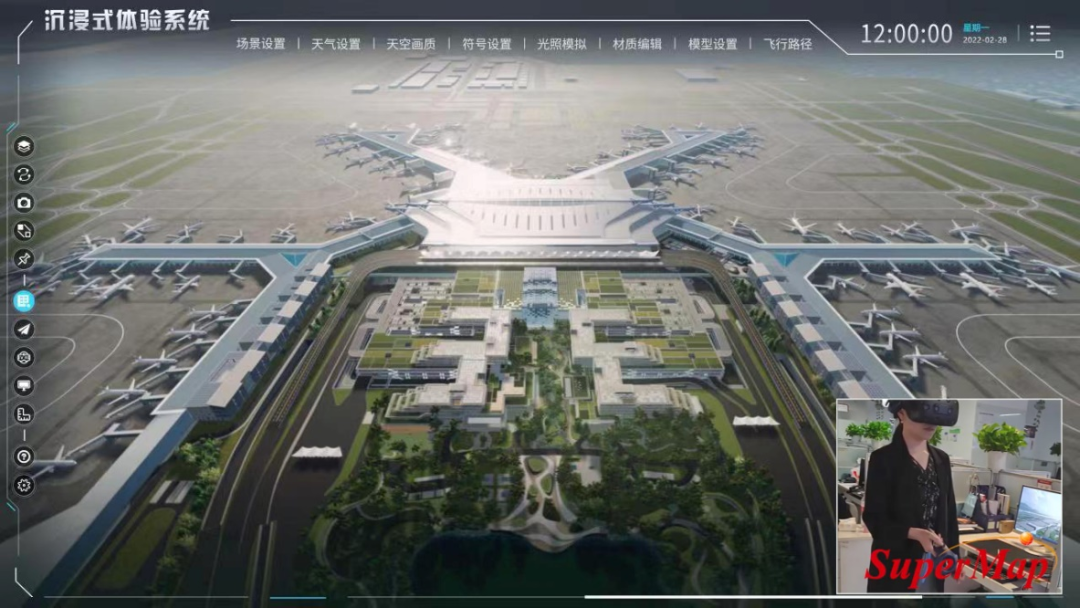
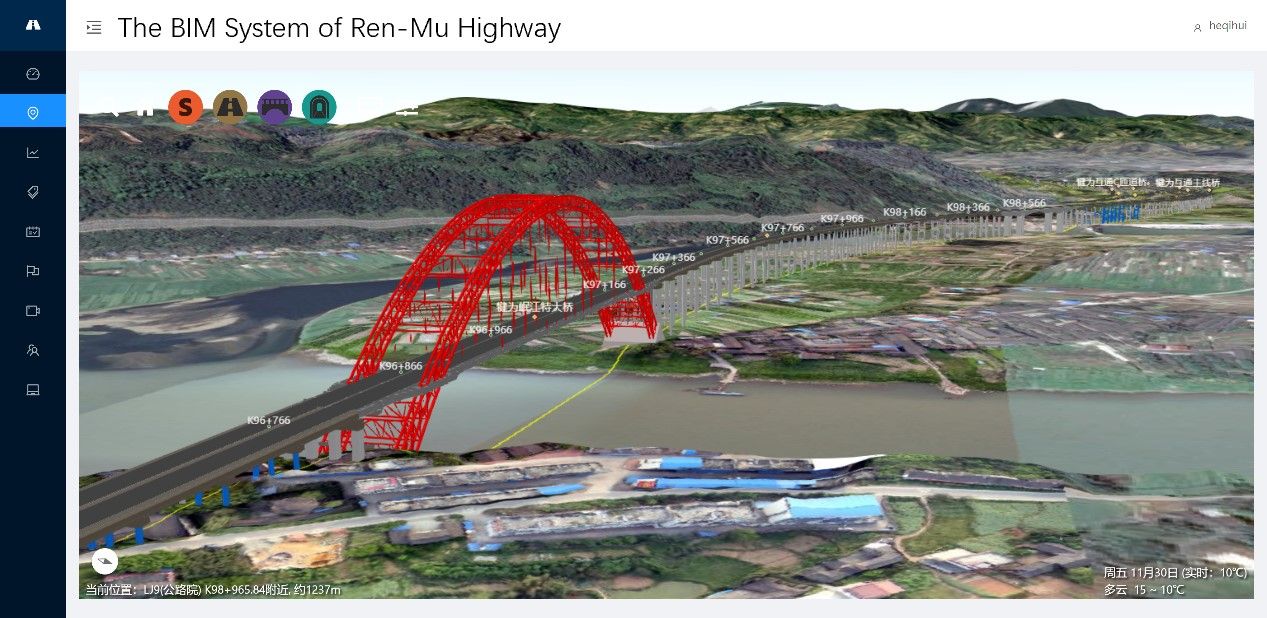
BIM+GIS in Building Information Management>
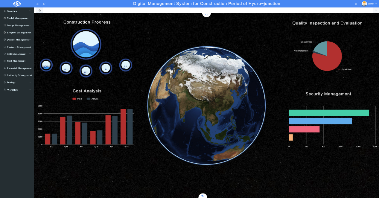
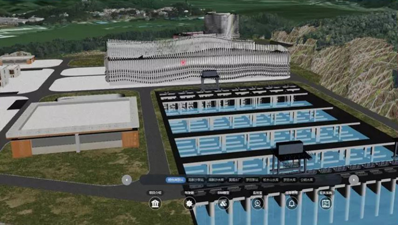
BIM+GIS Application in Life Cycle Digital Management of Yalong River Hydropower>