The Yalong River Basin is one of the 13 largest hydropower energy bases in China with an installed capacity of 30 million kilowatts, which is equivalent to 1.5 times of Three Gorges Power Stations. Till now, the Yalong River Basin has five downstream cascade hydropower stations, including Jinping I Hydropower Station, which is the world's highest dam, the Jinping II Hydropower Station, which has the world's largest hydraulic tunnel group, etc. Simultaneously, the midstream cascade power station is also under construction.
The development of water resources based river basins is a complex system project, which involves a wide range of management and contents. It is necessary to manage informational innovation with the advanced tecnologies.
The construction and demonstration application of the digital platform of the Yalong River Basin are carried out by Yalong River Hydropower Development Co., Ltd., Chengdu Engineering Corporation Limited, SuperMap and Tianjin University. It is based on GIS, BIM and other cutting-edge information collecting techniques to obtain the data of natural environment process such as basin meteorological/runoff, engineering equipment and facilities operational process, and socio-economic and production management process timely. Thus to realize integrated management of full basin, full-service, and full-level data, empower the business management and controlling, and to realize visual integrated demonstration of watershed environment and data resources on 3D geographic information platform.
The compression technology and lightweight technology of BIM model and the high-efficiency fusion technology of massive 3D geographic information and refined BIM model can optimize the BIM model of hydropower station design, so as to have a better integration and display with the 3D GIS platform and to realize the efficient combination of terabyte level of geographic information data and the BIM model of fine-to-equipment components. What’s more, the 3D browsing response time is short while the frame rate is high.

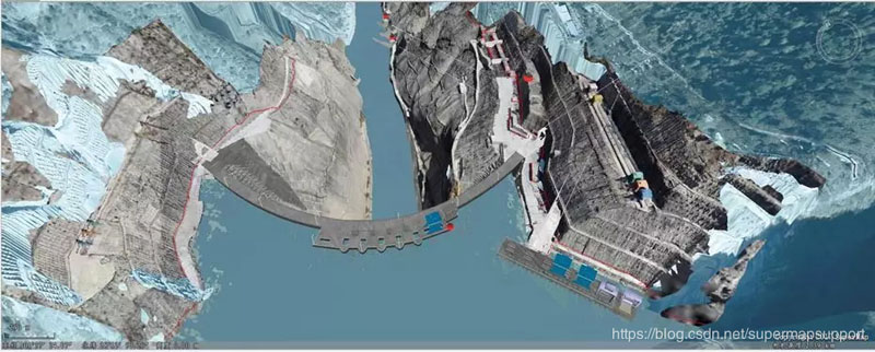
Design Model of Lianghekou Hub Project

The 560,000 3D Model Objects of Jinping I electromechanical

The DEM Data and Image Data (terabyte data volume) of High-precision Watershed
The conversion between the design model and the terrain data in the plane coordinate system and the earth coordinate system can achieve the accurate matching of the model and the terrain, so as to meet the precision requirements of the construction, operation and management of the hydropower enterprise.

The Matching Effect of Model and Terrain Data

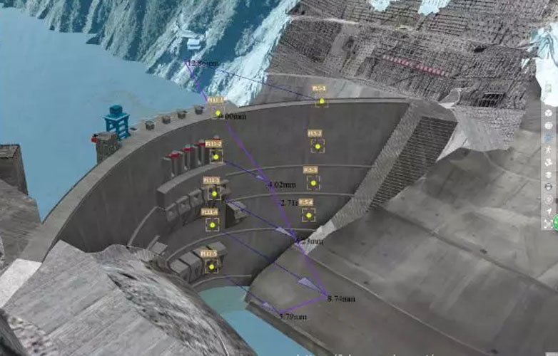
Information Inquiry of Dam Safety Monitor
The full life cycle, the full space scale, the full business information data model construction and the unified coding method of basin hydropower project is proposed by the basin hydropower lifecycle digital management platform for the first time, as well as the corresponding cloud platform architecture, resource integration and technical standards. The information acquisition technology framework of engineering management and the Yalong River Basin hydropower lifecycle management data center have been built on it, which can realize the comprehensive collection, transmission, centralized storage and sharing application of massive, multi-source and multi-dimensional river basins and project information. At the same time, the highly efficient fusion technology of massive 3D geographic information 3D GIS and building information model (BIM) has been established and formed a set of multi-level, cross-system, application and analysis techniques for hydropower construction and operation management.
BIM+GIS in Building Information Management>
BIM+GIS Application in Life Cycle Digital Management of Yalong River Hydropower>