JHS, one of the leading construction suppliers, is also in the business of evaluating house, with alliance of over 20,000 companies, owning the data of foundation strength of millions of houses, covering all over Japan. And SuperMap Japan constructed the database of spatial-temporal data for JHS, providing analysis services for it ally companies. Meanwhile, JHS chose SuperMap Cloud Service and released the land information report for disaster relief and foundation strength map, which has become a new area for SuperMap in disaster relief.

Foundation strength map can also compare the historical aerial photo, earlier version of terrain map, providing the shaking degree, ground liquidation, geological map, flooding map, micro-terrain map, land condition and distribution of education area, shelters, medical facilities, parks, etc. Users can easily view the information of arbitrary location. This service also has different terminals like PC, smart phones, tablets, providing the same service.
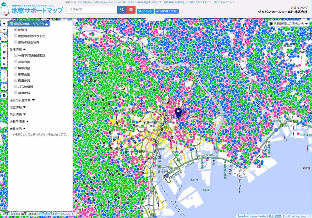
Currently, the database is being updated and enriched.
Satellite Tracking + Big Data GIS Application in Real-time Ship-controlling>
Big Data - Signaling Data Makes Cities Smarter>