In order to implement the requirements of the Ministry of Transport on the safety supervision of dangerous goods in ports, improve the safety supervision of major hazard sources in ports and strengthen the sharing of information resources of major hazard sources in ports, the 3D regulatory information system for major dangerous sources in Jiangsu Province is established. Based on SuperMap GIS software, the project realizes 3D supervision of major dangerous sources of ports in Jiangsu Province, including 2104 storage tanks and 2,589 tank material pipelines with a total length of 1,300 kilometers, which involving 70 companies.
Goals
1. The project further promotes the construction of geographic information service platform through the effective integration and configuration of the key hazard source data of the port to realize the management and sharing of data resources between port administrative departments and operator.
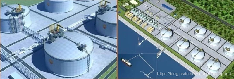
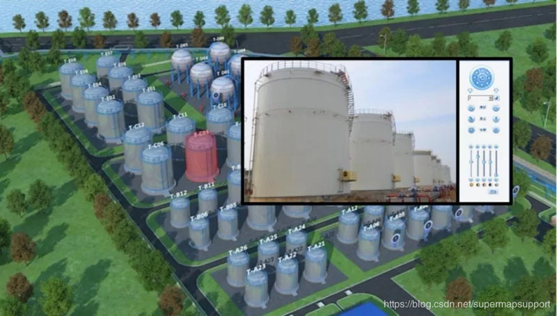
2. The project realizes the digitization and visual management of basic data resources. Through GIS technology, map elements and spatial information are integrated into the management system to display the storage tanks, material pipelines and other ancillary facilities in dangerous goods area, as well as the wharf, berth, related pipelines and dangerous goods container dumps in the method of 3D modeling technology.
3. The project improves the ability to deal with emergencies.
4. The project improves the basic data management of major hazard sources. The project can not only realize the spatial query of the storage tanks, material pipelines, other ancillary facilities, docks, berths, pipelines, dangerous goods container of local areas, but also realize the 3D display and management through the panoramic simulation browsing.
Highlights
1. Constructing a basic hazard source archives
The basic archives mainly includes basic information of major hazard source units, tank information, material pipeline information, emergency plan for major hazard sources, surrounding environment of tank area, layout, natural conditions, cargo information, potential dangers information, video surveillance information, filing information, etc.
2. Establishing informatization supervision platform of major hazard
Based on the geographic information service platform, the project carries out 3D modeling of tanks, material pipelines and other ancillary facilities in the tank area, visually displays the basic information such as the tanks and the location and attributes of the material pipelines in the tank area, and shows the distribution trend of the pipelines, the connection with the storage tank, as well as the business information of goods, cargo volume, hidden dangers, filing, etc.
3. Constructing port video monitoring platform
The project is connected with the municipal port video monitoring platform, based on the traffic e-government private network and takes the video data monitoring equipment of each port dangerous goods enterprise as the main data source to complete the integration and intercommunication of the image resources of the port dangerous goods enterprises in Jiangsu Province and assist the daily supervision and remote emergency rescue command.
New 3D GIS Technology in Underground Water Management>
2D and 3D GIS in Natural Resources Management>
New 3D GIS Technology Supports the Construction of "Digital Twins" in Transportation>