At the beginning of the year, the outbreak of the coronavirus has made great impact on people’ daily lives, and national prevention and control measures have been immediately taken to fight against it. Also, as one of the members of society, SuperMap has quickly launched the preplan and set up a "SuperMap Coronavirus Prevention and Control Emergency Response Team", and organized 20 colleagues with rich experience to work with the National Health Commission.
In response to the needs of clients, SuperMap and its subsidiaries, like Nanjing Guotu, dispatched teams to the frontlines of multiple epidemic projects in Shandong, Henan, Jiangsu, Shanghai and other provinces and cities.
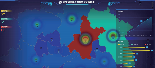
• Nanjing Guotu supports thematic application of public security and epidemic prevention
According to the requirements of clients of public security, the Guotu Information public security project team responds quickly to the epidemic. SuperMap map service engine is used to update the epidemic prevention and control thematic maps and related applications on the comprehensive situational command large-screen system of command centers at all levels, which provides geographic application supports for effective epidemic prevention and control.
• View epidemic map with Dituhui
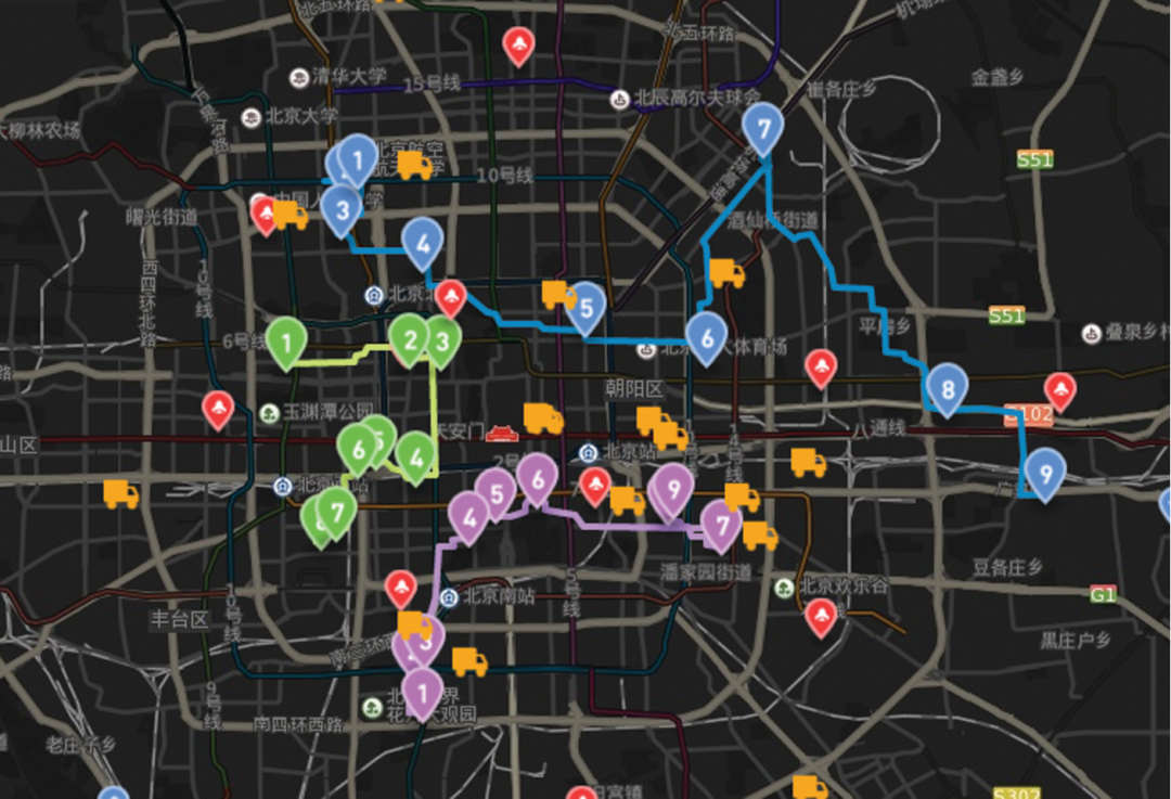
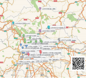
The prevention and control of major epidemics cannot be separated from the map. Through Dituhui, users can see multiple thematic maps such as the top 10 cities with the highest pressure on epidemic prevention during the post-holiday return, the dynamic map of the national epidemic situation, the distribution map of fever clinics in Beijing, and the distribution map of confirmed case management in communities. All these maps can display epidemic information directly to help make better decisions.
• Nanjing Guotu "Internet + Real Estate Registration" in anti-epidemic
In the special period of fighting the epidemic across the country, Nanjing Guotu ’s “Internet + Real Estate Registration” integrated platform provides services through its functions of “full business process optimization”, “data integration sharing” and technical means of portrait comparison, face recognition, intelligent voice recognition. By relying on the Internet, the platform provides companies and the public with service channels, such as WeChat public accounts, Alipay city services and others. Users only need to log in with their names, then select the services, all the real estate registration business can be conducted online.
• Race against time to empower the epidemic information system
Since receiving the epidemic prevention and control tasks from local austerities of Jining City in Shangdong Province on January 30, SuperMap and other local departments and institutes immediately moved to work together to ensure the epidemic works immediately moved to work and work together to ensure the epidemic prevention and control tasks.
"Although facing various unfavorable working conditions and the tough epidemic situation. I and my colleagues took 2 days and 2 nights to complete the framework of the system in local District. After 5 days of remote debugging, the system has been put into use on 7 February. "said Mr.Sui , technical support of SuperMap.
The epidemic information system is based on the high-precision oblique photogrammetry data that produced by local Institute, and applies the 2D and 3D integration technology to realize the spatial positioning and display of floor and household data from the perspective of 3D space and gridding. The system effectively protects 919 key prevention who return from Hubei, and supports the spatial positioning and management of various protective facilities and resources.
• Emergency development, serving the epidemic map of Pingdingshan, Henan
In order to provide people with location-based localized epidemic disclosure services in a timely manner and strengthen public opinion guidance, SuperMap Smart City Engineering Center works with the local Remote Sensing and Mapping Institute to conduct emergency research and development for 48 hours. The Epidemic Map service provides localized epidemic situation, epidemic trend, nearby cases, public transportation information sharing, medical resources, and prevention suggestions, etc., to further strengthen the transparency of epidemic information. The service informs people with the epidemic information around them, improves prevention awareness and reduces the risk of concentrated infections.
After the launch of epidemic map service, it has achieved certain results in epidemic works. Currently, the map service has been launched in other cities in Henan. SuperMap will continue to make efforts in providing local people with detailed epidemic release information.
Satellite Tracking + Big Data GIS Application in Real-time Ship-controlling>
Big Data - Signaling Data Makes Cities Smarter>