Based on SuperMap 9D, the 2D and 3D integrated police big data platform was developed, which includes a big data application system for visualization police, a police resource management system, and a police information sharing platform. The platform enhances the role of command controlling and security in providing a full range of police service information for the related public security authorities.
The police big data application system includes the services of the daily handling tasks of the command center, the command and controlling, the resource dispatch, the “address, real population, real housing, real units” data management, the management of the command controlling, the case management, the police resource scheduling, and the comprehensive statistics.
In addition, the system provides the operation and maintenance management services such as police resources, police information, plan templates, users, and system menus.
Based on the SuperMap iPortal 9D police information sharing platform, it mainly provides the sharing services such as external portal, shared resource management, shared application management, and online mapping.
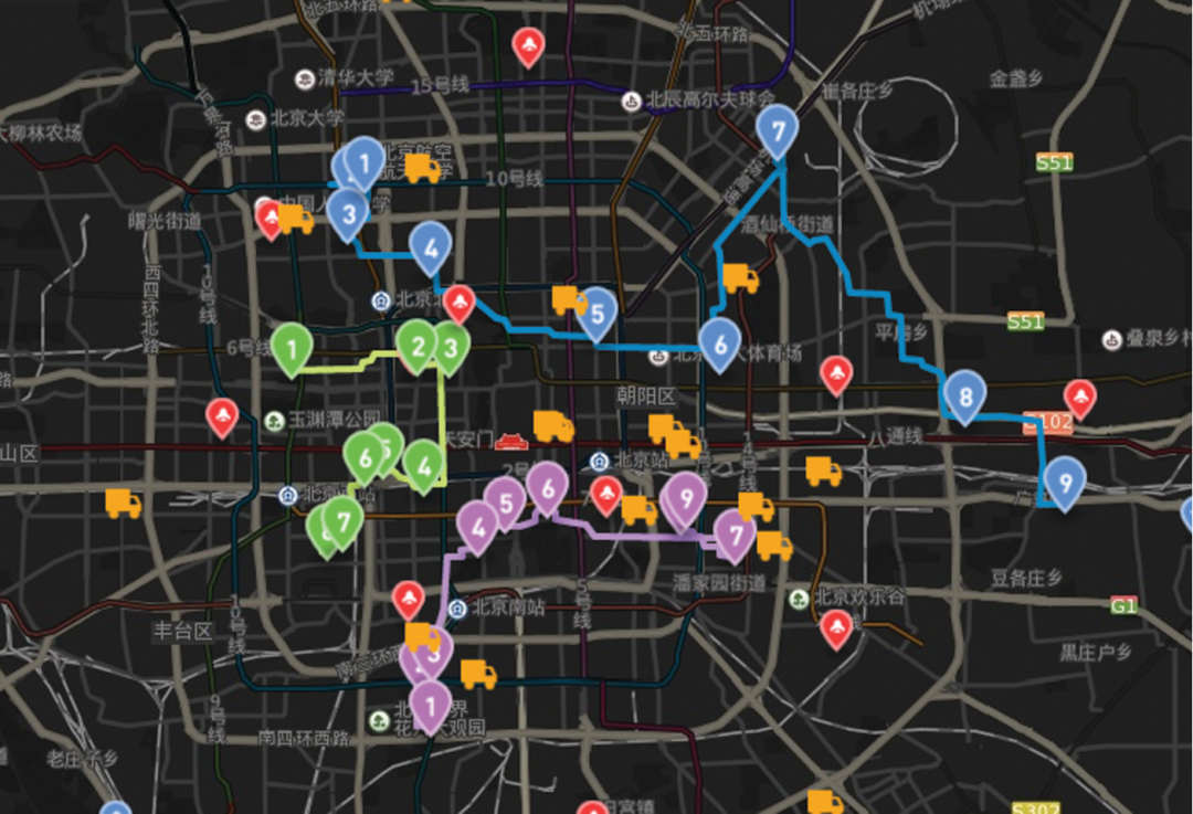
(1) To view the specific case on the map. By using the geographic information, the spatial analysis can be conducted on cases, and the situation of the area can be visually displayed.
The command and dispatch platform of the application system reports the new cases and the controlling objects, which can flashing prompts and voice alarms the cases and the object locations on the map. The map interface can automatically switches to the alarm location and pops up the real-time police resources that can be called up, such as video cameras, police officers, police cars, etc., to help the quick scheduling.
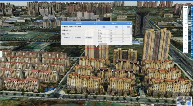
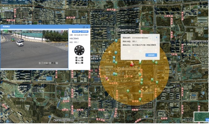
(2) The “address, real population, real housing, real units” data management
Based on the “address, real population, real housing, real units” data, the specific geographical location can be linked through 3D spatial technology. It can realize the visualized position of map and the related query of population, housing and data to assist the process of command center.
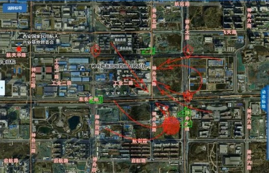
(3) The controlling plan
Adding a controlling task to the face recognition system, and performing a map real-time deployment controlling plan and loading the dynamic demonstration, the marked pictures can be printed and outputted. By using the geographic information, the control object track can also be draw to link the face capture machine to retrieve the real-time and historical videos.
Satellite Tracking + Big Data GIS Application in Real-time Ship-controlling>