Based on the various platforms developed by SuperMap and 2D and 3D integrated underground and underground spatial data, the platform can integrate BIM data and combine the sponge city with the current situation of the underground space and the pipeline data of various departments.
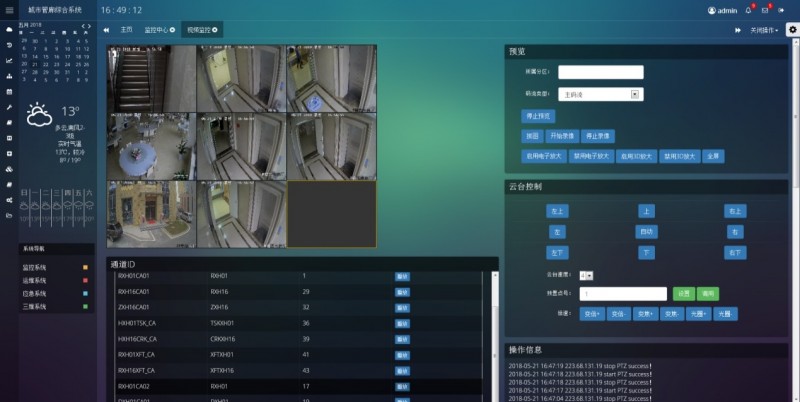
The platform supports the display of the corridor, partition structure, and various types of electromechanical equipment, sensors, etc. on the map for accurate positioning and real-time data viewing. It also supports GIS equipment real-time presentation and alarm, and the GIS personnel position through WiFi.
GIS supports 2D and 3D integration, which can be used for 2D and 3D switching or 2D and 3D screen display at any time. It supports the linkage control of 2D and 3D scenes and the on-site device.
The 3D GIS can provide various spatial query and analysis functions based on the surrounding macro geographic information, and the decision-making support for BIM. BIM model can make GIS move from macro to micro to realize the fine management of building components, and also make GIS move from outdoor to indoor. It can achieve the integrated space management of indoor and outdoor, ground and underground space.
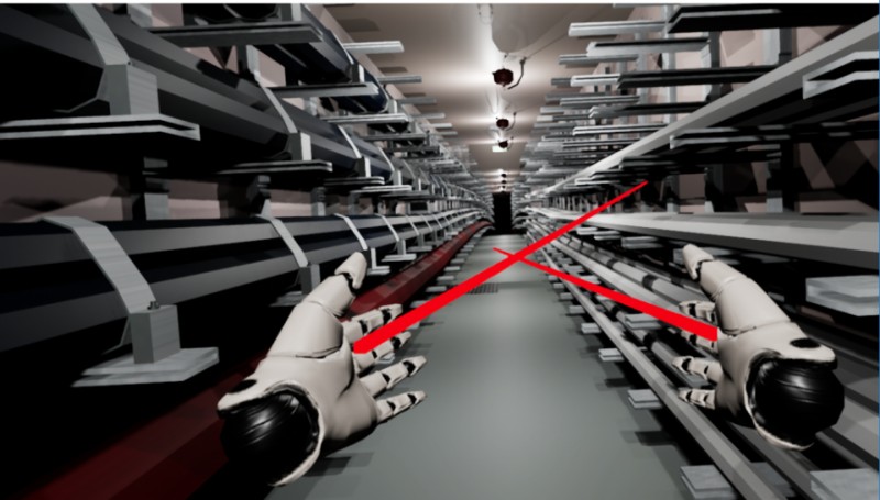
The platform supports VR control, immersive, multi-dimensional experience of the internal structure of the pipeline. It also can understand and analyze the operation of the equipment, simulate daily fire drills and disaster escapes, and equipment inspection and maintenance.
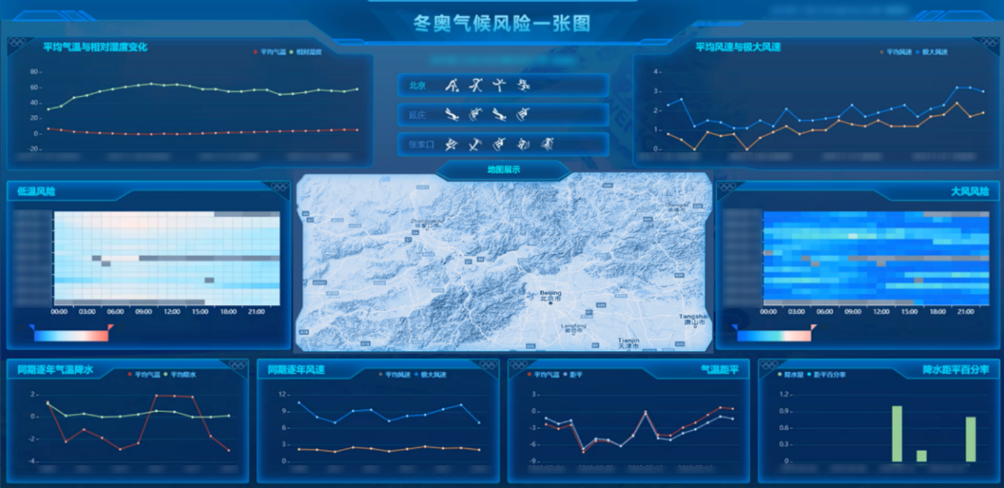
New 3D GIS Technology in Underground Water Management>
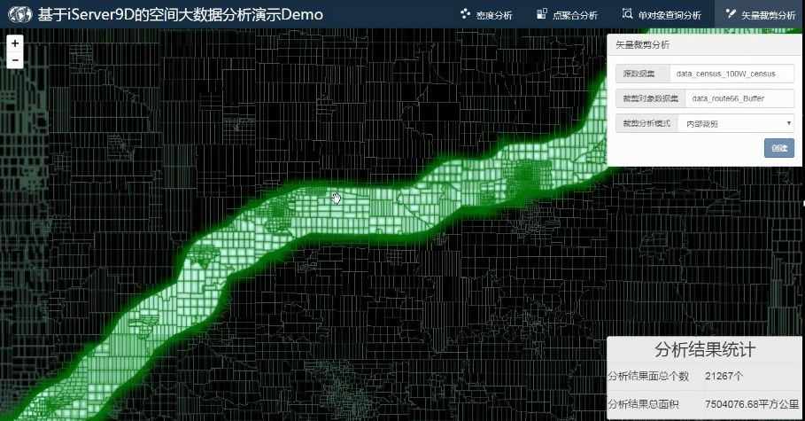
2D and 3D GIS in Natural Resources Management>
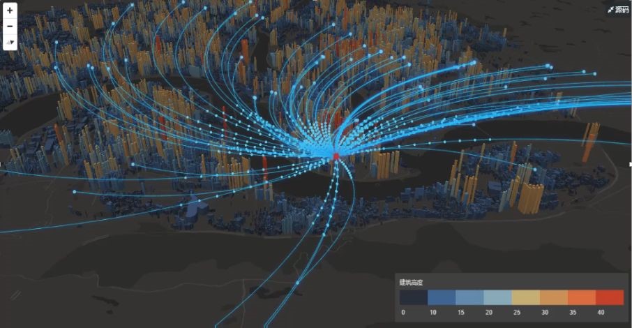
New 3D GIS Technology Supports the Construction of "Digital Twins" in Transportation>