1. The introduction of city underground pipeline network information platform
Based on SuperMap GIS technology, the city underground pipeline network information management platform applies the C/S, B/S and M/S network technology, 2D and 3D integrated technology, 3D visualization technology, big data storage technology, high-performance cache slicing technology, etc. By establishing a 3D scene of the downtown area, integrating road attribute information, and building attribute information and underground pipeline network attribute information, it builds an application software of the underground pipeline network information management and a platform for external Internet/mobile Internet application system to provide data foundation and technical support for fine management and the efficient use of urban underground pipeline network.
2. The construction contents of city underground pipeline network information platform
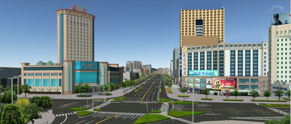
2.1 The ground building model and landscape model making
The content includes detailed modeling of existing building models, such as urban roadways, walking trails, landscape roads, greening trees, architectural sketches and so on.
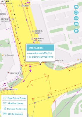
2.2 The 2D&3D integration application management system of underground pipeline network
Based on the C/S network architecture and the 3D visualization of various underground pipe network data of City, it can realize the functions of 2D&3D integrated browsing, query positioning, statistics, decision analysis and system and data management through the secondary development.

2.3 The underground pipeline network information service platform
Based on the B/S network architecture, the release of various underground pipeline network data and terrain data of the city, it can realize the functions of underground pipeline network data browsing, query location, statistics, decision analysis, system and data management, portal website through the secondary development.
2.4 The underground pipeline network inspection system
Based on the M/S network architecture and all kinds of underground pipeline network data and terrain data of the city, it can realize the functions of underground pipeline network data query and positioning, data inspection report, data inspection, data inspection statistics, inspection track view and measure annotations through the secondary development.
New 3D GIS Technology in Underground Water Management>
2D and 3D GIS in Natural Resources Management>
New 3D GIS Technology Supports the Construction of "Digital Twins" in Transportation>