SuperMap ecological partners in the field of transportation have already explored applications in the industry based on 3D GIS technology and conducted a number of excellent application projects.
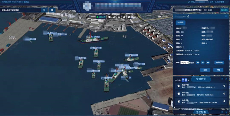
Ship dynamic monitoring project
SuperMap partner built a dynamic monitoring system for fishing ports based on 3D GIS technology and AIS information from ships. By building a 3D fishing port scene with 3D fishing port model, terrain, and image data, the system can superimpose dynamic AIS data to realize 3D applications such as dynamic position monitoring, trajectory playback, real-time warning of ships, and video overlay of harbor areas.
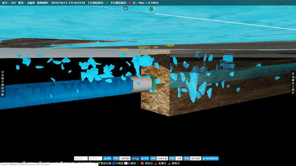
Submarine tunnel shield construction risk management and control project
Based on 3D GIS technology, SuperMap partner integrates submarine geological data, shield machine real-time data, camera monitoring data, and intelligent monitoring data, manual monitoring report data and other information sources. It can realize the visual display, the safety risk control of the construction site of the shield environment of the submarine tunnel based on BIM, which provides applications of multi-source geological modeling, geological prediction, shield safety risk management and construction guidance.
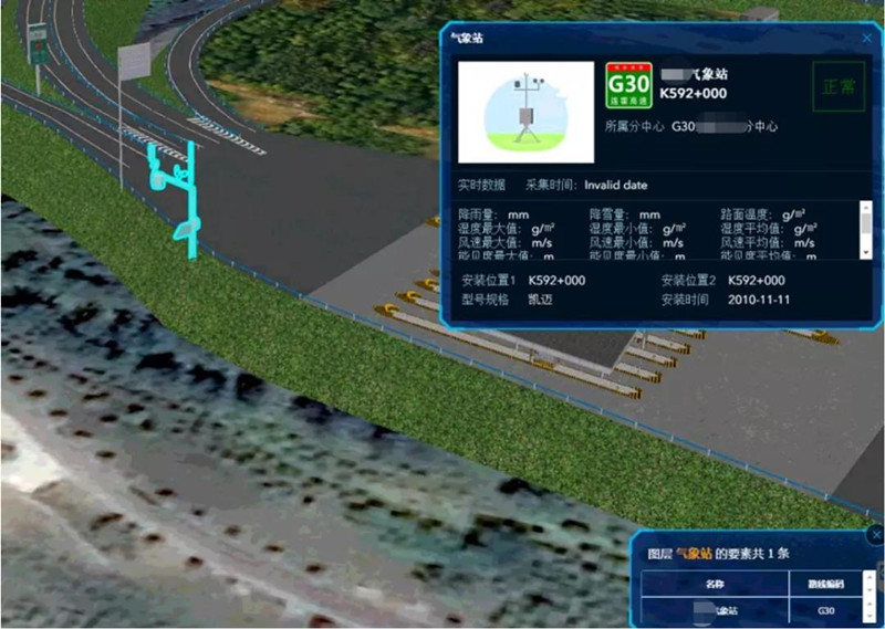
Digital management system of highway facilities based on 3D
Based on 3D GIS technology, SuperMap partner applies 3D scanning technology, 3D refined modeling technology, and combines with time and space massive data management technology, 3D dynamic display technology, interactive scene technology, etc., to realize rapid collection of highway environmental information, rapid construction of refined infrastructure spatial database, rapid inspection and comprehensive management of highway infrastructure. It can integrate and access highway dynamic business data to provide basic geographic information and data support for traffic operation status monitoring and analysis system on intelligent service platform, and comprehensively improve the digitalization and intelligent management of expressways.
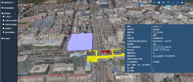
Urban Rail Transit Lifecycle Information Management Platform
Based on 3D GIS technology, SuperMap partner uses GIS-BIM, cloud computing, Internet of Things perception, mobile Internet, big data analysis and other technologies to establish big data smart platform for design optimization, construction supervision, smart operation and maintenance of rail construction auxiliary planning. It provides managers with fine-grained management and decision-making tools for the entire process of project quality, schedule, safety, and cost. The platform adopts oblique photogrammetry technology to model the real surface environment, realizing the real 3D expression of buildings, greening, road landscape and can carry out free roaming browsing, subway line tour and building property information query. It also can build BIM model to understand underground pipelines and geology to realize the organic integration of GIS and BIM, so as to carry out pipeline collision detection and analysis during subway construction, check the geological situation, and guide the construction of subway stations.
With the in-depth application of big data, artificial intelligence and other new technologies in the transportation industry, the combination of 3D GIS technology and them will promote the evolution of 3D GIS technology in the direction of intelligence, and promote 3D GIS technology to become an important technical means of the transportation and to realize the intelligent and efficient management of transportation industry applications. With the data mining and analysis capabilities of spatio-temporal big data and artificial intelligence, 3D GIS in transportation will be able to realize the automatic collection of high-precision facilities and traffic flow information. Through the analysis of massive transportation information, the traffic behavior supervision in 3D GIS will be more intelligent and predictable. Also, the means of information presentation in the 3D environment will also be more abundant. With the support of distributed technology, the 3D analysis performance and rendering performance will also achieve substantial growth.
New 3D GIS Technology in Underground Water Management>
2D and 3D GIS in Natural Resources Management>
New 3D GIS Technology Supports the Construction of "Digital Twins" in Transportation>