Establish a framework for natural resource application systems based on digital twin technology
In the field of natural resources, the application of digital twin technology in the field of natural resource survey and monitoring and real estate registration is relatively mature, while in other fields, although there have been some research and project practices, they are still in the preliminary exploration stage in general.
Under the background of comprehensively building digital government, digital city, and smart natural resources, we can establish a natural resource application system framework based on digital twin technology, build a digital land space, and fully tap the application potential of various directions.
The application system consists of five levels:
1. Infrastructure layer: data acquisition equipment, data modeling and processing software, hardware infrastructure;
2. Data layer: collect multi-source heterogeneous 2D and 3D data resources, build databases such as basic geography, remote sensing images, land surveys, land space planning, natural resources and real estate registration, etc., and support data standards and specifications to build a 3D “One Map” database for natural resources.
3. Platform support layer: Emerging technologies such as 3D GIS engine, rule management engine, AI, Internet of Things and big data, immersive technology, etc., form a basic information platform for land and space to carry, integrate, and communicate various data of natural resources.
4. Application layer: provide intelligent application support for key business areas of natural resources and planning, and form a three-dimensional, scientific, refined and intelligent decision-making method;
5. User level: Natural resources and planning departments at all levels, other relevant government departments, enterprises and institutions, and the public.
Typical application scenarios of natural resources based on digital twin technology
• 3D GIS technology: assisting the scientific preparation of spatial planning
The limitation of traditional 2D planning is that the amount of spatial information carried by the planar database is limited, and the resource distribution on the ground, surface, and underground cannot be intuitively displayed, and it is difficult to carry out unified planning for 3D land space.
The 3D “one map” of natural resources gathers 3D models such as terrain, landform, and ground objects, which can directly reflect the natural geographical pattern and the status of natural resources, and build a “twin” digital land space.
On this basis, problems such as sloping cultivated land can be identified by combining 3D analysis tools such as slope aspect analysis and inundation analysis. In addition, in terms of urban design, online scheme simulation can be carried out through parametric modeling, providing model material libraries, etc., and combined with real 3D previews to ensure the coordination of style and appearance.
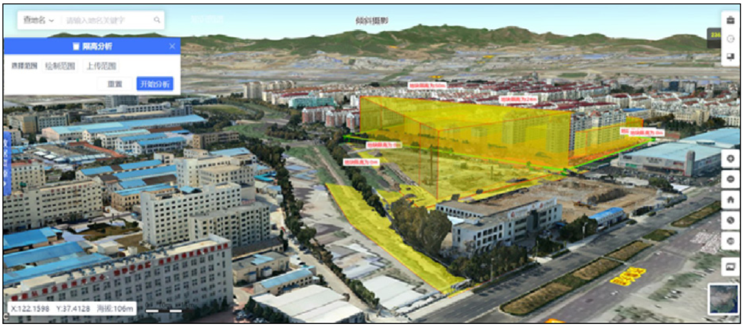
Real-scene 3D auxiliary space form control and style guidance
• Rule digitization technology: guarantee the accurate implementation of usage control
Digital land space not only contains virtual modeling of physical entities, but also contains a large number of natural resource management rules. The rule digitization technology is the process of formulating rule description specifications, standardizing rules, and converting text language into computer language on the basis of classifying and sorting out management rules.
By sorting out and constructing a system of control rules for the use of land and space, we can strengthen the organic connection between the content of planning control and development and construction activities, and ensure the orderly development of project construction. Focusing on the key links of use control from site selection to completion acceptance, multiple digital rule bases and corresponding algorithm models, such as construction project site selection condition base, compliance review rule base, and architectural design scheme review rule base, are constructed. Unified management of rules and custom configuration of models are conducted through the rule management engine to provide basic support for approval decisions
For example, in the phase of project planning permission, based on the 3D construction application standard specification and scheme review rule base, automatic computer review is used to assist manual review to improve the scientificity, accuracy and intelligence of the review.
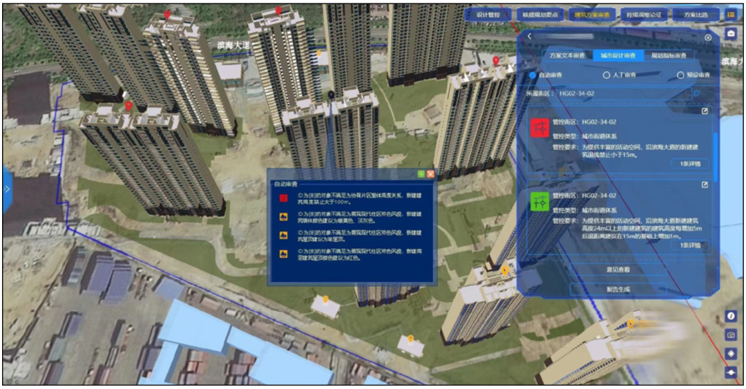
Digital rules support the review of architectural design schemes
• AI technology: assist in protecting and restoring real-time monitoring
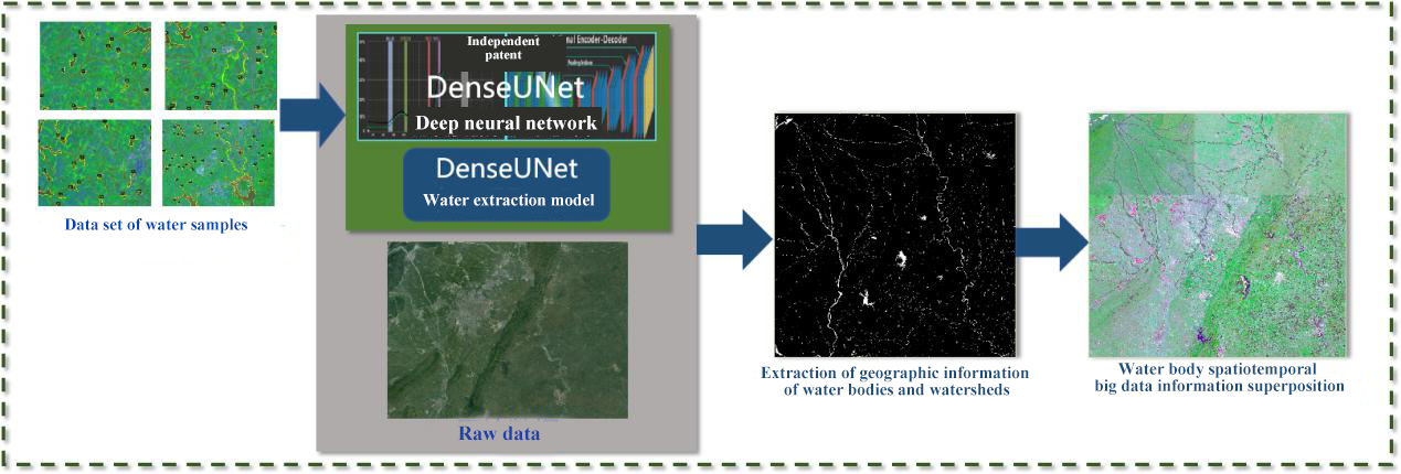
AI technology can greatly improve the capabilities of recognition, calculation, and analysis, and improve the accuracy and intelligence of geographic information services. The intelligent interpretation technology of remote sensing images based on AI can monitor the conditions of cultivated land protection and ecological restoration in real time. With a diverse, high-precision, and massive remote sensing image sample library as the training sample for the artificial intelligence engine, based on the deep learning algorithm, it can efficiently and accurately classify and identify remote sensing images. It is also possible to use feature search and analysis algorithms to compare and analyze remote sensing image data in different phases.
For example, based on the land survey data and post-temporal remote sensing images, it is possible to detect changed and unchanged cultivated map spots, and automatically identify the land type and planting type of the map spots to assist in judging whether the cultivated land is “non-agricultural, non-grain”. As another example, in the mine restoration project, high-definition remote sensing images are used to extract the regional surface changes of the mine, map the damaged surface and repaired surface of the mine area, calculate the area change of the repaired surface, and monitor the restoration progress in real time.
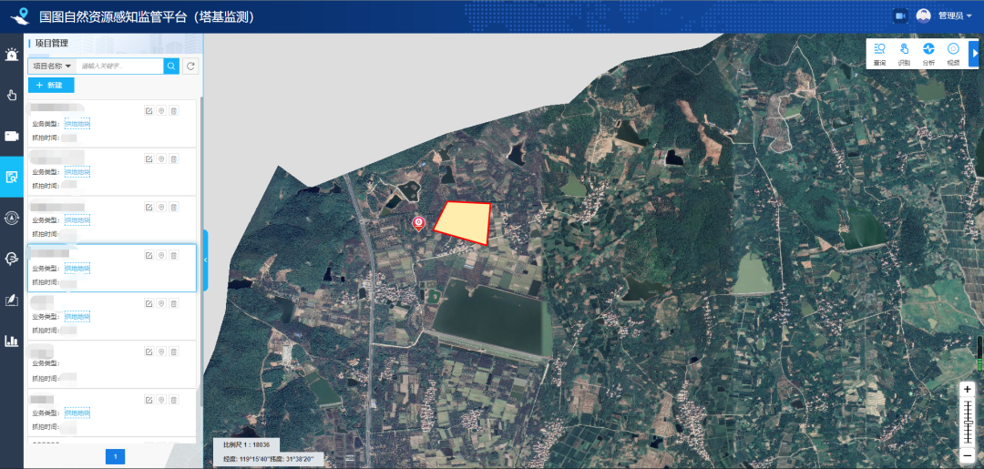
• Internet of things and big data technology: supporting the intelligent diagnosis of urban signs
The construction of digital twin land space is inseparable from the Internet of Things and big data technology.
On the one hand, Internet of Things, such as information sensors, radio frequency identification technology, global positioning system, infrared sensors, laser scanners, etc., real-time collection of telemetry data, mobile phone signaling, GPS data, video surveillance data, etc., is required to achieve the real-time dynamic update of the digital space, and provide basic data for the evaluation of urban physical examination.
On the other hand, it is necessary to integrate, display and manage the massive structured and unstructured data generated by the Internet of Things. At the same time, combined with distributed storage and parallel computing technology, powerful big data capabilities can be realized, providing services such as traffic flow analysis, and population flow trend analysis.
• Immersive Technology: intelligent participation
Immersive technology can enable more realistic visualization and user experience in the digital homeland space.
Relying on the game engine, it can make models of buildings, vegetation, water surface and so on to show real-time reflection, unevenness and other textures. At the same time, through augmented reality (AR) technology, the digital model is superimposed on the real scene, such as projecting the 3D model of the architectural design plan to the project site in real time, so that the planning designer and the construction departments can visually view the effect of the plan and judge the rationality of the plan, to strengthen the interaction between virtual space and real space.
It can also be combined with virtual reality (VR) technology to optimize 3D data stereoscopic imaging. By wearing VR equipment, the public can roam in the three-dimensional digital space and obtain an immersive experience and all-around observation, thereby improving the participation experience of the public.
The digital twin applications in natural resources emphasize the deep interaction and mapping connection between real space and digital space on the basis of spatiotemporal information visualization. It brings far-reaching impacts on many natural resource-related fields such as land space planning, usage control, cultivated land protection and ecological restoration, and urban physical examination and assessment.