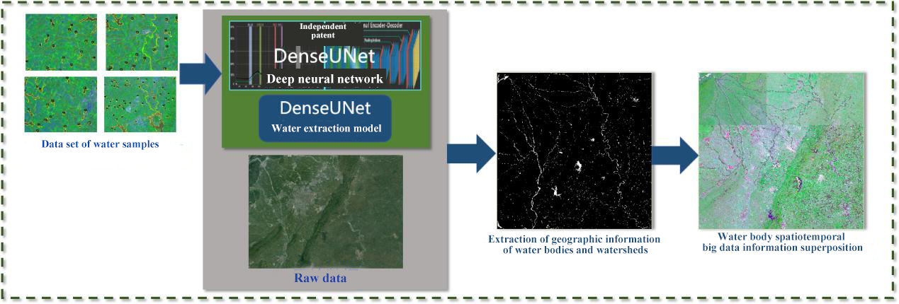
Yilong Lake is a typical plateau shallow lake. Due to its proximity to the urban construction area and the serious damage to the ecological environment in the early years, although the ecological environment of Yilong Lake has been effectively managed for many years, it still faces severe challenges, and traditional governance methods have been unable to solve the problem. To fully grasp the important environmental, planning, management and other information of Yilong Lake promptly, and scientifically establish the relationship between protection measures and lake water quality response, Yunnan Geological Surveying and Mapping Institute cooperated with companies including SuperMap to adopt the cloud-native architecture, relying on technologies such as Internet of Things, big data, cloud computing, intelligent decision support model for water environment, and 2D and 3D visualization to build “smart lake” precision pollution control system, and a digital supervision platform for the protection of the Yilong Lake Basin.

The platform is committed to the whole process of decision support and management of the water environment in the lake basin. The establishment of a monitoring network and data resource center achieves the unified management and publication of environment elements data including water volume, hydrology, water quality, and pollution sources of Yilong Lake. It also supports the unified management of basic geographic data, and spatial planning data of the basin.
The platform uses the Internet of Things (IoT) and big data technology as the carrier to form a digital management platform with application functions such as data management, space management and control, water quality forecasting, water resources allocation, law enforcement supervision and management, etc.
The establishment of the platform will further support the digital economy of Yilong Lake, enhance the water quality management capabilities, and improve the ecological environment of the basin.
• Three-dimensional water environment perception
Traditional manual monitoring methods have many drawbacks such as low frequency, high time consumption, slow analysis, etc., and cannot achieve real-time acquisition, real-time analysis, and real-time application, so they are less likely to support intelligent water environment decision-making analysis.
The platform adopts the “manual+automation” monitoring solution. Based on the original monitoring system of Yilong Lake, it expands the automatic monitoring modules including water quality, hydrology, pollution sources, meteorology, groundwater, video monitoring, etc.
Through the real-time monitoring of the water environment in the basin, we have a better understanding of water quantity and volume, and further monitor water flow and water quality change from the source. The construction of the water environment monitoring and analysis system allows the environmental data in the basin to be transmitted to the application layer in real time, allowing users to understand the real-time status of the water environment in the basin in detail.
• Data resource integration
Yilong Lake Basin involves data from different areas such as ecological environment, meteorology, water conservancy, natural resources, agriculture and forestry, as well as basic, spatial, monitoring, model, business and other data information. It has various data formats, large volumes, inconsistent standards, and data storage, multi-source media, etc.
The comprehensive integration of data resources of the platform relies on the environmental foundation of the big data cloud platform. It uses a hybrid storage architecture, and is based on fully combining industry standards, considers applications at different business levels, designs and builds a comprehensive database, and improves the data storage standard system. The resources are classified according to the data category. A total of 5 major categories, 15 middle categories, and 100 subcategories of data resources are integrated, which achieves the unified storage of data resources.
To realize the unified management and sharing of data resources, a data management system is built according to the idea of graph integration and business management, and a visual interface is used for Yilong Lake's comprehensive database data management, which can facilitate business personnel to quickly and easily analyze the data, perform routine data editing and report statistics and other data manipulation functions.
• Intelligent space management and control
Reasonable development planning is closely related to changes in the ecological environment. Due to a series of unreasonable development and utilization brought about by human activities and social and economic development, the ecological environment of Yilong Lake has deteriorated.
The platform formulates project entry review rules and builds an intelligent evaluation and warning system where reports of spatial inspection, environment capacity inspection, land use review, etc., can be generated.
• Intelligent water quality analysis
The water quality analysis of the platform is based on real-time monitoring data and meteorological forecast data to monitor the status of the water environment and predict pollutants. By establishing a “meteorological-land-water coupling” model system, it can realize short-term early warning and prediction of lake water quality. It provides decision-makers with the spatial distribution and concentration trend of nitrogen and phosphorus nutrients and algae in the body in the next three days. Thus, it can support the water quality prediction of the main points of Yilong Lake, the water quality distribution of the lake in the next three days, and the water quality early warning. The model boundary conditions are used to test the rationality of the model prediction results.
• Scientific water resource allocation
Yilong Lake is a typical plateau shallow lake. Since there is no inflow of active water sources, it mainly relies on water resource scheduling in the outer basin, which makes the development and utilization of water resources extremely difficult. Therefore, how to carry out scientific water resource allocation and scheduling is important in water quality improvement.
Through the intelligent decision support model of the water environment in the basin and 3D GIS technology, the platform displays the current situation of water resources in Yilong Lake, analyzes the pattern of water resources in the basin, and evaluates the impact of adjustment and replenishment projects on water quality. Relying on the Internet of Things monitoring system and the water environment intelligent decision support model, it displays the current situation and history of water resources in the Yilong Lake Basin and predicts the change process of water resources in a certain period in the future.
Based on the allocation of water resources in the Yilong Lake Basin over the years and the actual results achieved, an optimization analysis model of water resources allocation was established to invert changes in the water level, water quality, and pollutants of Yilong Lake, and dynamically simulate the optimization scheme of water resources allocation under hydrologic years. Through scientific water resource allocation optimization, the progress, timeliness, and forecast period of Yilong Lake water resources management will be further improved, thereby providing more scientific, fast, and effective support services for the scientific management of the lake.
• Law enforcement and supervision
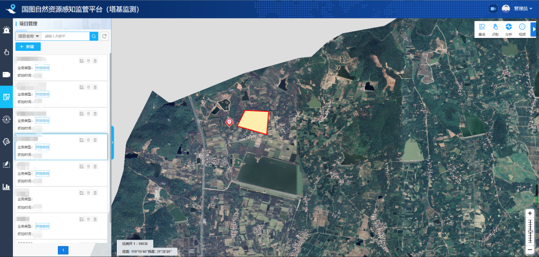
The platform has established a law enforcement and supervision system for Yilong Lake Administration that integrates inspection, supervision and command. Real-time supervision of illegal acts through surveillance cameras, and voice reminders, real-time monitoring of law enforcement, salvage, and water ecological circulation systems in the lake area, high-definition cameras and remote shouting to stop, or arrange law enforcement personnel to take actions through law enforcement supervision APPP, and form law enforcement records. At the same time, through the 100-square-kilometer 3D oblique photographic model in the watershed, a preliminary understanding of each object and surrounding information in the watershed can be carried out and the status quo can be fixed, to facilitate emergency command and planning management.
Dynamic early warning+Tracking management: The platform is working.
1. Dynamic early warning of water quality in the whole lake
integrates multi-source data, and uses spatial big data analysis and water environment data analysis model calculation engine to achieve the dynamic tracking of the whole process of “pollutant generation-loss-reduction- lake entry-lake water quality response” to avoid water pollution from the source.
2. Track and manage the whole process of the lake’s supervision
To build a water environment monitoring system and river environment intelligent decision-aided model system to establish a system of “real-time monitoring-dynamic appraisal-forecast and warning-decision support-scientific dispatch-enforcement and supervision”.
3. Cloud construction, Cloud operation and maintenance, Cloud service construction mode
Relying on the Yunnan geological big data service platform, the platform’s computing resources (IaaS), data resources (DaaS) and platform resources (PaaS) are used to support the efficient operation of the lake model under the support of the distributed spatial computing architecture, which greatly improves the model computing performance. Finally, the cloud service application (SaaS) of the private cloud platform can be conducted.
Author: Yi Peng;Guo Cui;Huang Shitong, SuperMap Application Business Group