The smart airport digital twin solution integrates cutting-edge technologies such as the Internet of Things, big data, BIM, GIS, and artificial intelligence. By establishing a complex relationship between airports in the physical world and virtual space that corresponds, maps, collaborates, and interacts with each other, a smart airport with intelligent planning, construction, management, and operation is built to optimize airport operations and passenger experience.
The solution utilizes digital expression, visual presentation, data fusion supply, spatial analysis and calculation, simulation deduction, and virtual-real fusion and interaction to create a spatial intelligent data system, which enables the airport’s “ground/underground” full space, “past/current/future” full-time refined management, deeply empowering the construction of smart civil aviation with digital twin technology.
1. Whole-process solution
Relying on SuperMap GIS platform software, spatial intelligence, and digital twin technology, the civil aviation team of SuperMap has created a set of safe and efficient whole-process smart airport digital twin solutions.
As for space intelligence, the program constructs the Airport Information Model (AIM) of entities such as the Ground Transportation Center (GTC), terminal building, flight area, vehicles, aircraft, facilities, and equipment. It integrates various spatial data resources, mines airport operation rules and models, and simulates, verifies, predicts, and controls the physical entities of the airport, involving airport construction and operation, simulation exercises, intelligent security, passenger services, equipment operation, maintenance, etc.
2. Multi-source heterogeneous data to build a spatial intelligent data system
The solution enables the data engine and data governance standards that support BIM+GIS multi-source heterogeneous data fusion: through the SDX+ spatial data engine, the integration of spatial data such as raster images, vector maps, laser point clouds, 3D models, and BIM models is enabled. Using multi-source heterogeneous data fusion technology, a multi-dimensional unified spatial intelligent data resource pool is formed in the digital space. It can provide geographic analysis capabilities required for planning and design including rule modeling, spatial analysis, red line detection, height control analysis, skyline, sunshine analysis, and volume ratio analysis.
When BIM is integrated into the digital twin space, a more complete and detailed airport digital twin will be formed, forming the basis for the whole life cycle management of twin airports, achieving the intercommunication of BIM data in planning, construction, management, and operation, and improving the application value of BIM data assets and conducting highly efficient digital twin management.
3. Empowering application scenarios to support the “smart brain” of airports
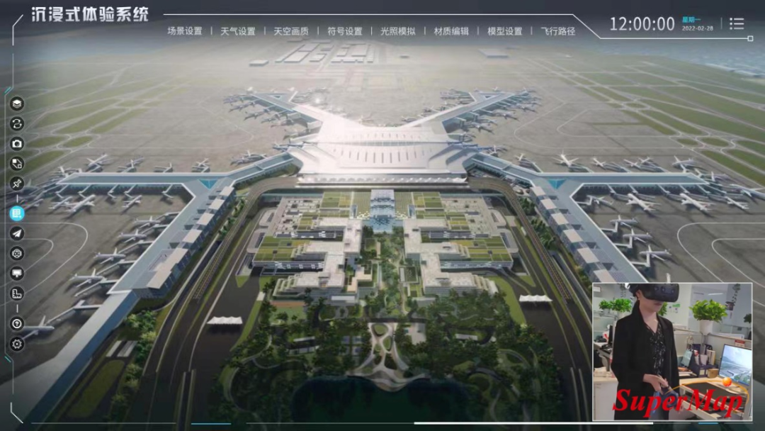
Based on the airport digital twin platform, the solution has a high simulation and high-performance rendering capabilities. It adopts SuperMap’s self-developed GIS+UE conversion engine. Based on the integration of BIM+GIS technology, it is further realized with the excellent rendering capabilities of the game engine. Through cross-border integration, it can provide users with a 3D experience with higher performance and higher realism.
The airport digital twin platform supports VR terminal access, which can allow planners or reviewers to perform immersive roaming in the digital twin space, and can intuitively experience the overall effects of landscaping, architectural lighting, and night scene lighting after the airport is completed. Users can load the previous planning and design effects into the digital twin scene for comparison, and can more realistically experience the overall matching experience of airport landscape, color-matching design, or barrier-free design, discover design defects in time, optimize the design plan, and improve the feasibility of the plan and save design cost.
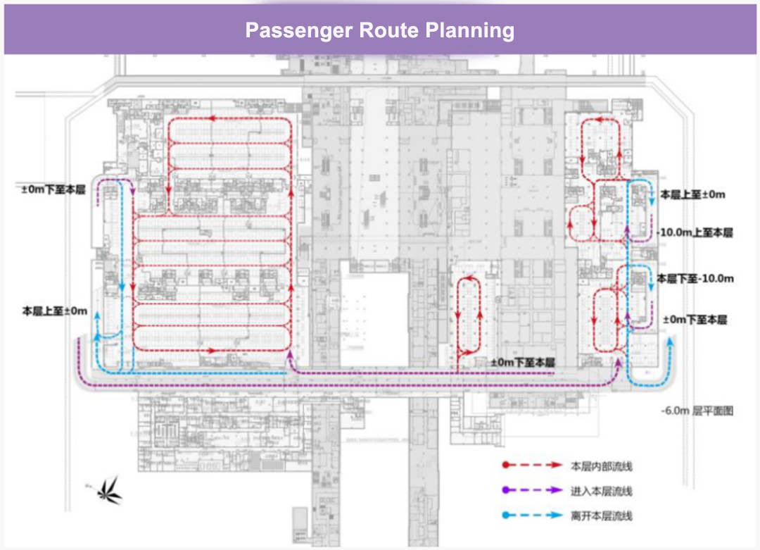
The airport digital twin platform can establish the GTC simulation scene, simulate the comprehensive operation situation of vehicle flow and passenger flow in real time, and intuitively display the operation status of each layer of GTC and the trend of passenger flow.
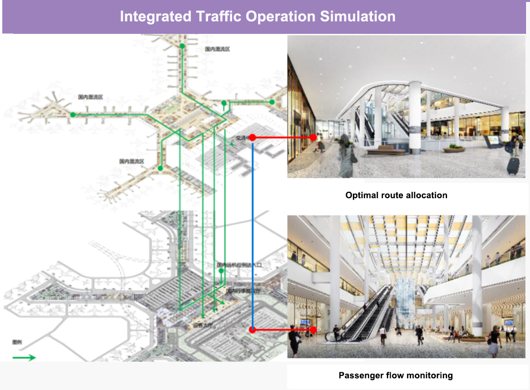
For the traffic flow, passenger flow density, and flow direction, the airport digital twin platform can perform three-dimensional detection, quickly find the GTC congestion point, generate a route optimization plan to guide passengers to transfer, and help passengers avoid congestion; through traffic simulation to empower the comprehensive traffic management platform, timely predict and relieve congestion.
The airport digital twin platform enables simulation and real-time twin scene deduction. By entering the “twin world”, according to the airport flight plan, seat scheduling, vehicle scheduling, and other data, using big data analysis technology, the airport can be deduced in the virtual twin world. The future operation status is used to verify the simulation of the airport operation command plan, avoid actual operation conflicts, improve the efficiency of the airport operation, and create a safe and controllable airport.