To support data fusion and sharing, digital collaborative management, and construction-management-maintenance integration in the digital transformation of the highway, Shandong Provincial Communications Planning and Design Institute Group Co., Ltd uses the SuperMap desktop and Web GIS software technologies including spatial data generation, multi-source data integration to develop and construct a full life cycle application and management system aimed at the stage of design, construction, maintenance of highway infrastructure,
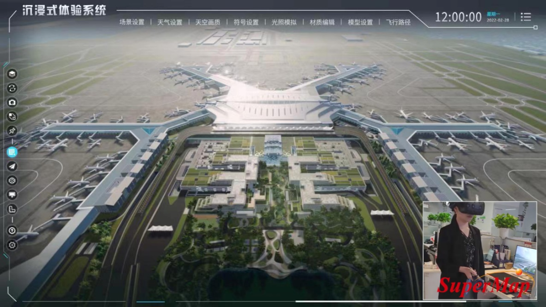
Highway Engineering Sand Table Design Program
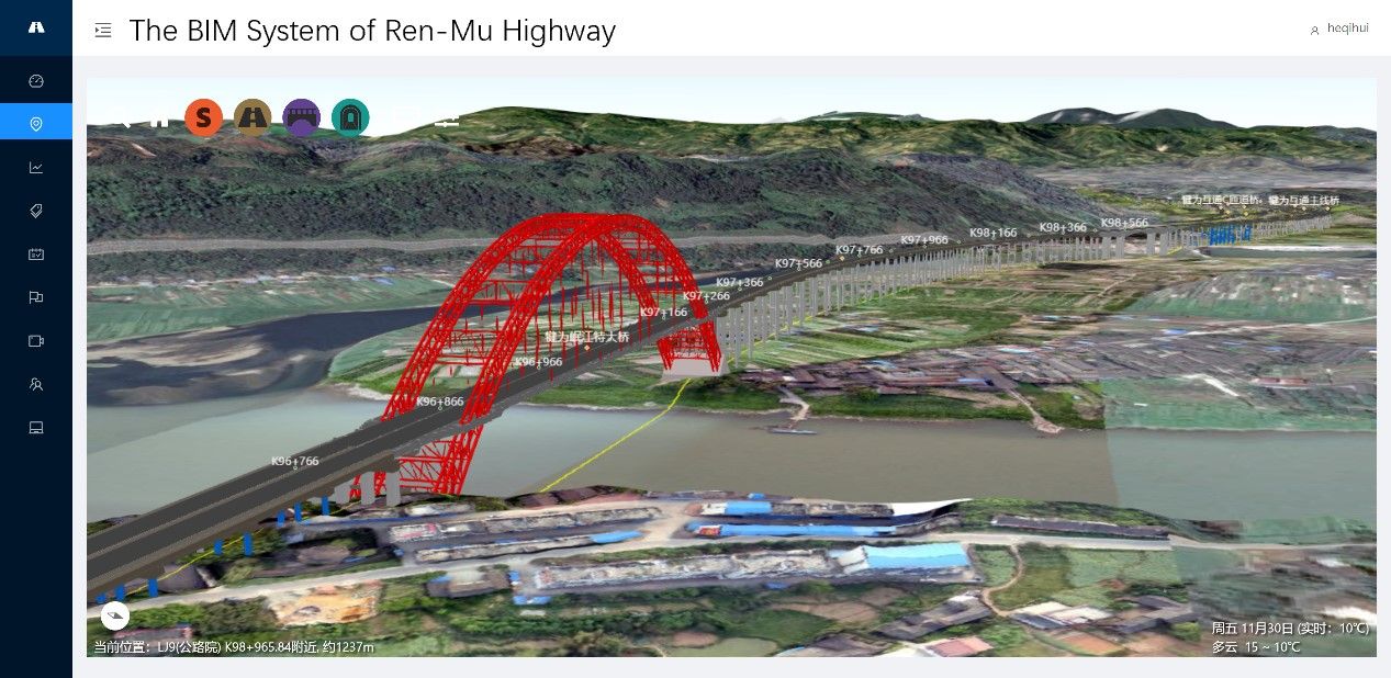
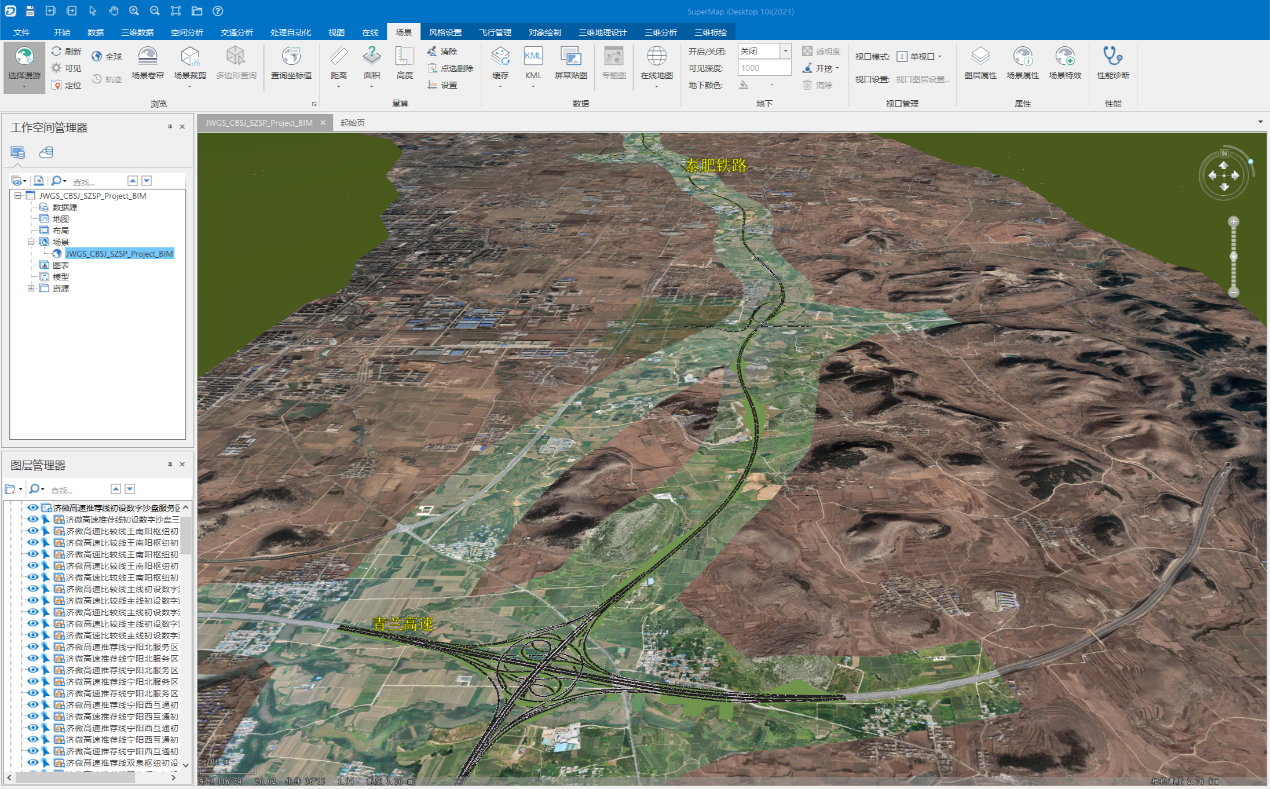
The road engineering sand table design program is developed based on the SuperMap desktop. For the highway engineering planning and preliminary design stage, this system realizes automatic analysis of data and rapid model creation of roads, bridges, tunnels, and intercommunication hubs. Combined with high-precision 3D geographic scenes, it provides intuitive and vivid model support for visual route selection, scheme comparison, and design optimization.
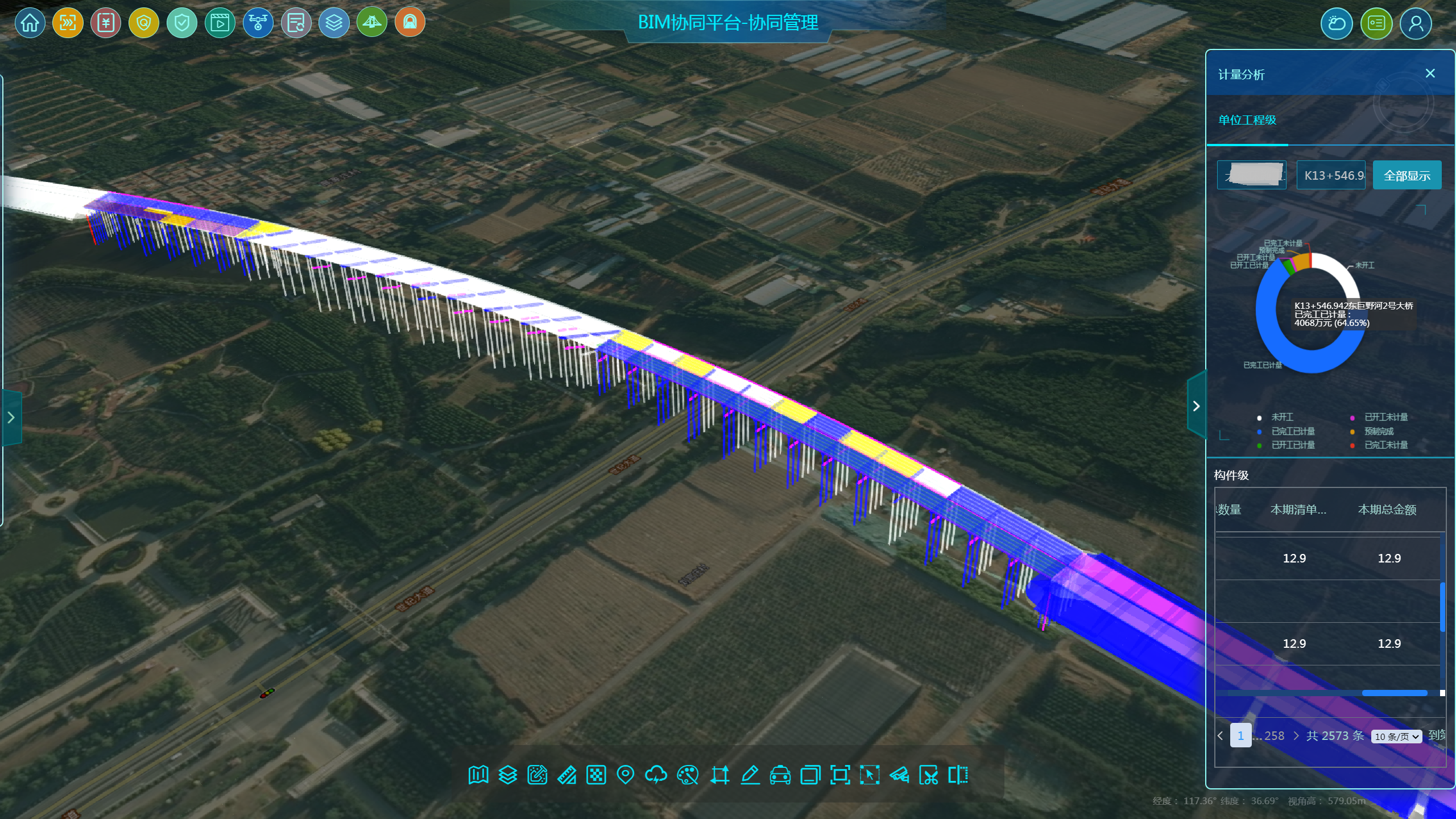
BIM Collaboration Platform for Construction Management
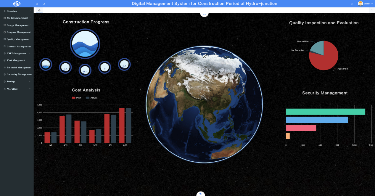
A BIM+GIS collaborative management platform (for enterprises) is developed. It takes the refined BIM model as the information carrier, integrates multi-source information such as drawings and construction operation chart data, establishes the mapping association between model components and data through standard coding principles, and realizes the integration from components to projects. It realizes the comprehensive application of multi-level construction management.
In the function module of construction progress and measurement analysis, the intelligent analysis and visual display of business data are the core, and the progress and measurement situation is displayed in various forms through visual charts and coloring models to assist the owner in decision-making analysis and improve the efficiency of construction management.
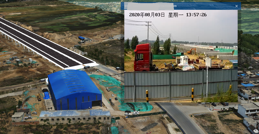
Using BIM + GIS + IoT technology, the camera location can be accurately positioned in the model, and through the real-time access of on-site monitoring video, users can directly view the construction quality, environment, and production safety of the construction site on the web page.
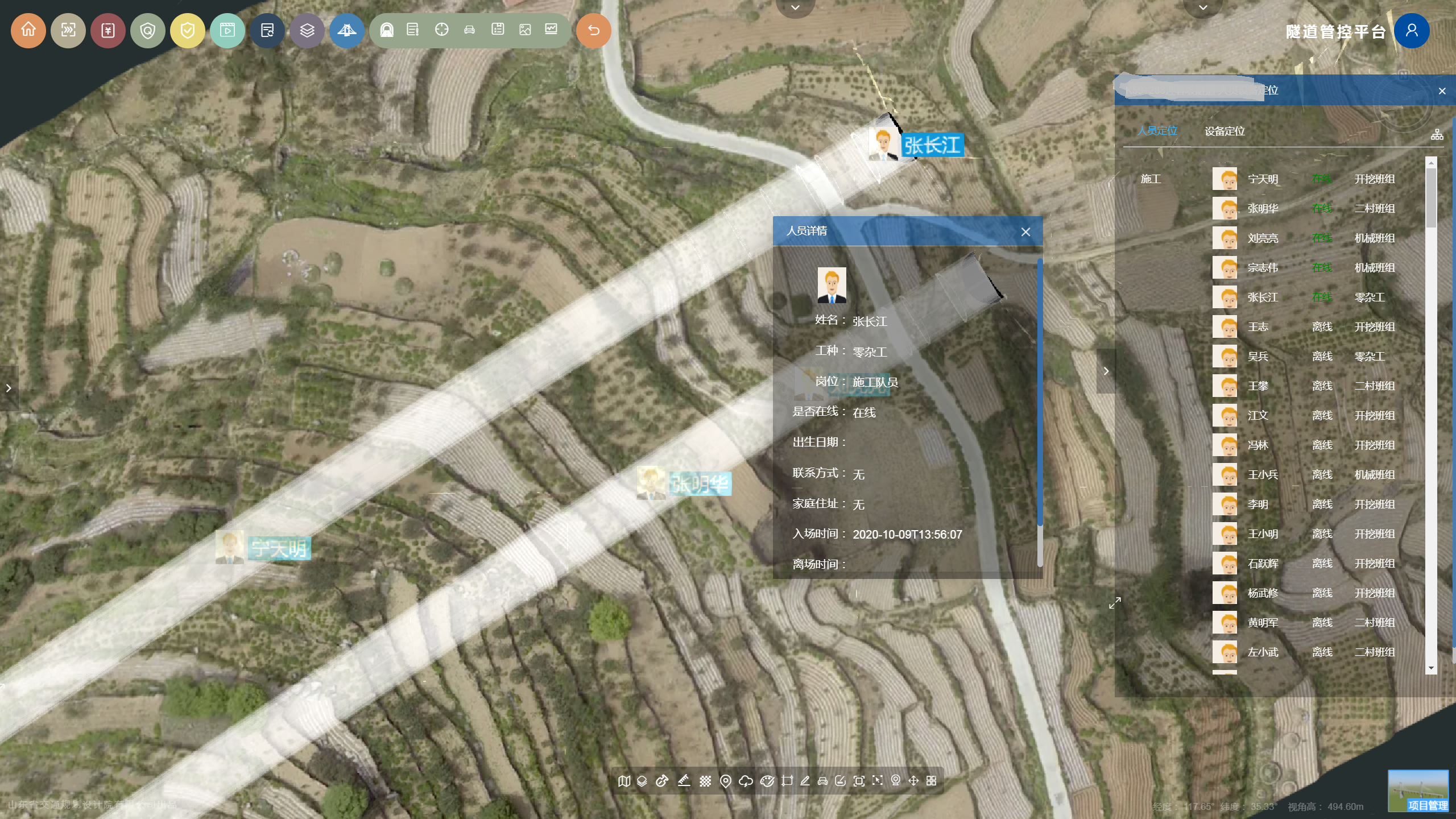
Integrating the professional module of tunnel safety management and control, it realizes the information integration and visual display analysis of personnel and equipment positioning, risk assessment, monitoring and measurement of surrounding rock deformation, advanced geological forecast, and assists the safety management and control of tunnel construction period.
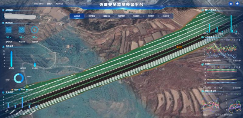
Integrated Platform for Road Infrastructure Monitoring and Early Warning
The platform is developed in B/S mode and uses the MQTT IoT protocol to transmit device data to ensure the stability, scalability, and real-time performance of the system. The platform includes multiple professional modules for roads, bridges, tunnels, and slopes, which can realize the integrated management of the health and safety status of highway infrastructure. It is equipped with functions of 3D correlation display of monitoring results based on BIM+GIS, statistical query, comparative analysis, intelligent early warning, reports automatic generation, comprehensive evaluation, trend prediction, and inspection management.
Through the development of a series of application software and platforms, a digital solution for the whole life cycle of highway engineering is formed, which takes the model as the information carrier and the BIM+GIS platform as the information processing analysis, visual display, and multi-party collaboration tools. At present, this solution has been applied in more than 20 highways.