SuperMap has partnered with Jilin Fengsheng Software Technology to build the Yongji County Flood Defense Visual Command Platform based on SuperMap10i product.

Yongji County (Source: www.jlyl.gov.cn)
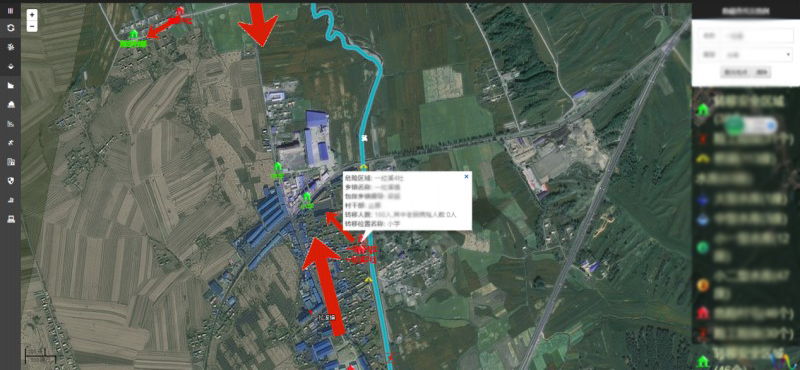
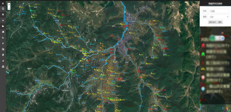
Its main functions include basic map operations, such as graphic control, object selection, map zooming, spatial calculation, dynamic legends, situational plotting; information resources visualization applications, including water systems, reservoirs, villages in flash flood, flash flood prone locations, geological disaster locations, temporary shelters and resettlement locations during flood season, key enterprises, etc. Each map integrates a kind of local business data for map spatial expression, and the data is accurately plotted on the corresponding coordinate points in the form of thematic maps. Each key part is attached with relevant flood control data. The data is highly integrated and combined with the application of spatial data, providing an intuitive expression, reliable basis for auxiliary command, and direct access to the information to the responsible person. The command of flood control is conducted on “One Map”, which facilitates the flood proofing actions. The platform supports real-time dangers monitoring, integration of IoT system and GIS system, real-time obtaining of locations’ videos and images, information monitoring, threshold setting and correlative alarms.
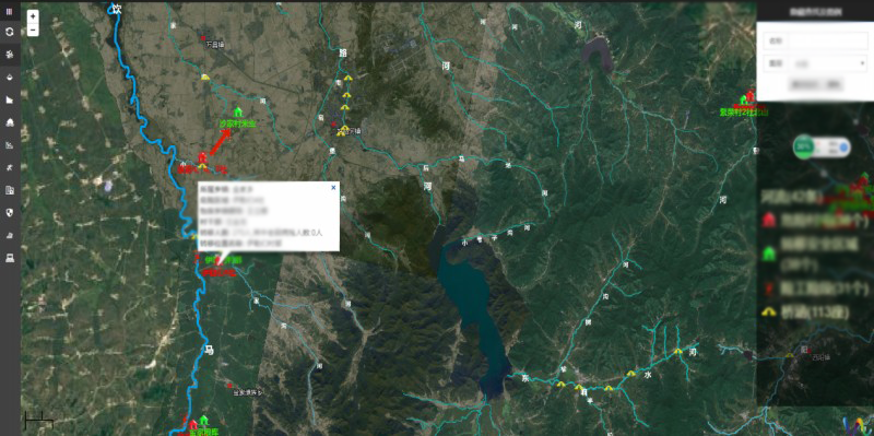
Dangerous rivers
Dynamic plotting
Dangerous landmarks
Source: Jilin Fengsheng Software Technology