To assist partners in tackling problems of low efficiency of monitoring and supervision of cultivated land and difficulty in quantity verification facing partners, SuperMap GIS comprehensively uses remote sensing, GIS, big data, AI, 2D&3D integration, Internet of Things, etc., to establish a dynamic supervision mechanism for cultivated land protection to assist in the entire process of cultivated land resources supervision.
Spatial query assists in summary statistics of cultivated land
SuperMap GIS technology provides spatial query, and users can customize the query conditions to quickly summarize and count the scale and quantity of cultivated land over the years, helping to analyze the trend of cultivated land.
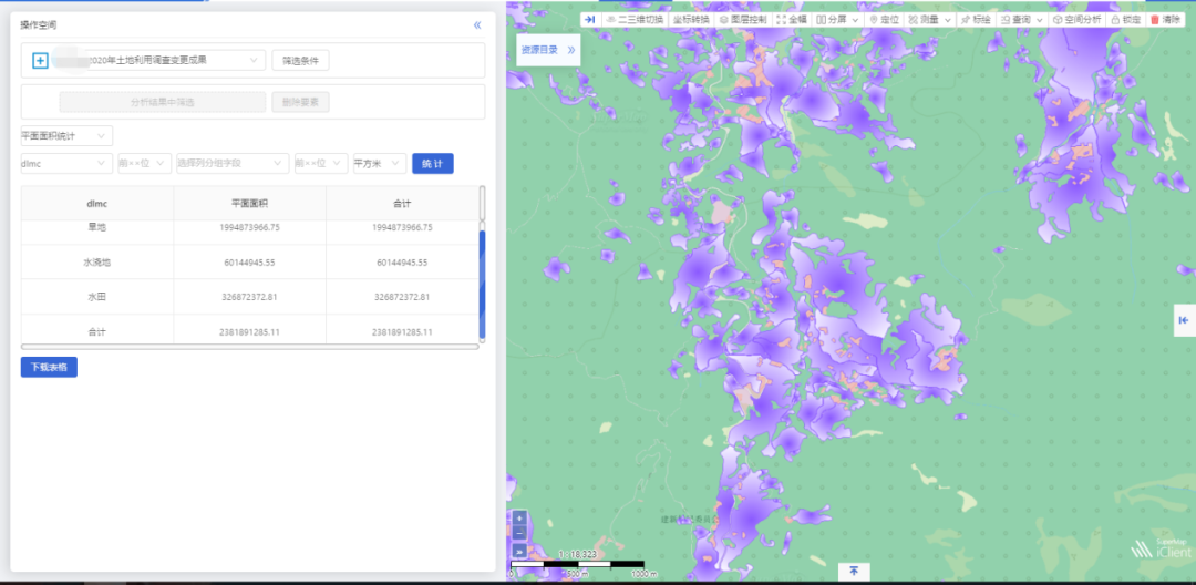
Spatial query - annual summary statistics of cultivated land
GIS+AI+remote sensing images assists in the change monitoring of cultivated land
SuperMap provides GIS+AI to monitor cultivated land. By comparing the high-definition remote sensing images of different phases, AI technology is introduced to automatically identify and extract the occupied cultivated land for greening and afforestation, occupied cultivated land to dig lakes and landscapes, occupy permanent basic farmland to expand natural reserves, and occupy cultivated land for non-agricultural construction. By comparing high-definition remote sensing images of different phases and introducing AI technology, automatic identification of grain and non-grain planting can be realized, changing areas can be extracted and verified, and the planting distribution and area of grain crops in the current season can be found out, and non-food area plots discovered by the analysis can be marked.

Automatic identification of changes in cultivated land
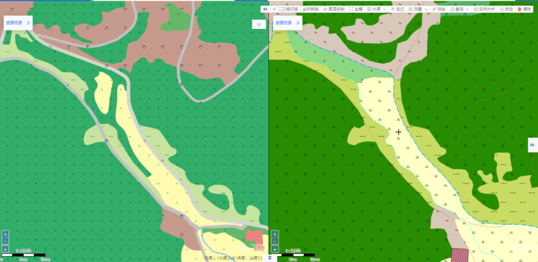
Contrastive analysis of changes in cultivated land types in different years
GIS+AI+video pictures assist in law enforcement supervision
SuperMap GIS provides a variety of information collection technologies based on drones, video surveillance, mobile terminals, monitoring vehicles, etc. It comprehensively uses high-speed communication networks and Internet technology to support change perception, intelligent analysis, timely early warning and rapid processing, real-time geographic information visualization and intelligent geographic analysis solutions to help investigate and deal with illegal occupation of cultivated land.
2D&3D integration analysis assists in disaster prevention and mitigation
SuperMap GIS combines 2D&3D Integration technology to realize high-performance visualization of 2D data in 3D scenes, rich analysis functions in 3D space, superimposition of multiple types of information in geographic space, and provide users with multiple perspectives to analyze and acquire implicit information.
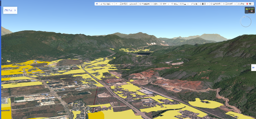
3D display of cultivated land resources
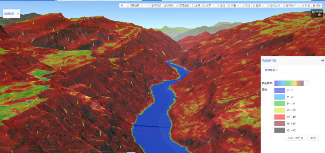
3D analysis of slope aspect of cultivated land
The 3D analysis of cultivated land slope and aspect can more intuitively display the situation of cultivated land with different slopes, and provide auxiliary decision-making for the prevention and control of natural disasters such as returning farmland to forests and floods and soil erosion.
Author: Yu Zhiquan; A Chunliu, Li Xinyu, SuperMap Application Group