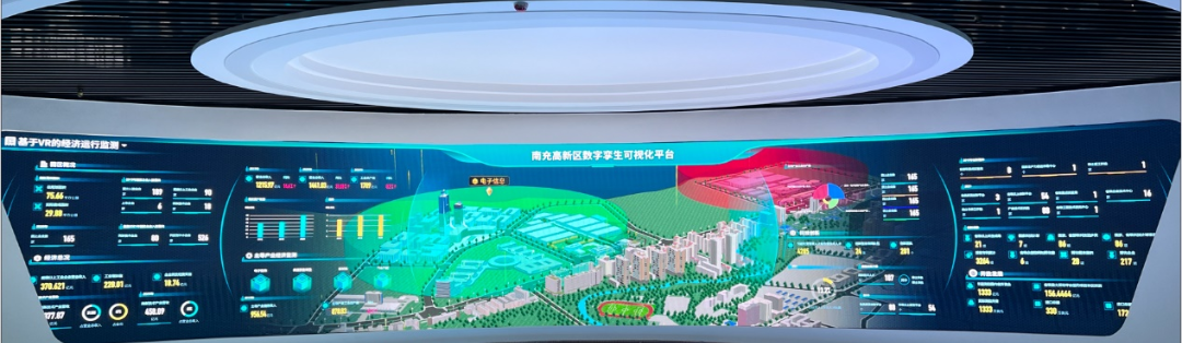
Nanchong is the second most populated city in Sichuan province, China. It is considered the cradle of the Spring Festival. Chengdu Tongyuan Technology and SuperMap jointly built the Nanchong High-tech Zone Digital Twin Visualization Platform relying on digital twin technology and SuperMap Cloud GIS application server platform SuperMap iServer 10i.
Digital twin builds a whole scene of industrial economic monitoring
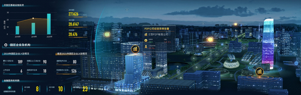
Through digital twin technology, the platform provides map services, spatial data services, 3D data publishing and browsing, and 3D spatial analysis functions based on the SuperMap Cloud GIS application server platform SuperMap iServer 10i. A 3D model map covering 77 square kilometers was built, presenting the virtual reality of 60 hotspots (enterprises and key landmarks) in the whole area.
The platform has also built a “nerve center” for regional industrial economic services. By rendering the full economic scene of each park in the region in real time, and superimposing key industries, enterprises and operation data, it is possible to get an overview of the operation status of all industrial parks in one picture.
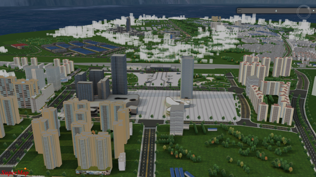
Companies and buildings
Digital technology empowers regional environmental monitoring and green development
With the development of smart zero-carbon parks, real-time environmental monitoring, green production methods, low-carbon lifestyles, and institutionalized green development have become the focus of smart park development.
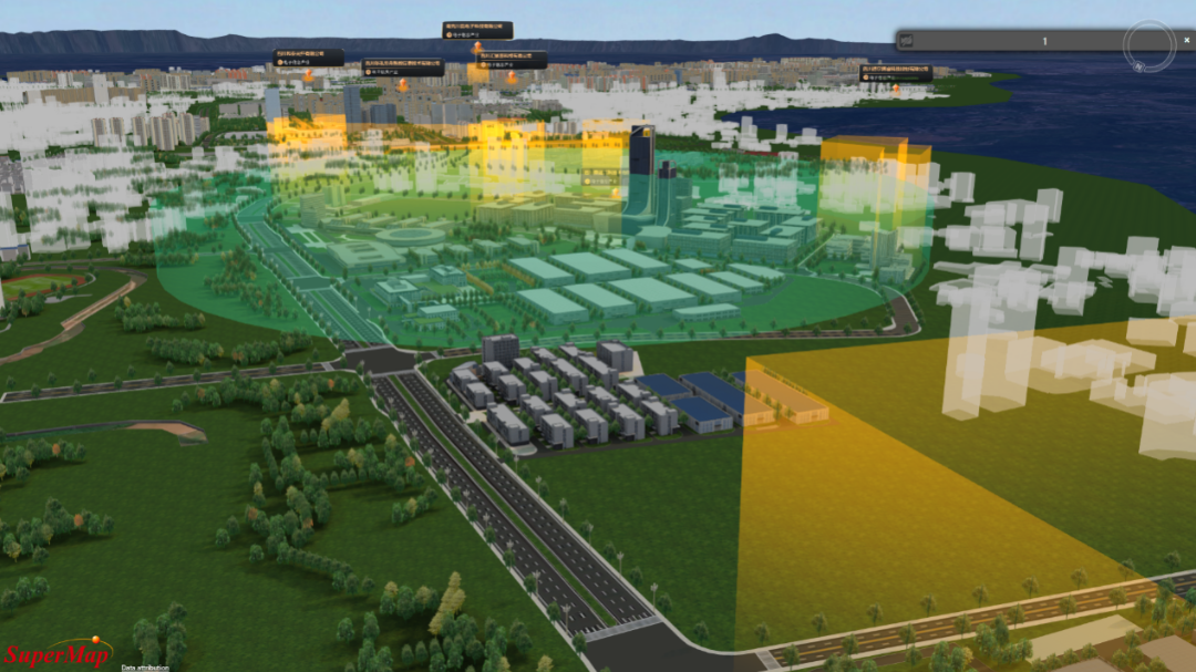
Through the digital twin technology, the platform has created a whole scene of regional environmental monitoring:
using the advanced network, communication and information technology, with practicality, simplification and visualization as the main features, it sets monitoring points in relevant areas, to collect the data on air quality (such as SO2, NO2, PM2.5, wind speed, temperature, etc.) in real time, to monitor the environmental conditions of the park. The collected data are connected to the regional environmental monitoring platform -- the atmospheric panorama analysis subsystem.
The subsystem has five functions: 3D map, pollution traceability, dynamic control, forecasting and warning, and pollution source data sorting. Through digital twin technology, it can display the real-time full-scene of environmental monitoring in the area.

VR-based environmental monitoring system for key industrial parks
Management of key projects and the scene presentation
The platform implements full connection and full integration of key data for key projects in the region, making key projects visible, manageable, and controllable; focusing on key scenarios.
Combined with continuous operations, regional industrial services and project services are enriched, to better serve the industry and enterprises.
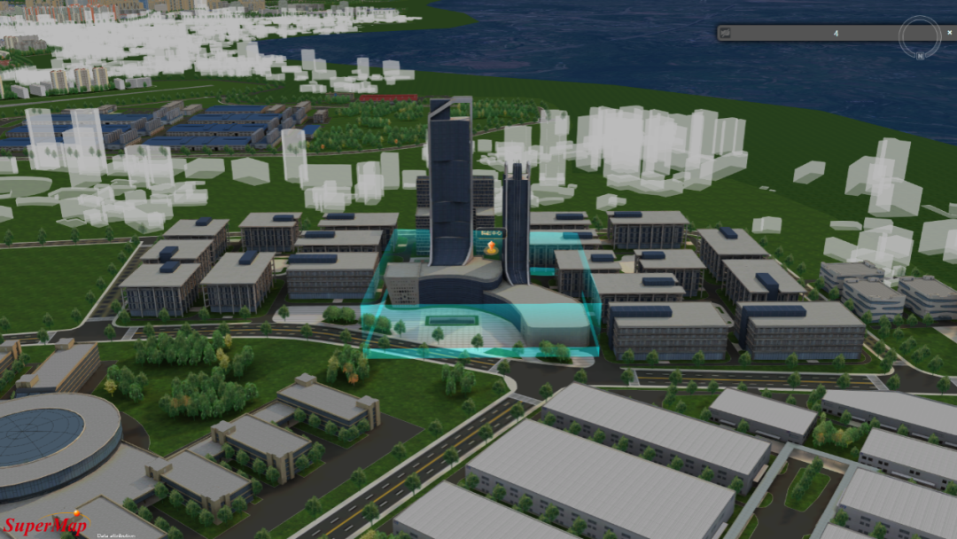
Science and Technology Innovation Center (Park Exhibition Hall)
Integrated management of key industrial resources
The platform applies digital twin technology to the management of regional industrial economic data, to display the overview of resources, and manage companies’ basic information, historic development, annual operation data, key products, etc.
The integrated industrial resource management platform conducts unified information collection and unified storage management of industrial resources in the local area, which supports the administration departments to get a comprehensive understanding of local key industrial resources’ competence.
VR-based monitoring of the economic operation of key industrial parks


