Driven by the growing application demand and the ever-changing information technology, the GIS software technology system is also increasingly enriched. Among them, AI GIS technology is an important research direction at present, and more and more researchers are discussing AI from different professional application perspectives. GIS technology, such as remote sensing image processing, water resources research, spatial epidemiology and environmental health fields, etc., and has made remarkable achievements. Many studies have shown that AI GIS expands the data processing capabilities of traditional GIS, and can efficiently identify and analyze geographic information in unstructured data such as street views, remote sensing and aerial images, and text; The complex spatial and temporal relationship of dynamic changes is captured in the data, which enhances the analysis and prediction ability of the GIS model.
SuperMap AI GIS is a general term for the integration of artificial intelligence technology and SuperMap GIS technology. The system includes data, domain library, framework and functions. Data is the basis of the entire technical framework, and users can choose different storage solutions according to different data characteristics. The domain library is a unique concept for the application of AI GIS, which manages the samples and models involved in the use of AI GIS in a unified manner. The framework is the guarantee for the realization of AI GIS capabilities. On the one hand, the framework itself implements some classic algorithms, and on the other hand, the framework can quickly expand and derive new algorithms. The function is the capability realization of AI GIS, including three core contents: GeoAI, AI for GIS and GIS for AI. GeoAI is spatial analysis and processing integrated with AI; SuperMap provides a unified GeoAI process tool to connect all processing links. AI for GIS is based on AI technology to enhance and optimize GIS software functions; GIS for AI is based on GIS technology.
Since the start of the construction of Yunnan Geological Big Data Service Platform in 2017, after more than five years of construction, it has accumulated a wealth of data of topographic maps, geographical and national conditions monitoring, land and space planning, control points, images, 3D, and documents. When solving the problem of the high-frequency comparison of large-area cultivated land, the traditional manual calibration method is difficult to support the explosive growth of tasks and workloads. Therefore, the use of AI methods to achieve intelligent automatic processing of remote sensing images has far-reaching significance.
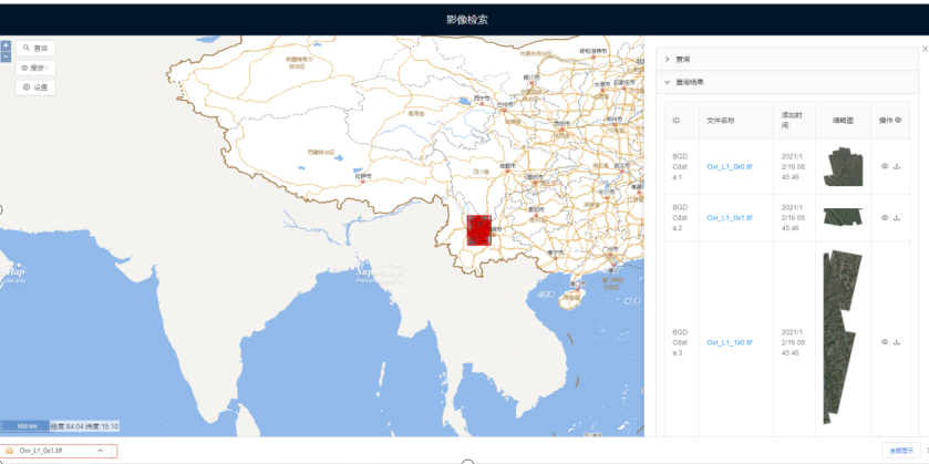
1. Build a unified image management service platform to solve the query, browsing, distribution and use of large-scale and different resolution image data
Image data, as an important part of geospatial data, can truly and intuitively represent the geographical features of the region, which is more informative than simple vector data. With the increase in remote sensing image data acquisition methods and data volume, how to manage, analyze and share massive remote sensing image data has become an urgent problem to be solved. Through the construction of a unified image management service system, the management function of remote sensing image data is built, and the unified management, browsing and query of image or raster data are carried out on the Web side based on mosaic dataset technology.
Form a set of intelligent image management process
Based on existing data, the system formulates data management standards, realizes efficient storage, management and release of remote sensing images and various special data, optimizes data production process internally, improve production efficiency, optimizes business process, and reduces the difficulty and cost of finding and using data for users, realizes the overall management of result data, and give full play to the use value of data. Externally, based on multi-source, multi-temporal, high-resolution remote sensing image data such as provincial high-resolution satellites and aerial images, and using GIS, big data and other technologies to develop a GIS+AI service platform, it can store, manage and publish remote sensing images in real time and efficiently. Thematic data provides users with functions such as online retrieval, image analysis, data download, and technical services, and realizes the timely sharing and efficient use of remote sensing image products among provincial industries.
AI Services
To analyze GIS data based on GeoAI technology. AI is an important direction of GIS development and an important technological driving force affecting future GIS development. The combination of GIS and AI will further promote the in-depth evolution of geographic intelligence and meet wider and deeper application needs. Based on rich spatial statistical methods, GeoAI function research and development is carried out in two aspects of spatial machine learning and spatial deep learning, supporting AI GIS applications, and serving the processing, analysis and mining of GIS spatial data. The system is integrated into the geological big data service platform system, connected with the general AI platform for geological big data, and builds business process models and publish according to business needs, and shares the published models by registering them in the asset management platform. and reuse, which is conducive to the accumulation and use of results.
2. Model application
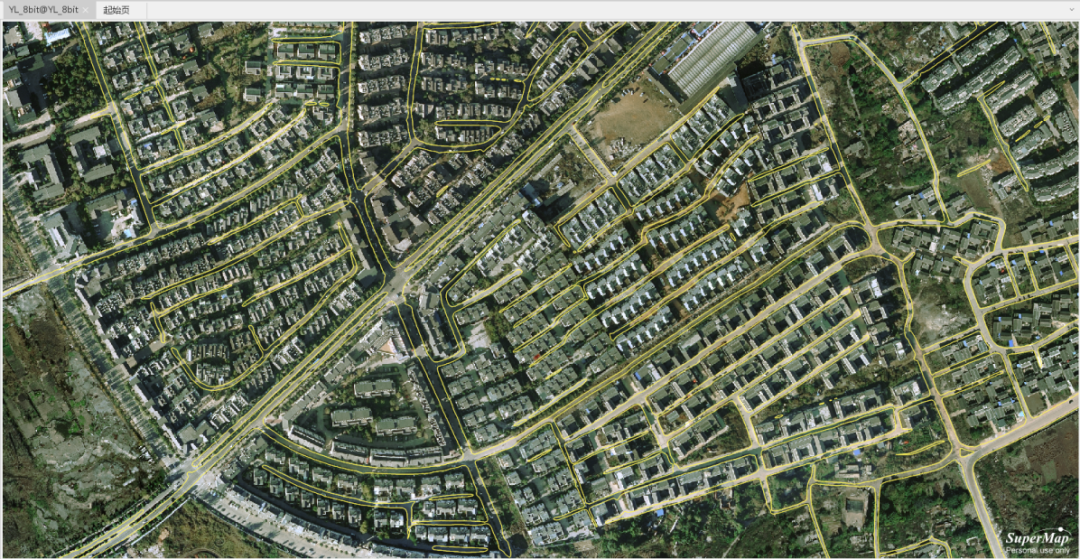
Road centerline extraction
The system takes the orthophoto remote sensing image data of Hekou County as an experiment to extract the bottom surface of the building, uses the binary classification to judge whether each pixel in the image is an interest category through the neural network model, and calculates the position, boundary and area of the interest category through the pixels to provide road information for Hekou 3D One-map System.
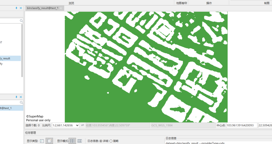
Extraction of the bottom surface of the building
The system takes the orthophoto remote sensing image data of Hekou County as an experiment to extract the bottom surface of the building, uses the binary classification to judge whether each pixel in the image is an interest category through the neural network model, and calculates the position, boundary and area of the interest category through the pixels to provide building information for a 3D map of digital free trade, and use it for functions such as model single query.
3. Summary
The Yunnan Geological Big Data Service platform has formed a core data warehouse of internal resources. The next step will be to further mine industry data, such as the extraction of urban components, the integration of 3D models, and the deepening of platform functions such as power grid inspections to promote smart cities, digital twins, etc.
Author: Yangli; A Chunliu; Yu Zhiquan, SuperMap Application Business Group