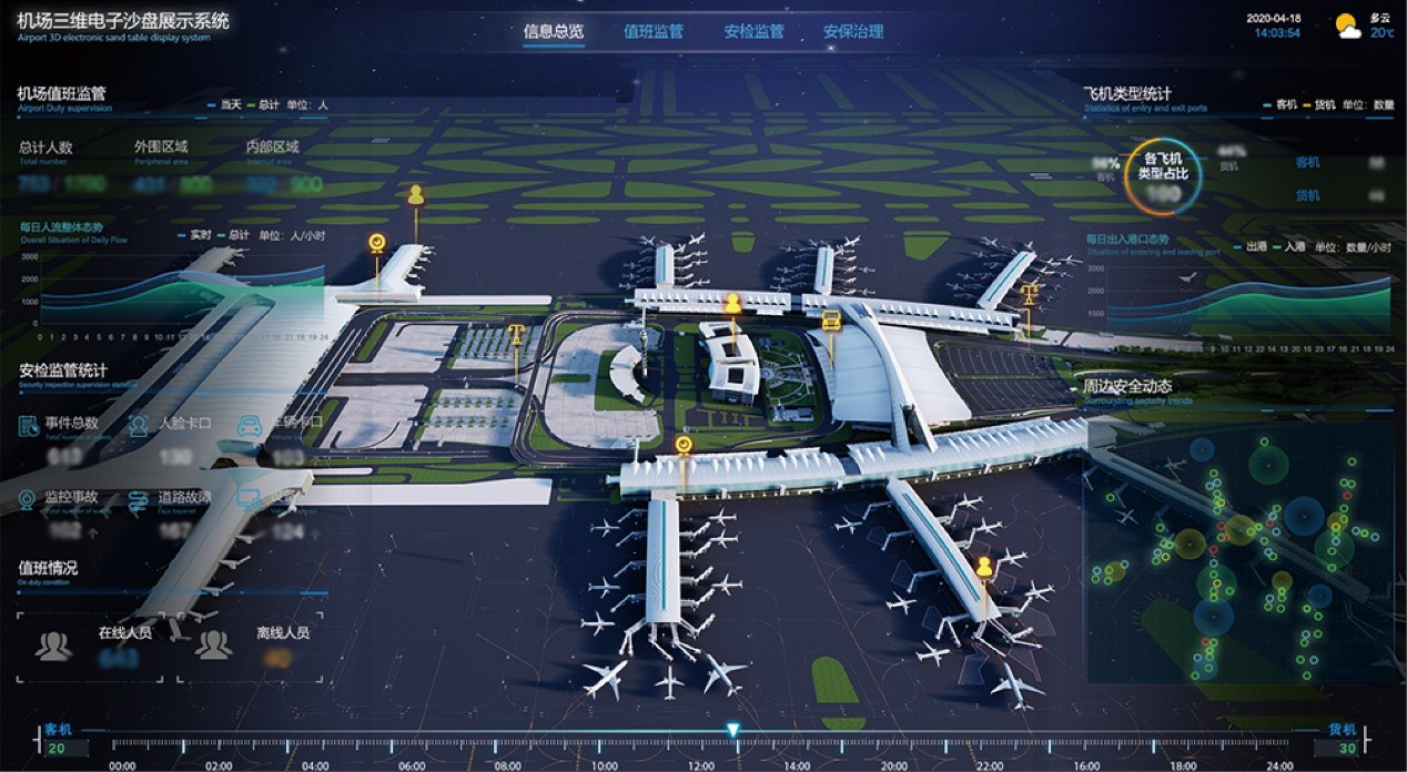
SuperMap has developed a safe and efficient “Airport Digital Twin Platform” after years of development and practice based on SuperMap platform software. The platform builds the Airport Information Model (AIM) of entities such as the ground transportation center, terminal building, flight area, vehicles, aircraft, facilities, etc. It utilizes key technologies such as the Internet of Things, big data, AI, AR, VR, and comprehensive positioning. It integrates various data resources, mines airport operating rules and models, and simulates, verifies, predicts, and controls the physical entities of the airport to optimize production operations, simulation drills, intelligent security, passenger service, equipment operation, maintenance, etc.
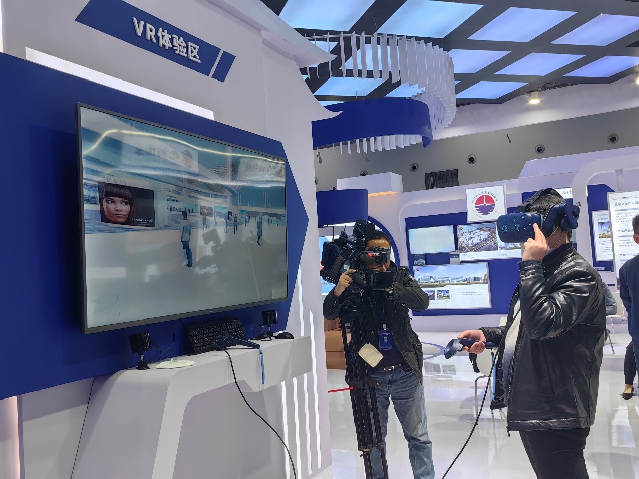
Xiamen Xiang’an Airport VR exhibition area constructed by SuperMap welcomed numerous guests. When wearing AR glasses, visitors can experience the boarding process of Xiang’an Airport immersively and explore the magnificent terminal space by operating the remote control handle.
Technological advantages
1. 2D and 3D integration, meeting the needs of different application scenarios
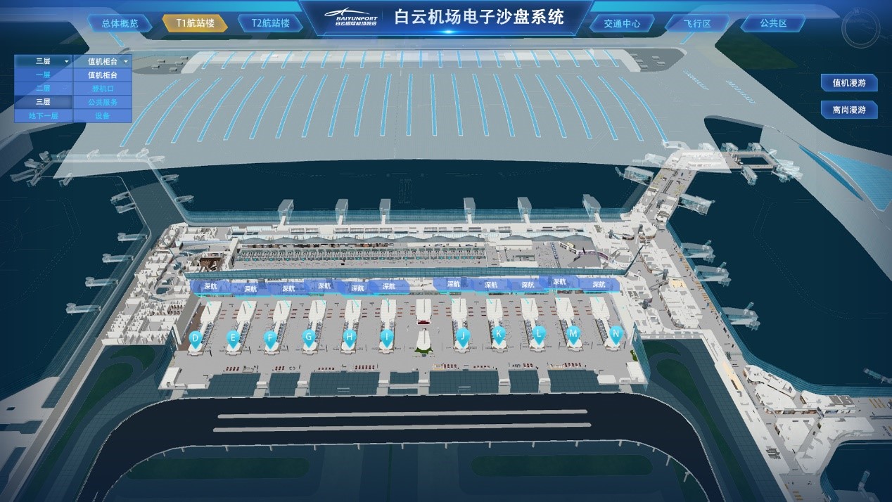
Based on the 2D-3D integrated GIS technology, the platform further expands the 3D spatial data model and its analysis and calculation capabilities and can adapt to the needs of airport users in different 2D and 3D application scenarios.
2. Integrating the game engine, exhibiting super 3D space analysis
The platform enables cross-border integration with the game engine, performing well in a realistic 3D experience. Its super 3D space analysis capabilities can be reflected in visual analysis, visual field analysis, skyline analysis, collision detection, contour analysis, submergence analysis, slope aspect analysis, etc.
Plentiful applications
1. Safe operation
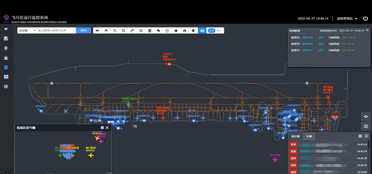
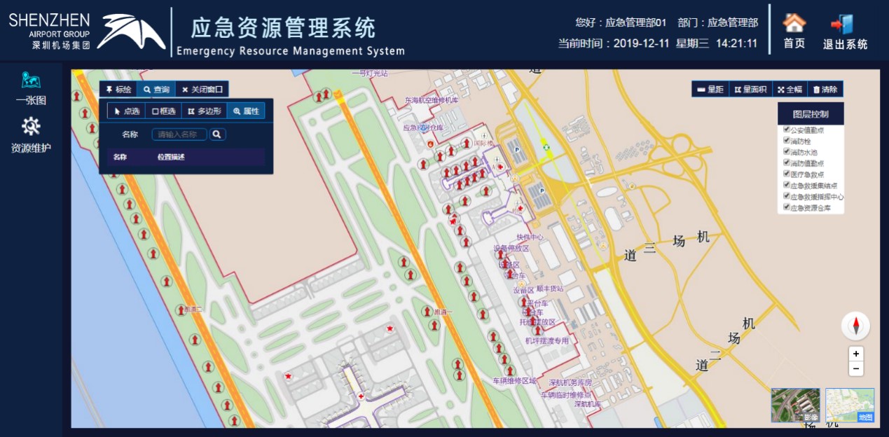
The platform integrates positioning methods such as ADS-B, A-CDM, radar, and high-precision differential GPS vehicle equipment to achieve real-time positioning, monitoring, tracking, and management of various vehicles in the airport flight area.
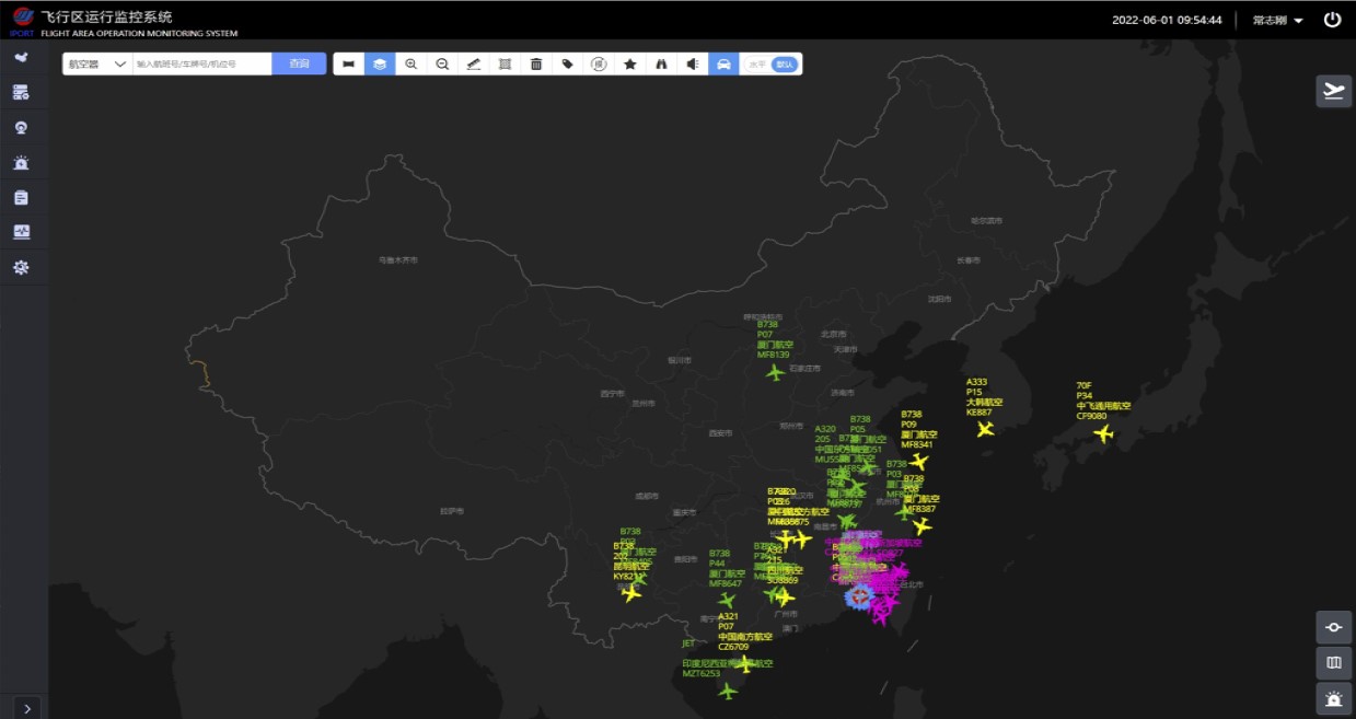
The platform has built-in rules such as height limit, speed limit, and restricted area, and analyzes driving behavior through the AI algorithm, which can provide real-time early warning of illegal driving and provide technical support for the safe operation of vehicles and drivers in the flight area.
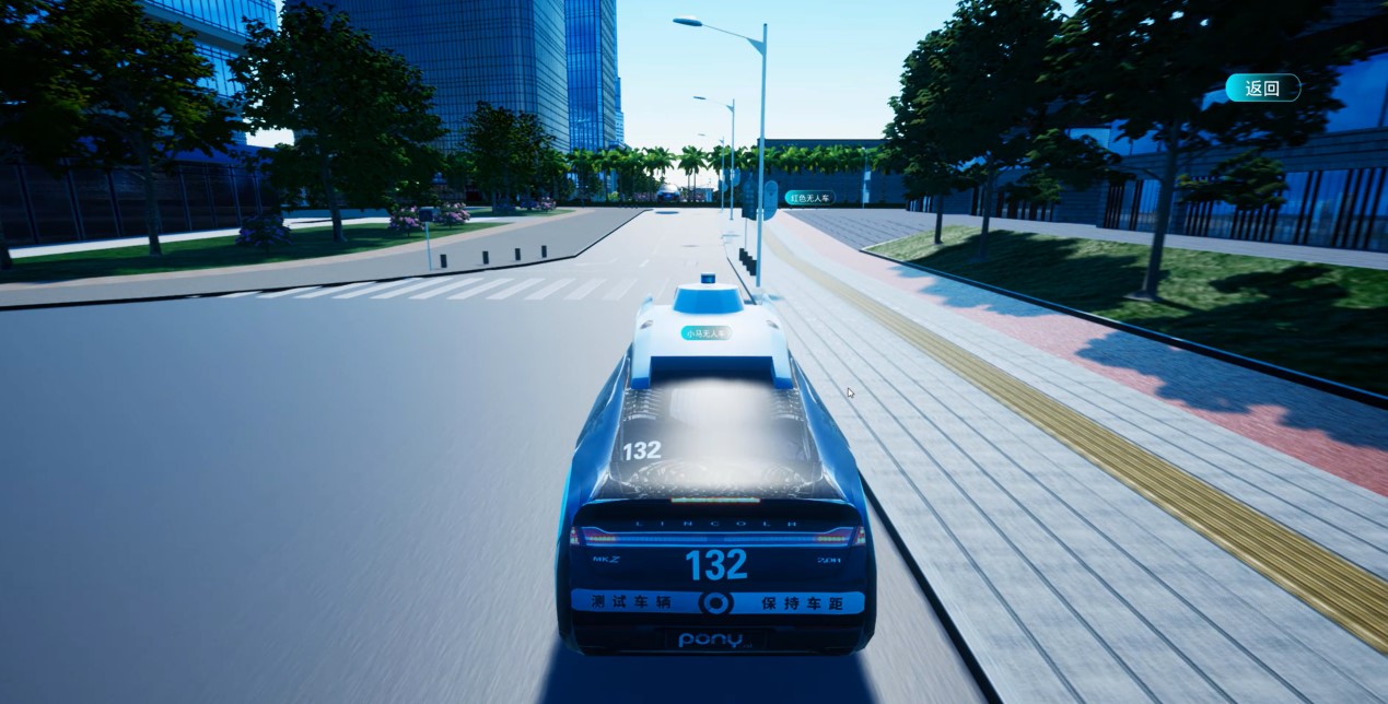
The platform can connect to the data of unmanned vehicles, enabling the real-time positioning of unmanned vehicles, and monitoring of the status of unmanned vehicles in real time. At the same time, it can freely switch between multiple perspectives such as the cockpit perspective and the third perspective.
2. Simulation training
The platform can generate various emergency plans and simulate the rescue process of various emergency events. When an emergency event (such as aircraft failure, vehicle failure, etc.) occurs, the video or voice function of the platform can be used to command and dispatch vehicles and personnel such as firefighting, ambulance, and public security, so as to ensure timely and proper handling of emergency events and reduce personal and property losses.
3. All-around intelligent security
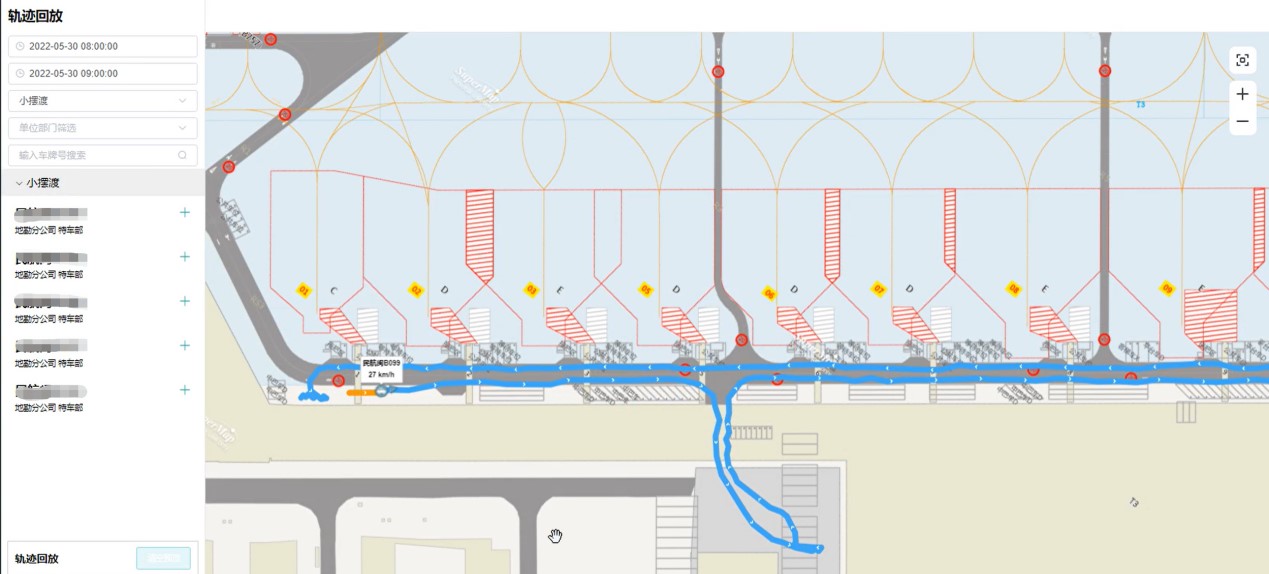
The platform can record the trajectories of vehicles and aircraft in real time, as well as the space, time, content, and other operational information of various disposal tasks in the whole area, and establish a twin scene of the flight area with comprehensive mapping and fusion of virtual and real. When an accident occurs, the platform can be used to trace back to the time of the incident, fully restore the operation status of the airport at that time, and analyze the real situation and work items on the scene all around in the simulation scene.
4. Orgaznied asset management
Based on the platform, a 1:1 model of assets such as terminal stores and billboards can be built to achieve the whole process management of assets such as resource asset registration, project approval, lease execution, contract management, resource withdrawal, lessee evaluation, and resource statistical analysis. At the same time, the spatial analysis function of the platform assists in evaluating the value of various assets.
5. Comprehensive passenger services
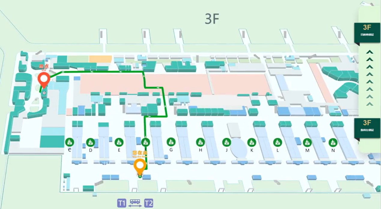
The platform has the navigation function of check-in, security check, boarding, etc., and can synchronize the guidance information of the platform to the mobile phone applet, and guide passengers to their destinations in the form of virtual road signs based on AR technology.
The platform can open up the whole chain of data such as flight operations and passenger travel, connect AR devices to the platform, guide ground service personnel to passengers based on AR+ face recognition technology, and provide personal services accurately according to each passenger’s condition.
6. More accurate equipment operation and maintenance
Based on the platform, a 1:1 model of facilities such as electromechanical and sensors can be constructed, and the internal structure of the corresponding equipment can be displayed to monitor the operating status of the facilities and equipment. At the same time, the use of technologies such as VR and AR can support the automatic inspection of facilities and equipment, provide operation and maintenance personnel with more accurate fault information, and reduce the impact of equipment failure on airport operations.