We know that using 3D effects to display buildings on the map can increase the realism of the map. MapStudio, one of the SuperMap Online WebAPPs, supports the creation of 3D layers with one click, so that buildings can be quickly displayed as 3D effects on a 2D map.
1. Data Preparation
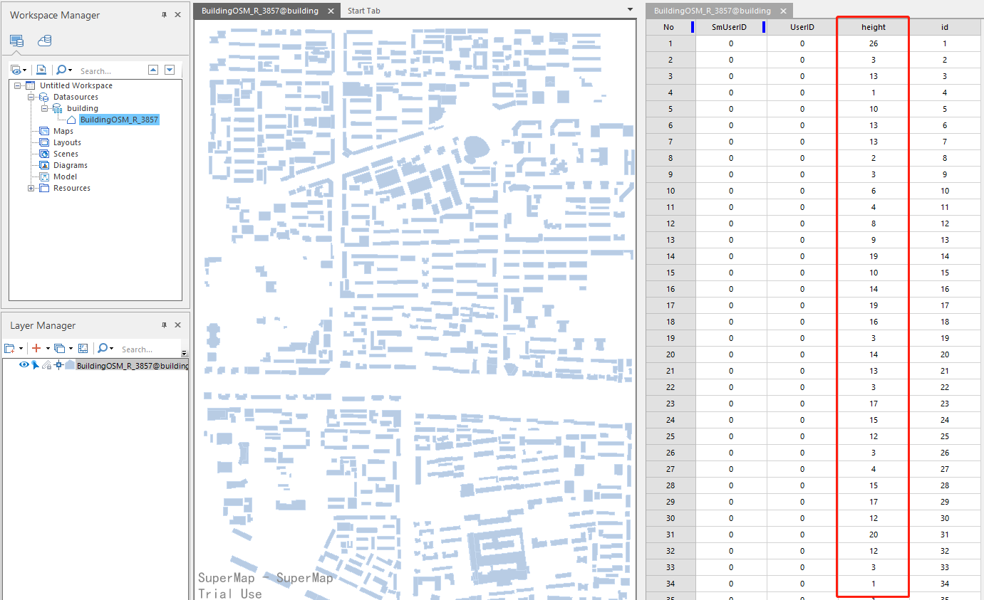
First, we prepare the building data with height attribution, store it in the SuperMap UDB DataSource, and package the UDB and UDD files into. ZIP format.
Then log in to SuperMap Online through the following link:
Enter Resource Center, then select Start Creating.

Select the "Upload Resource" button to upload and publish the prepared zip file as a rest data service.

2. Add Data to MapStudio
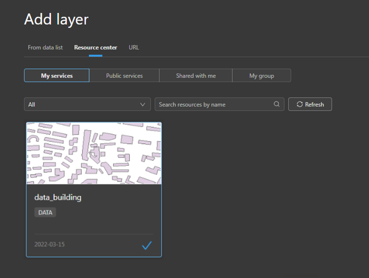
Go to the MapStudio page under the WebApps and click "Get Started" to enter the MapStudio. Add the data service we just published through Add Layer -> Resource Center -> My Services, and then add it to the current map.
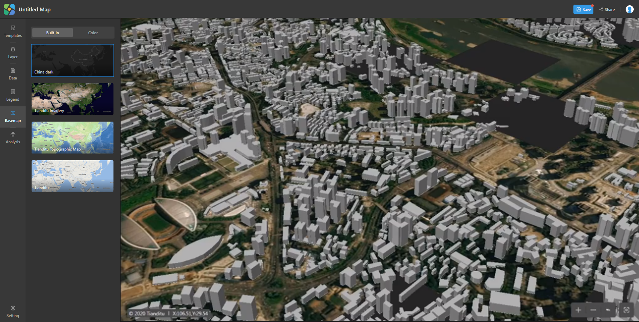
3. Create 3D Effect of Buildings
Select "Create as 3D" in the right-click menu of the layer, and set the building height field in the style setting panel on the right. Then the 2D building will be displayed as 3D effect.
You can also switch the base maps, as well as switch the perspective through the right mouse button, making the whole map more vivid.