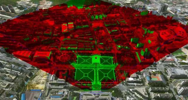
SuperMap logo
  • Products

    What is GIS

    About SuperMap GIS

    Technology System

    • Big Data GIS
    • New RS Software
    • New 3D GIS
    • Geospatial AI
    • Distributed GIS
    • Cross Platform GIS

    SuperMap GIS 2024 New!!

    • Cloud GIS Server
    • Edge GIS Server
    • Terminal GIS for Desktop
    • Terminal GIS for Components
    • Terminal GIS for Web
    • Terminal GIS for Mobile

    Previous Versions

    • SuperMap GIS 2023
    • SuperMap GIS 11i(2022)
    • SuperMap GIS 10i(2021)
    • SuperMap GIS 10i(2020)
    • SuperMap GIS 10i
    • SuperMap GIS 9D(2019)
  • Solutions

    Smart City

    Natural Resource

    Land Management

    Facility Management

    Public Safety

    Natural Disasters

    Transportation

    Water Conservancy

    BIM+GIS

  • Stories
    • Articles
    • News
    • Events
    • Magazines
  • Support
    • Download & Online Help
    • Online Demonstration
    • Ask & Answer
    • Discover SuperMap GIS
    • Trial License
  • About
    • lntroduction
    • Careers
    • Contacts
    • Suggestions
 
  • English
  • 中文
  • Español
  • Français
  • ภาษาไทย
  • русский
  • Türkçe
  • Português
  • 日本語
  • 한국어
  • Indonesian
  • عربي
Articles

Articles

  • Home
  • Stories
  • Articles
  • 4 Major Key Technological Directions for Current GIS

    Every technological Revolution will create huge change on GIS basic software, which brings major influence on GIS developers and end users.GIS software develops very fast, which has 2 driving factors: requirement needs and IT driving.On the IT driving par…

    14 Jul,2017 3D GISCloud GISbig data
    4 Major Key Technological Directions for Current GIS
  • Mapping Data and Application Integration Solution

    The combination of basic mapping data production of Sunway Technologies and SuperMap GIS makes basic mapping data into GIS applications, providing more straight forward support. In the intelligent mapping situation, building a mapping circle can provide i…

    11 Jul,2017 3D GISbig data
    Mapping Data and Application Integration Solution
  • NK3C Cloud Contact Center Tackles Challenges of Real Estate Hotline

    With the construction of real estate registration platform all across China, real estate registration platform meets new opportunities, with the background of ‘Internet+’, how can we improve the services in real estate registration has become an importa…

    10 Jul,2017 Cloud GIS
    NK3C Cloud Contact Center Tackles Challenges of Real Estate Hotline
  • What Can Map Do For Us?

    This article is translated from Chen Hu, China National Geography.Map, as one of the greatest invention in the human history, is a micro simulation of real world, in the map, people can get all the information they need, no matter in political, milit…

    07 Jul,2017
    What Can Map Do For Us?
  • Zhengzhou, a Template for Smart City Upgrade

    Zhengzhou started digital city about 6,7 years ago, however, its data is still and 2D. Comparing with digital city, smart city needs to be measurable, analyzable, visible, an existed city driven by technologies like big data, etc.Zhengzhou, capital city o…

    04 Jul,2017 Smart City
    Zhengzhou, a Template for Smart City Upgrade
  • Big Data: From Data Economy Perspective

    Data is now become the blood for the modern economy, everyone is not only consuming data, but also creating data. Therefore, data cannot be consumed, it will self-motivate and reproduce. This brings the growth of the industry as well as problems.Data is t…

    03 Jul,2017 big data
    Big Data: From Data Economy Perspective
  • The Storm is Coming, How can GIS React?

    The storm is destructive, bringing huge damage on property and transportation. Since 2000, there are multiple city flooding disasters in China, with over 200 each year, which influences the life quality, also brings severe property loss. For example, Guan…

    22 Jun,2017 Natural Disastersbig data
    The Storm is Coming, How can GIS React?
  • Land to Control Tax

    In May, 2013, Ministry of Land and Resources and State Administration of Taxation issued ‘land to control tax pilot program’, under the guidance of the state administration of taxation and land resource department, different cities started pilot work of…

    15 Jun,2017 big data
    Land to Control Tax
<<< < 36 37 38 39 40 > >>>

SuperMap GIS

  • Cloud GIS Server
  • Edge GIS Server
  • Terminal GIS for Desktop
  • Terminal GIS for Components
  • Terminal GIS for Web
  • Terminal GIS for Mobile

Stories

  • Articles
  • News
  • Magazines
  • Events

Support

  • Download & Online Help
  • Online Demonstration
  • FAQ
  • Demo Code
  • Technical Docs
  • Training Files
  • Videos
  • Trial License

Events

  • [list:pagetitle] [list:targetlink]
  • {/zzz:list}

About

  • lntroduction
  • Careers
  • Contacts
  • Suggestions

Follow Us

  • LinkedIn
  • Facebook
  • Twitter
  • Instagram
  • YouTube
© 1997-2023 SuperMap Software Co., Ltd.
  • Sitemap
  • | Privacy