The digital twin river basin is the core of smart water conservancy. The full-space digital twin technology helps to integrate the spatial data of the river basin and build the base of the platform scene in an all-around way.
Relying on the self-developed digital twin platform and SuperMap 3D GIS game engine development platform, Chengdu Hightop has constructed a digital twin river basin platform based on the “2+N” system (2 applications: flood control in river basins and water resources management and deployment; N operation scenarios). A full-space digital twin river basin platform is built, which takes the physical river basin as the unit, spatiotemporal data as the base, water conservancy model as the core, and water conservancy knowledge as the drive.
1. Current status of digital twin river basin applications
After years of construction, river basin water conservancy informatization has achieved remarkable results, but it is still in the initial stage of smart water conservancy in general, and there are still shortcomings compared with smart leading industries such as cities, transportation, electricity, and meteorology.

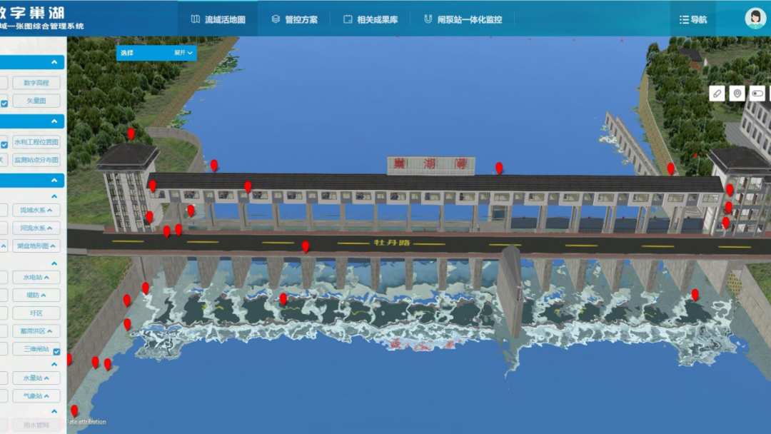
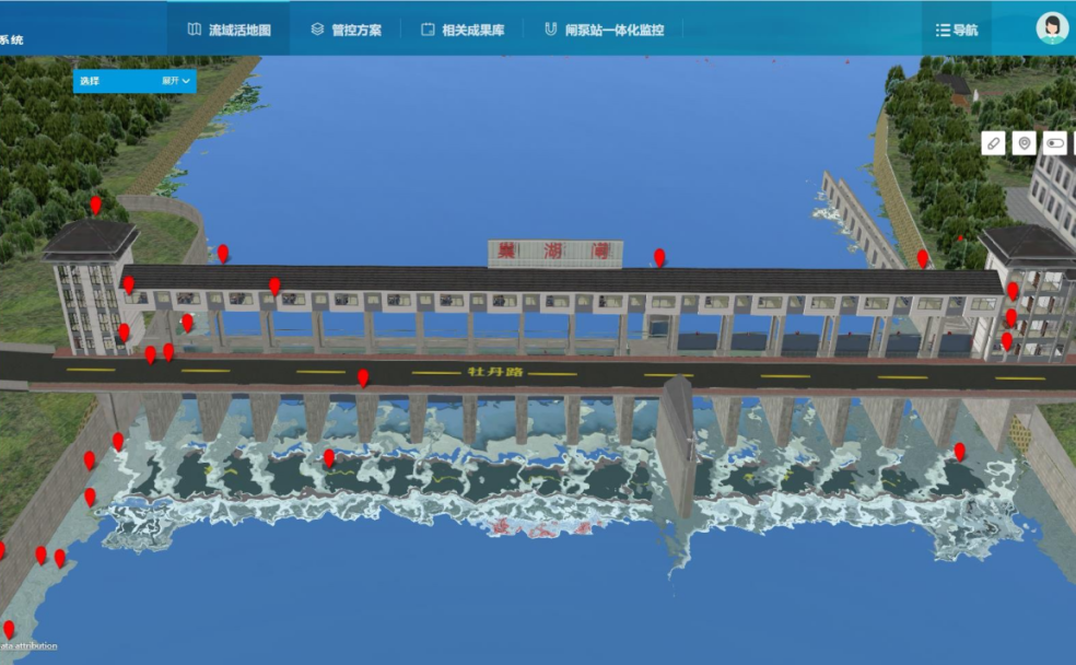
The digital twin of the river basin
The platform construction has preliminarily achieved the integration and visualization of information on water conservancy facilities, hydraulic equipment, and water conservancy applications, but it is still in the exploratory stage in terms of how to deeply integrate with water-related application services. The main problems are as follows:
1.1 Insufficient data to support the total-factor perception in the river basin
There is insufficient access to hydrological monitoring data within the basin, so it is an urgent need to expand data access channels; The collection of monitoring data for the safe operation of water conservancy projects is insufficient, and the monitoring data has not reached the requirement of hierarchical collection, which makes it difficult to support accurate forecasting and fine scheduling at the basin scale; River basin monitoring data collection is insufficient. New technologies such as new sensor equipment, intelligent video cameras, navigation and positioning, and remote sensing have not been widely used, and Internet of Things technology has not been fully applied.
1.2 Insufficient model to meet business simulation requirements
The connection between the models is poor, and the overall design and integration are lacking; There is an insufficient continuous application of models and a lack of unified management; Some water conservancy facilities and hydraulic structure models have been built for a long time, and the accuracy of the models is insufficient, so they need to be updated; The 3D model construction in the digital twin application that has been carried out is mainly a pilot, and the scope and accuracy are not enough to support the application requirements.
1.3 Insufficient knowledge to improve the business informatization
The construction of the knowledge platform belongs to the exploratory stage, and the development of informatization in various business fields is unbalanced and insufficient, and does not match the needs of realizing water-related comprehensive service applications.
2. The goal of building a full-space digital twin river basin
The construction of the full-space digital twin river basin mainly includes: building the digital twin model scenes of the river basin, providing intelligent application support, and developing the “2+N” system applications. The main construction goals are as follows:
2.1 Construct the twin bases of the river basin and build the foundation for the upper-level operation application
Build a database to realize the digital mapping of river systems, water conservancy projects and affected areas in the basin and build a solid foundation for digital twin basins. By improving the perception capability of the Internet of Things and providing sufficient data support for the platform, the dynamic, real-time information interaction and deep integration between the physical river basin and the digital watershed is enabled.
2.2 Carry out an intelligent simulation to realize the simultaneous simulation of the digital river basin and physical river basin
Conduct the precise simulation of the whole process of water conservancy phenomena and governance, and the simultaneous simulation operation of the digital twin river basin and the physical river basin.
2.3 Use the knowledge platform to generate decision-making proposals
According to the technical framework of “big platform + micro-service”, Hightop builds “2+N” business applications for water-related services, strengthening data support for river basin governance, ensuring scientific decision-making plans and supporting precise decision-making.
3. Build the space-time base of the full-space digital twin river basin platform
The premise of the construction of the space-time base of the digital twin river basin platform is to clarify the user needs and data system, and after the user positioning is clarified, it should be constructed according to the needs. It mainly includes the construction of macro river basin scenes and micro hydraulic engineering scenes.
3.1 Construct the macro scene of the river basin
There are two construction modes for macro river basin scenarios according to operation application requirements.
The first is a platform that serves macro-level river basin management. Based on collecting imagery, topography, underwater topography, and vector data, it will also collect key areas including but not limited to regional model data of flood storage areas, flood detention areas, flood discharge areas and their surrounding areas, fully constructing spatial scenes.
The second is to serve as a platform for micro water conservancy project management. It collects macro scene images, topography, and vector data and adopts spatial superimposition technology to construct the macro floor, which is used in combination with micro water conservancy project scenes.
Relying on the self-developed digital twin platform and SuperMap 3D GIS game engine development platform, Chengdu Hightop has constructed the macro waters basin scene, which enables the visual presentation of information such as topography and spatial distribution of the river basin. In order to ensure efficient collaboration between the macro river basin scene and the real world, the platform supports real-time data updates according to different data accuracy and update cycle.
3.2 Construct the micro scene of water conservancy engineering projects
The micro scene construction of the water conservancy engineering projects mainly includes: collecting images, terrain, underwater terrain, vector, 3D model, BIM model and other data of water conservancy project reservoir area, dam area and downstream affected area of the project; updating data of different types and precision in time. Hightop self-developed digital twin platform and SuperMap 3D GIS game engine development platform are combined to reconstruct the micro-hydraulic engineering project scenes.
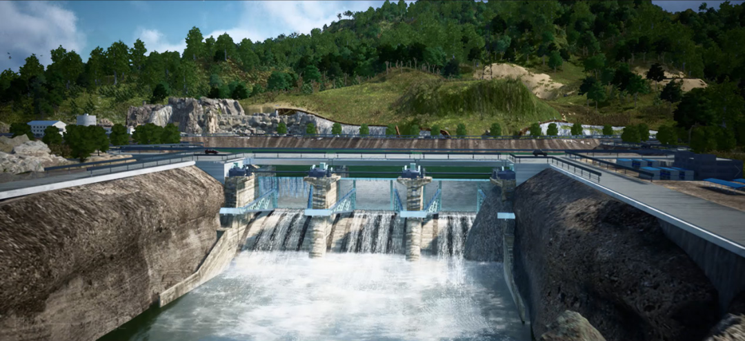
The digital twin of the hydropower station
4. Build the full-space digital twin river basin platform
The construction of digital twin river basins focuses on improving the capabilities of “forecast, early warning, drill, and pre-planning”, and fully improves two applications: flood control applications in river basins and water resources management and deployment applications, expands N operation scenarios, and builds the “2+N” application system.
4.1 Strengthen the ability to “forecast, early warning, drill and pre-plan”
These four capabilities are the basic capabilities widely used in the digital twin river basin platform. Strengthening these four capabilities mainly depends on consolidating basic computing power, fully connecting IoT sensing devices, integrating river basin-related data to enrich the database, continuously training and optimizing algorithm models, and comprehensively improving the above four capabilities and platform prediction accuracy.
4.2 Improve the application of flood control in river basins and the management and deployment of water resources
The two applications – river basin flood control application and water resource management and allocation application are both important in the application field of the digital twin river basin platform. Flood control in the basin will be based on the national flood control and drought relief command system, expand and customize flood control digital scenes in the basin, upgrade and improve flood forecasting and early warning functions, focus on building simulation modules, supplement comprehensive drought monitoring and early warning functions and dam flood forecasting functions, and build a “forecast, early warning, drill and pre-plan” platform. The water resources management and deployment application combined with the national water resources monitoring capacity building project and national groundwater monitoring project, perfect the digital scene of water resources management and deployment, integrating water intake permit approval, water resource tax (fee) and other information systems, as well as functions such as water resource supervision and early warning, allocation management decision-making, etc., to build a comprehensive platform for government services and deployment of water management.
4.3 Expand N operation scenarios
The platform will combine the application scenarios of the water conservancy project, and improve N application scenarios such as water conservancy project construction and operation management, water and soil conservation, and rural water conservancy and hydropower.
5. Innovative technology facilitates the construction of the platform
5.1 Optimize digital twin 3D engine rendering technology
The platform further optimizes the digital twin 3D engine rendering technology, effectively solves the rendering problems of images, terrains and other objects, and facilitates the construction of application scene space for river basin level and water conservancy engineering level.
5.2 Optimize the 3D simulation technology based on the algorithm
Through the combination of data and algorithms, the platform drives the 3D simulation with the results obtained by the algorithm. With the high rendering engine capability, the algorithm-driven simulation is enabled, making the 3D simulation results more realistic and instructive.
5.3 Research on basin-oriented data standard system and data collaborative governance technology
Based on the water conservancy industry, the platform compiles a set of data standard systems suitable for river basin management based on previous operations, service platform data collection, and service distribution, constrains the consistency of data from the source, and ensures the stable operation of the platform.
6. Empower the intelligent construction of multi-sector water conservancy
The platform integrates full-scenario and full-service application data in the river basin applications, breaks data barriers, and builds a spatial twin covering macro river basin scenes and micro water conservancy engineering scenes. It meets the needs of data interoperability, information sharing, scene sharing, and collaborative applications. At present, it has provided water-related application platform services for multiple river basin management companies, provincial water conservancy departments, municipal water affairs bureaus and other departments to empower the intelligent construction of water conservancy.
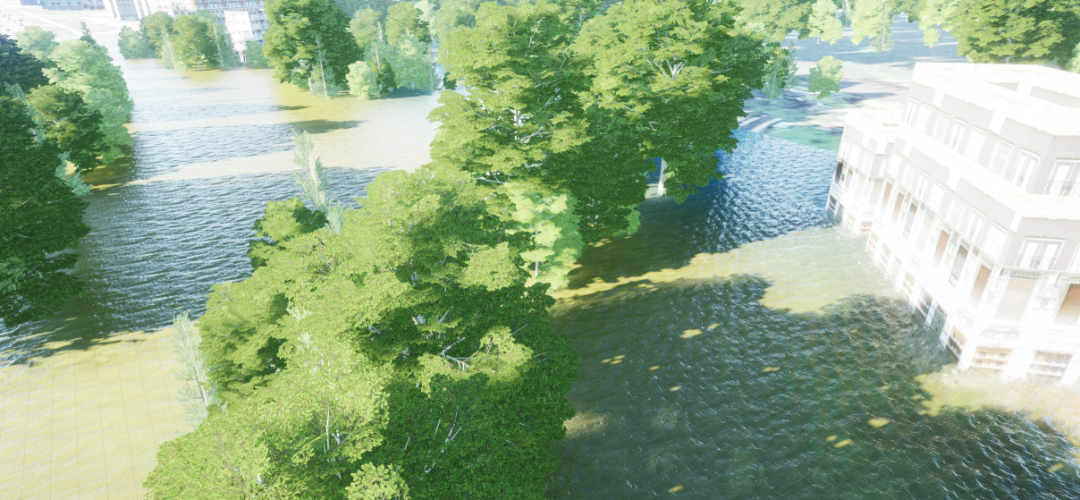
Water basin flood evolution simulation