In summer, many regions suffer from heavy downpours. They have the characteristics of a large amount of accumulated rainfall, long duration, extremes, and overlapping falling areas. Flood disasters caused by heavy rainfall endanger the safety of life and property of the region. Emergency departments and water conservancy departments take flood control as a primary focus. To effectively improve the efficiency of flood control work, the Information Center of the Ministry of Water Resources in China has improved the functions of the National Water Resources Map System to provide decision-making and technical support for flood control work.
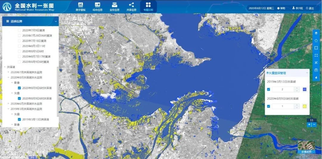
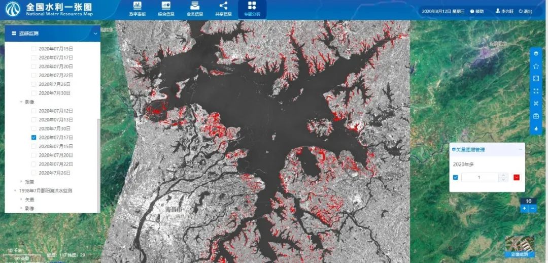
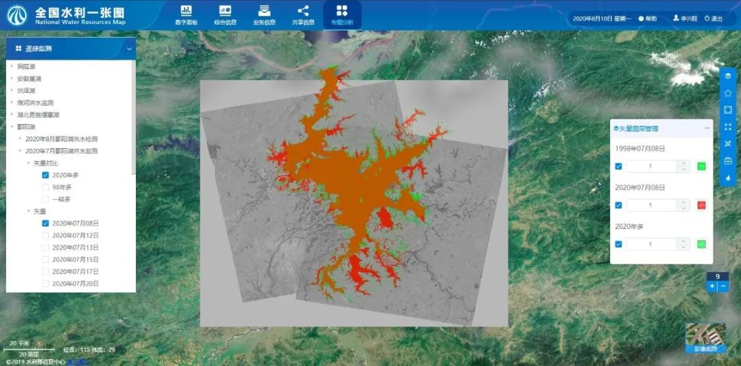
Flood Control Feature - Remote Sensing Monitoring
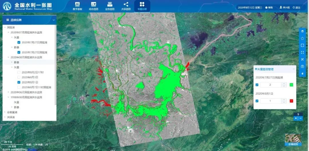
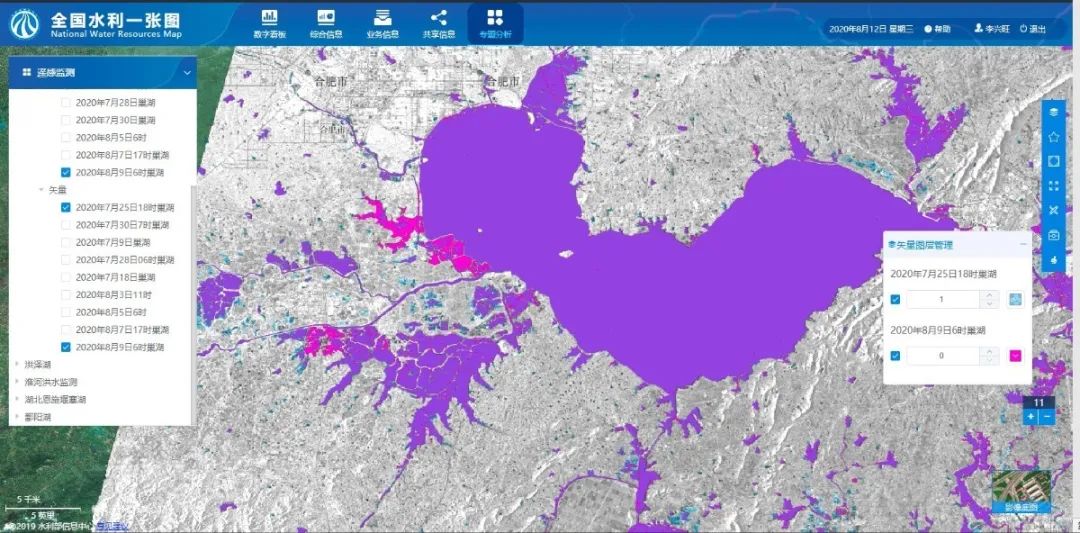
Use high-resolution remote sensing image data for image analysis to support the comprehensive research and judgment of the flood, and to learn the flood situation in time. In the Water Resources Map System, based on the image data formed by high-resolution satellites, flood conditions in key water areas have been observed and analyzed, and by combining it with the briefing report on remote sensing monitoring, we can use the map to display the remote sensing monitoring. Once the water surface area is significantly expanded or even submerged, the system will quickly analyze the flooding situation of surrounding houses through the circumstance of the inundation of water bodies, which will support flood control and disaster relief and post-disaster recovery of various departments at all levels.
The system integrates the flood monitoring information of some main lakes during the past two decades and makes an overlaying display, which enables the same water body range in different years and months to be compared and displayed, and the daily data can be quickly updated. The whole process includes steps such as data acquisition, data processing, water body extraction, data conversion, and data presented on the map. Functions such as rapid image uploading and data comparison of remote sensing monitoring data can not only improve people's work efficiency but also reduces the work intensity. It analyzes the discovery of dangerous situations and possible hidden dangers and provides a reliable basis for making decisions to eliminate dangers.
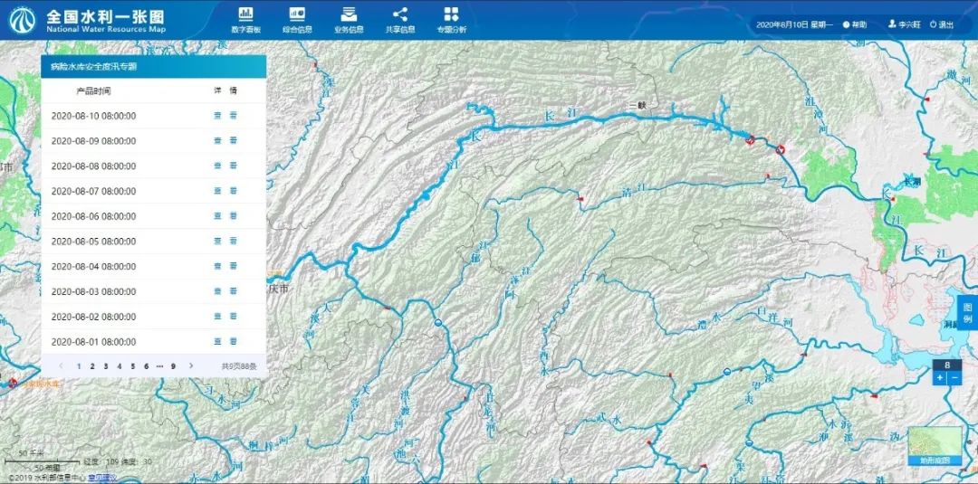
Flood Control Feature - Flood Control Reservoir
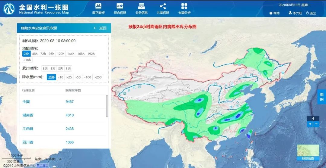
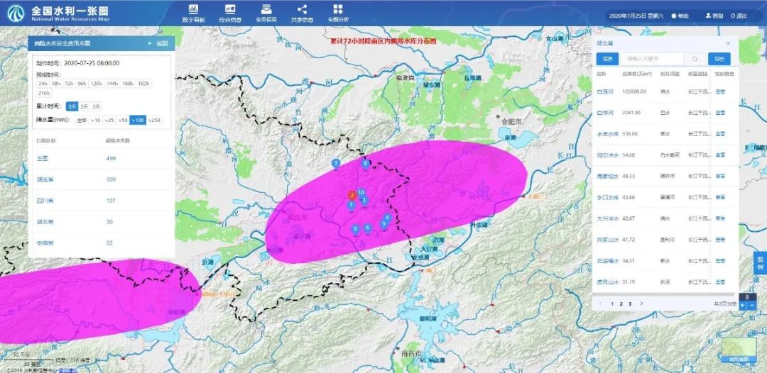
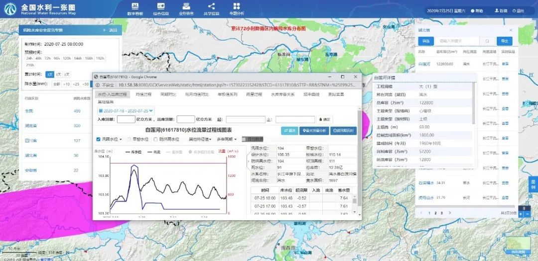
Dangerous reservoirs will bring great hidden dangers to the safety of surrounding residents during the flood season. We develop a flood-related feature on risky reservoirs based on the system; use the precipitation forecast result data of meteorological analysis, and combine the risk indicators of reservoirs in the Water Resources Map system to display the distribution of reservoirs within the rainfall range; analyze areas with more precipitation and extract affected and dangerous reservoirs in the area to provide technical support for the reinforcement of reservoirs in the emergency process.
Access to meteorological and precipitation forecast results: In the Water Resources Map system, we access the meteorological and precipitation forecast results in real time, and display them on the map in the form of a precipitation distribution map.
Precipitation effect reservoir analysis: We use the spatial information of precipitation results, and combine them with the Water Resources Map reservoir information, to analyze the distribution of reservoirs under different rainfall levels.
Real-time information on dangerous reservoirs: Through the combination of the list of reservoir distribution, we can filter by attributes such as reservoir name, reservoir level, dam height, storage capacity, etc. Users can view the detailed indicators of the reservoir and the real-time information of the reservoir monitoring station.
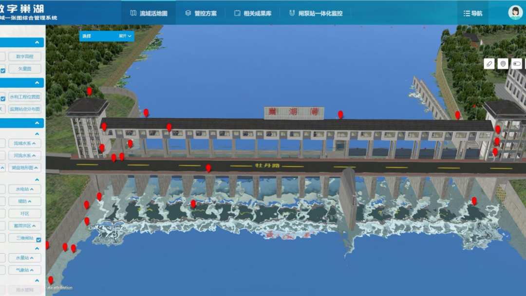
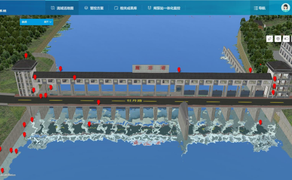
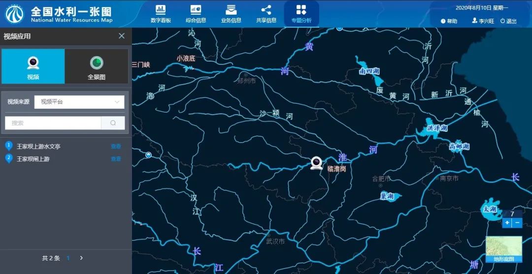
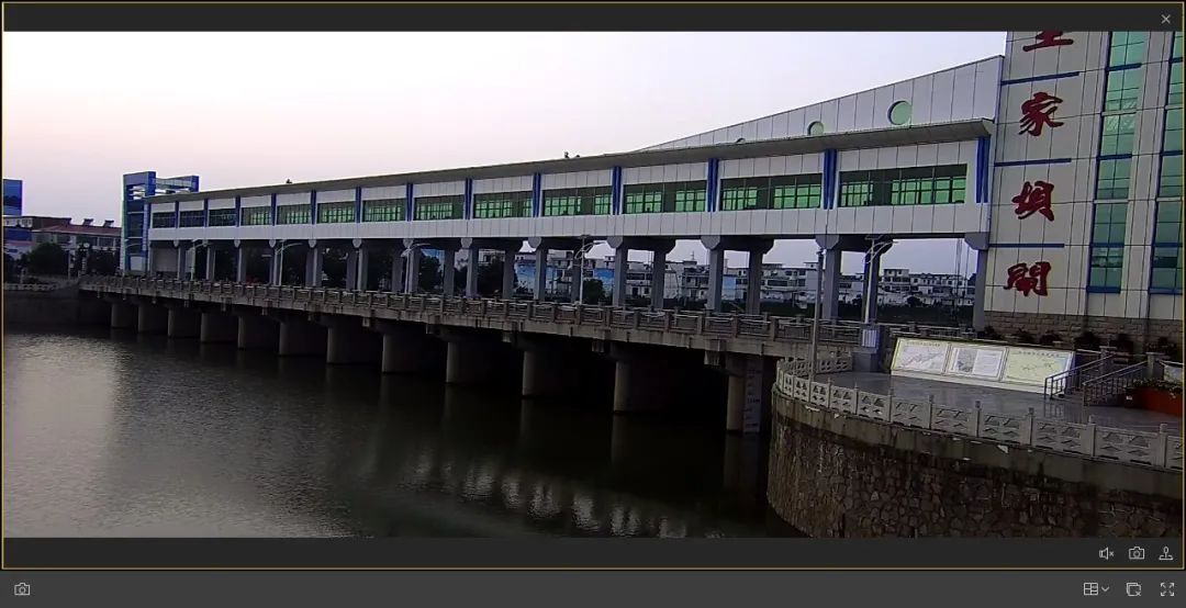
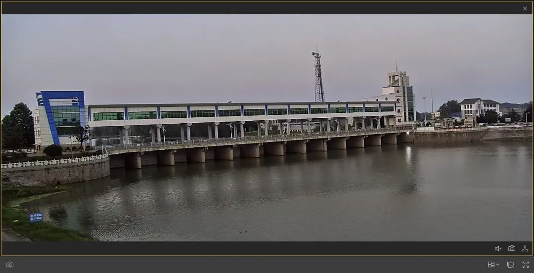
Flood Control Feature - Video Surveillance
Video real-time monitoring is an important part of flood control work. The Water Resources Map system supports docking with the video platform to ensure real-time monitoring of reservoirs and dams during flood season.
Author: Li Xingwang;Chen Lang, SuperMap Application Business Group