The 3D highway digital management system applies GIS technology, 3D scanning technology, 3D refined modeling technology, and combines with the spatio-temporal massive data management technology, 3D dynamic display technology, interactive scene technology, etc. The system realizes the rapid collection of highway environmental information, refined spatial database of infrastructure, rapid construction, rapid inspection and comprehensive management of expressway infrastructure. It also can integrate and access the highway dynamic business data to provide basic geographic information data for traffic operation state monitoring, analysis systems and smart service platforms.
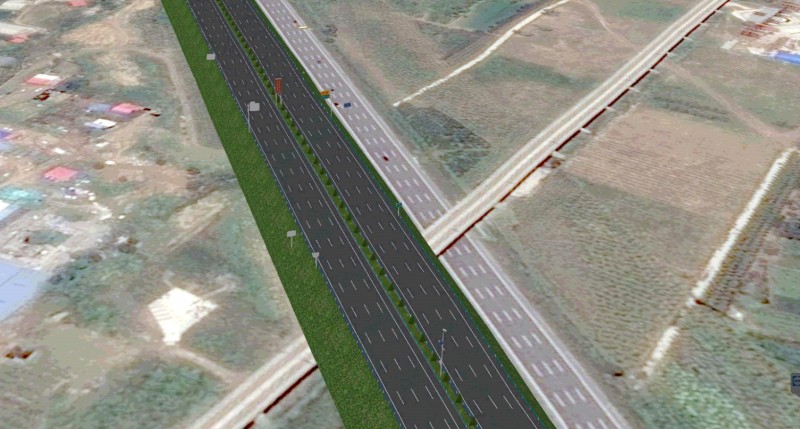
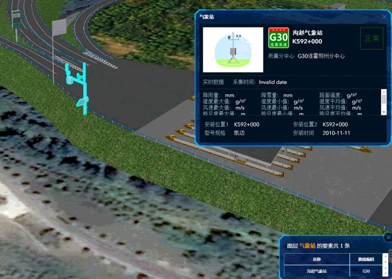
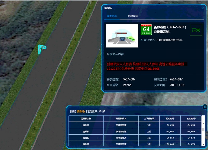
(1) The 3D visual display and query positioning of infrastructure
The system provides layered 3D model display based on topographic maps, highway roads, interchanges, toll stations, service areas, bridges, tunnels, entrance and exit ramps, monitoring equipment, marking lines, mileage piles, information boards, lighting facilities, noise reduction facilities, isolation belts, and reflective facilities. It can realize the visual inspection and browsing of expressway infrastructure, and quickly locate and query equipment attribute information according to equipment number or station number to provide support for highway asset management.
(2) The traffic operation decision management
The traffic operation decision management mainly realizes the visual condition monitoring by accessing the dynamic traffic information such as the highway monitoring video data and the traffic flow monitoring data, and utilizes the height limit and the width limit of each road section and each structure (bridge and tunnel) acquired by the acquisition.
3D GIS Related Solutions
New 3D GIS Technology in Underground Water Management>
2D and 3D GIS in Natural Resources Management>
3D GIS Technology Assists the Informationization of Public Security of Large-scale Events>