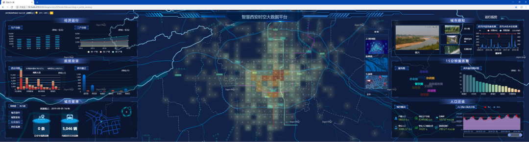
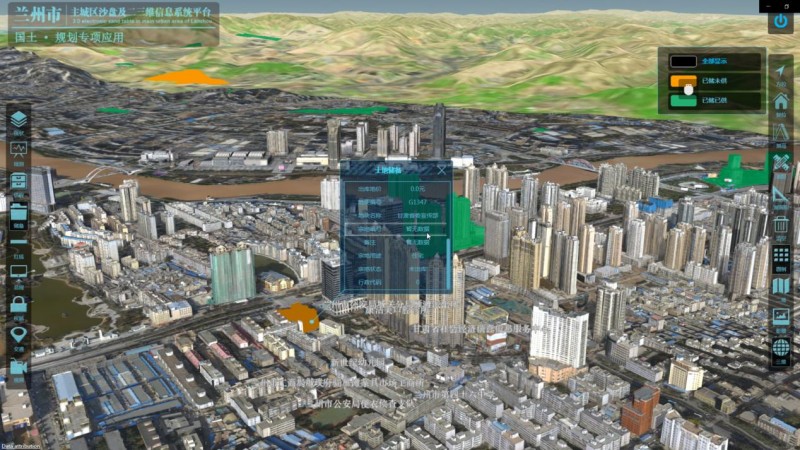
The 2D&3D Sand Table Information System Platform applies 3D true-color accurate terrain sand tables, the Internet of Things and other information technology. In the manner of 2D and 3D integration, the city land, traffic, surveillance video and other basic information systems can be ran on physical and electronic sand tables. In the followings, more specialized business application data in the city can be gradually transformed to achieve multi-source data integration and added-value, build spatial mathematical models, simulate complex urban systems, monitor urban activities, innovate working methods and technical methods of urban management. Also, public security managements such as traffic management, video remote monitoring, remote emergency management can be integrated, which can help to form a supportive platform for urban management decision-making and to provide quantitative tools for studying urban issues.
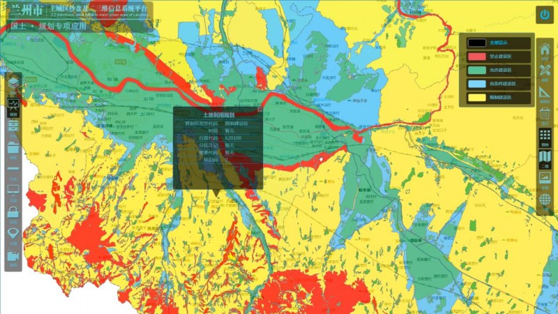
"One Map" land management platform
The “One Map” land management platform will integrate multi-source information of remote images, current status of land-use, farmland conditions, remote monitoring, mineral resources, geological environment. Through the combination of these information and administrative supervision systems of land resource plan, approve, supply, supplement development, law enforcement, a comprehensive supervision platform can be built.
Public platform for transportation big data
1) Through the comprehensive integration of the traffic data, geographic information data, traffic information system data and other internet data, a public traffic big data platform can be built. It can cover the main urban areas and its accuracy is higher than the current domestic public traffic big data platforms such as Gaode and Baidu.
2) Provides the public with traffic road conditions, traffic control, traffic index and other road condition information.
3) Through the mining and analysis of historical data, the big data analysis applications such as traffic prediction, traffic index evaluation and diagnosis, etc., can be formed to provide decision-making basis for the traffic management department.
The comprehensive video management platform
The comprehensive video management platform collects the rich value and structure of video images through intelligent analysis technology, and forms a real-time information database, and then conducts demonstration applications according to business scenarios. The demonstration application mining faces, objects, behaviors and scenes based on objects such as people, cars, and objects in the video image. The function is aimed at the elderly and children accidentally lost, items lost, etc.
New 3D GIS Technology in Underground Water Management>
2D and 3D GIS in Natural Resources Management>
New 3D GIS Technology Supports the Construction of "Digital Twins" in Transportation>