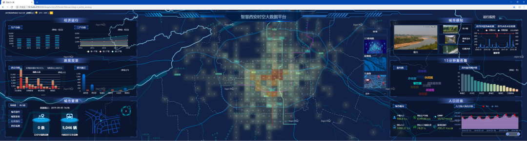
The “One-map in High-tech Smart Park” project uses the SuperMap GIS software to realize the geographic information system of “One-map of Park”. Based on the “One Map of the Park”, various visual interactions can be realized, including searching and viewing all the park information on the map, like enterprise, construction, pipe network, areas, plot, grid, street light, monitoring, parking lot, etc., and the functions such as surface measuring , ranging, and marking can be realized.
Based on the visual geographic information system, the function of displaying the landscape of the park can be achieved by superimposing the geographic information layer, and the unified monitoring, unified alarm, and unified dispatch can be realized to create a practical park management command and control center.
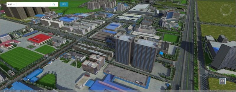
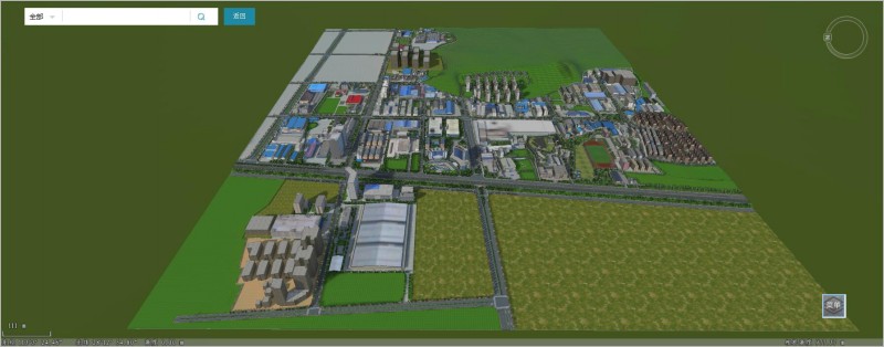
1. The display of the park overall look
According to the permission viewing area of users, the visual map range can be automatically loaded. In the system interface, the overall style of the park can be displayed in three styles: 2D, 3D and satellite image. By clicking of the point information on the map, such as building, plot, camera, street light, roads, etc., the detailed data of the points can be viewed, so that the overall look of the park can be visually displayed, and the purpose of enhancing the investment competitiveness of the park through visual maps can be achieved.
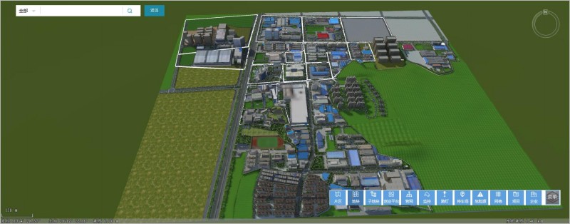
2. The display of grid data
The business data identification: Identifying the coordinates of enterprises, buildings, pipe networks, areas, plots, grids, street lights, monitoring, parking lots, etc. in the park, and visually displaying the existing landing conditions to achieve the effect of remote monitoring.
3. The grid editing management
The project supports the managing and editing of all map objects in the park, and provides various graphic drawing with the form of point, polyline, smooth line, polygon, smooth polygon, rectangle, rounded rectangle, circle, etc. It can realize the operations of visualize pre-process to diagrams, interrupt intersections, graphical inspections, insert attributes, modify attributes, refresh graphics, property viewing, map positioning, layer matching, graphics cleanup, inserting plots, inserting markers, and more.
New 3D GIS Technology in Underground Water Management>
2D and 3D GIS in Natural Resources Management>
New 3D GIS Technology Supports the Construction of "Digital Twins" in Transportation>