Based on 3D WebGIS technology, the 3D urban planning decision platform integrates 2D&3D data technology, 3D visualization technology, and big data storage technology to realize the functions of comparing of planning schemes, planning index analysis, planning condition review in modern urban planning through the establishment of 3D urban scenes.
1. The framework of platform technology
The platform construction process is divided into four phases: the foundation layer construction, the data layer improvement, the application service layer, and the extended service layer.
2. The organization of platform data
Based on the characteristics of urban planning business, the platform conducts multi-source data organization based on real geographic location for basic geographic data, planning result data, and land surveying and mapping, and serves the planning analysis and decision-making.
Main data: DEM, image, terrain, cad, planning, DTM, model, BIM, attributes.
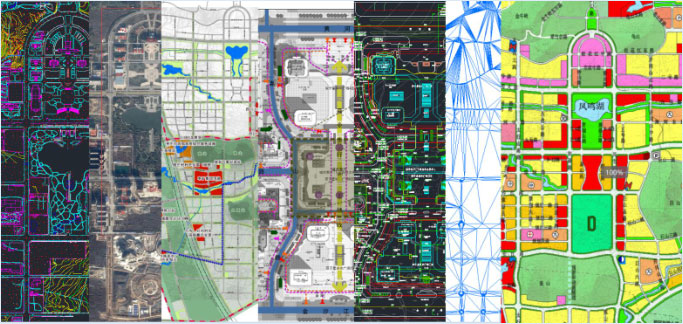
Figure 1 The urban housing model and information
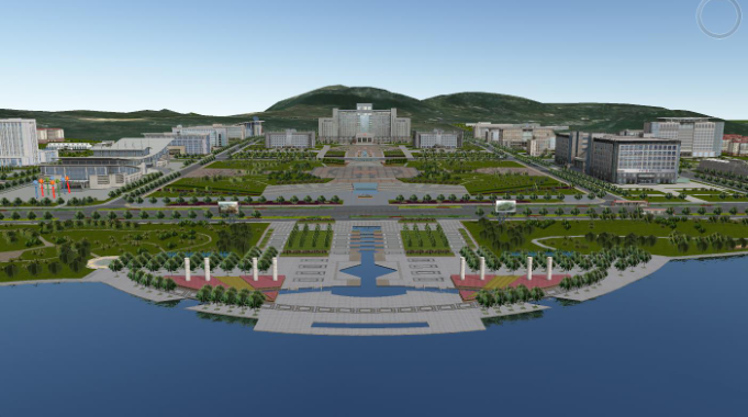
Figure 2 BIM information of key buildings
3. The features of platform
3.1 3D display of urban planning results
(1) 3D display of results in urban design stage
The platform realizes the 3D expression of the planning result information through the 3D thematic rendering of the control indicators of the urban planning. The 3D visual display of urban design can be realized by integrating information such as urban form, urban color, urban street-view and skyline in the urban design stage.
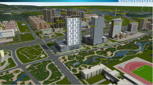
Figure 3 3D display
(2) The 3D city simulation scene display
The platform carries out refined simulation modeling of the 3D urban scene within the project scope, which realizes seamless connection with urban planning and urban design scheme, and realizes interactive roaming browsing at any height and angle and customized flight routes within the 3D scene.
3.2 2D&3D query browsing
(1) The urban planning results browsing
The platform can call 2D planning information system data and plan business data to realize the visual comparison of the results of 2D&3D planning information browsing, retrieval, query and planning.
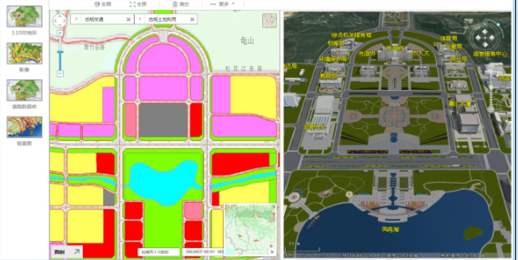
Figure 4 Results browsing
(2) The 3D city ground object information inquiry
The platform can realize the browsing, retrieval and inquiry of basic attribute information and related planning and design materials of public buildings and residential buildings within the scope of the project.
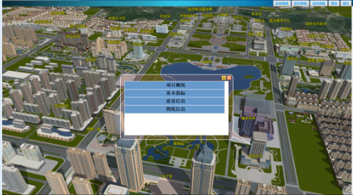
Figure 5 The 3D city ground object information query
3.3 The auxiliary urban planning
(1) The natural terrain analysis
The digital elevation model is generated based on the topographic map data, and the remote sensing image can be superimposed to realize the analysis of slope and vegetation coverage.
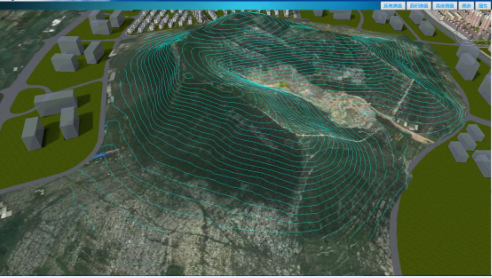
Figure 6 The natural terrain analysis
(2) The 3D urban spatial analysis
Based on the 3D urban scene, the city contours and architectural forms can be compared and analyzed from any angle and any height. The 3D models in the platform are carefully modeled according to the planning and design scheme, and the height, length and area of the 3D space can be measured.
(3) The 3D visualization of sunshine simulation
The platform can simulate the sunshine of 3D ground object of urban buildings and green landscapes throughout the year and all time periods.
(4) The urban height control analysis
The platform can carry out the 3D visualization indicators according to the urban planning control indicators.
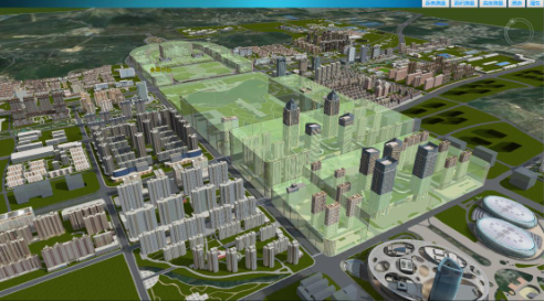
Figure 7 The urban height control
3.4 Auxiliary urban design
(1) The 3D visibility analysis
The platform enables visibility analysis of any point-to-point or multi-point within a city scene.
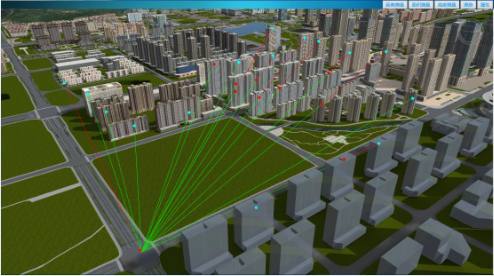
Figure 8 3D visibility
(2) The 3D visual field analysis
The platform can realize the visual field analysis of the interior and exterior of the key buildings and the surroundings and the stereoscopic visual analysis of the street-views.
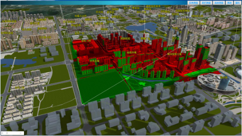
Figure 9 3D visual field
(3) The 3D city skyline analysis
The platform can analyze and compare urban axes, city panoramas, and urban interior contours in real time.
(4) The comparison and selection of 3D urban architectural schemes and color analysis
The platform allows for comparison and analysis of architectural solutions, colors, and street facade effects in the city.
(5) The 3D city street-view analysis
The platform can compare and analyze street-view elements such as urban homes and road facilities.
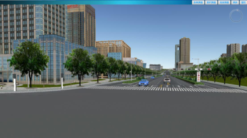
Figure 10 The 3D city street-view
3.5 The auxiliary plan reviewing
(1) The comparison and selection of urban plans
The platform can compare multiple plans and indicators in the 3D space.
(2) The urban plan adjustment
The platform can realize the adjustment of the plan control indicators, the building height, the building position, and also can realize the function of the planning and design plan reviewing.
New 3D GIS Technology in Underground Water Management>
2D and 3D GIS in Natural Resources Management>
New 3D GIS Technology Supports the Construction of "Digital Twins" in Transportation>


